Conveyor belt of cold fronts closing in
Here they come. One cold front after another for at least the next week for southeast Australia.
This is good news for snow lovers, but not such wonderful news for those of us who don't enjoy wet, cold, windy weather.
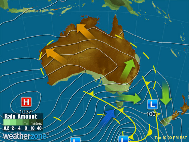
Image: The synoptic chart for next Tuesday, showing potentially the strongest and coldest front of the period approaching SE Australia.
Adelaide, Melbourne, Hobart and Canberra (and everywhere in between) can expect a persistent spell of blustery, cool to cold, showery weather – with the first burst on Thursday into Friday morning, a second colder burst on Saturday, and the coldest outbreak of the period looking increasingly likely to arrive early next week.
Sydney will duck the worst of it, with top temps staying in the high teens and even peaking in the low twenties on a couple of days in the warmer northwesterly wind flow between fronts, while Brisbane will completely avoid the wintry weather, with a prolonged spell of delightful fine days and top temps in the low-to-mid twenties.
But the real story is down south. This is a classic Australian late winter pattern for the southeast and Adelaide will feel the first rumbles of it on Thursday – perhaps literally, as a thunderstorm in the morning or afternoon is possible. Melbourne could also see storms later on Thursday.
As for the mountains, snow is coming as mentioned. How much?
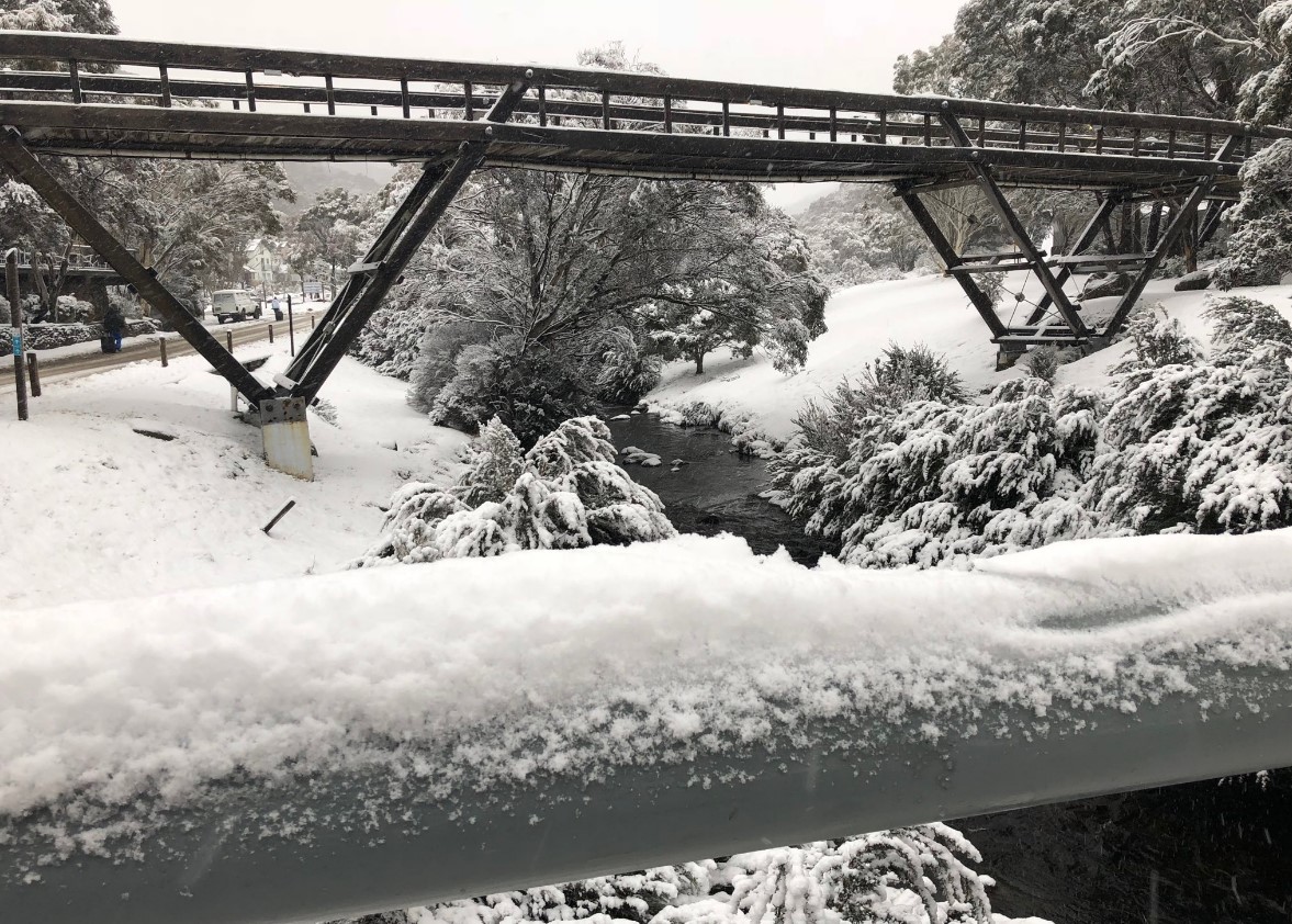
Image: Expect scenes like this over the weekend in Thredbo. Source: Author's pic.
Well, it's probable that totals in the vicinity of 50 cm could accumulate at higher elevations by this time next week, and perhaps a little more. Be sure to keep checking the Weatherzone snow page for the latest.
A little rain could fall on all but the highest peaks on Thursday in the warmish air ahead of the first front, but from then on, it all looks like the good stuff.
At this stage, snow also looks likely to penetrate a fair way north next Monday or Tuesday, with the potential for good snowfalls on the Central Tablelands and Blue Mountains of the type which we haven't seen this winter since the first few days of June.
We'll keep you posted.