
'Conditional Intensity' levels to help define violent tornado risk this season
Spring means thunderstorms become more active across a part of the United States known as ‘Tornado Alley’. But tornadoes are not all the same, and some are more destructive than others.
This year, the Storm Prediction Center (SPC) will include extra detail on their Severe Weather Outlooks to highlight areas that are at risk of more intense weather, such as violent tornadoes.
On March 3, 2026, the SPC updated their 3-Day Severe Weather Outlook graphics. The risk levels used for Categorical Outlooks, like Marginal/Slight/Enhanced, are still being used. However, there is now more detail on the outlook maps for tornadoes, wind and hail.
The change introduced three different intensity levels, known as Conditional Intensity, which show hazard severity. The Conditional Intensity levels allow forecasters to highlight areas where there is a risk of more intense, violent storms, even in scenarios where severe weather risks are relatively low.
Using the Tornado Outlook map below, the areas showing an Intensity Level 1 mean those areas have a better chance for an EF-2 tornado to develop if any tornadoes form.
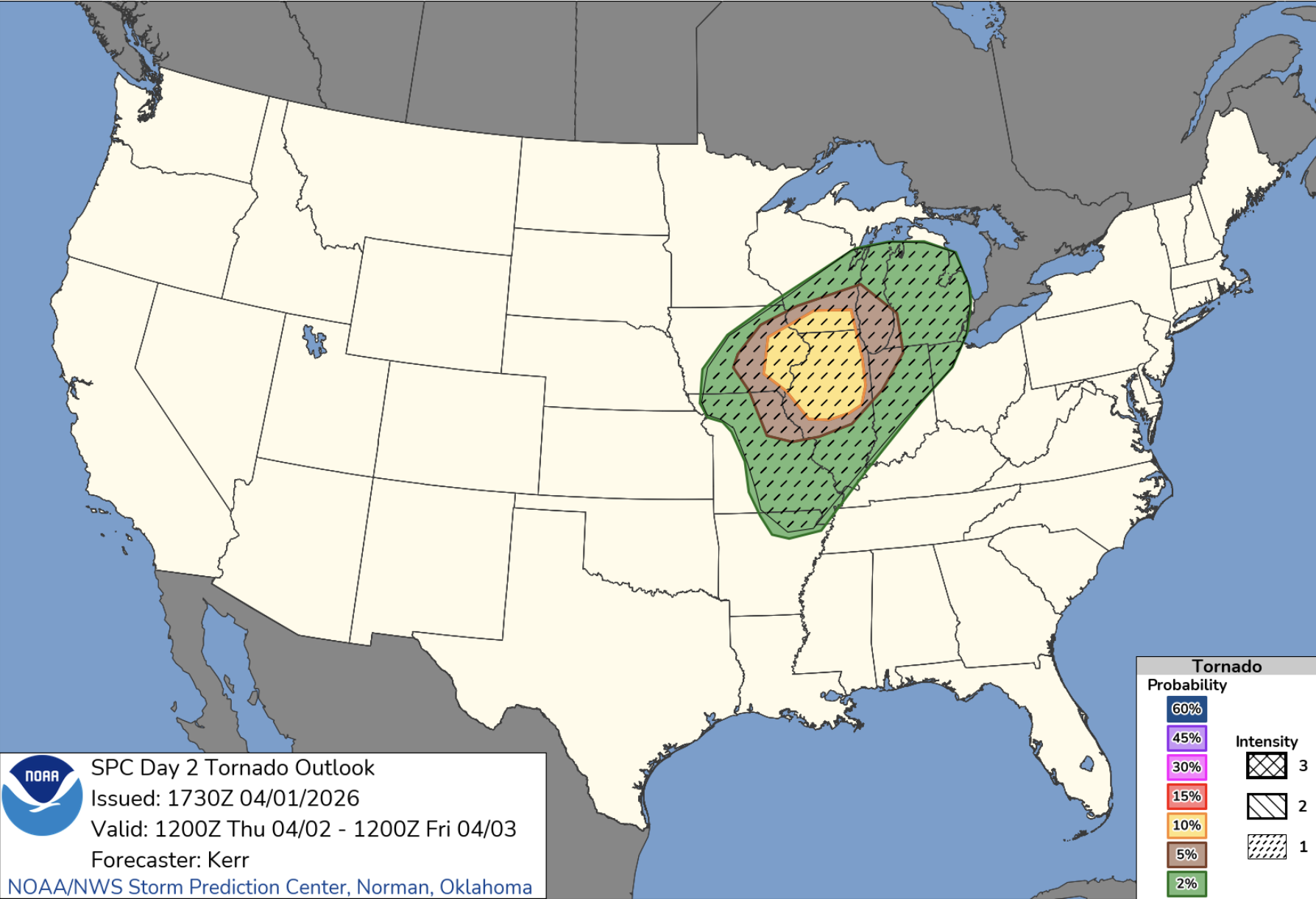
Image: SPC Tornado Outlook for Thursday, April 2, 2026. Source: NOAA.
The three Conditional Intensity levels for tornadoes are:
- Intensity Level 1 – Significant severe weather is possible.
- Intensity Level 2 – A dangerous environment exists with potential for intense tornadoes or extremely large hail.
- Intensity Level 3 – The area could see a historic outbreak level intensity like violent tornadoes or intense derechos. This level is rare.
Information detailed in the next image from shows another example of what each intensity level means when looking at tornado outlooks.
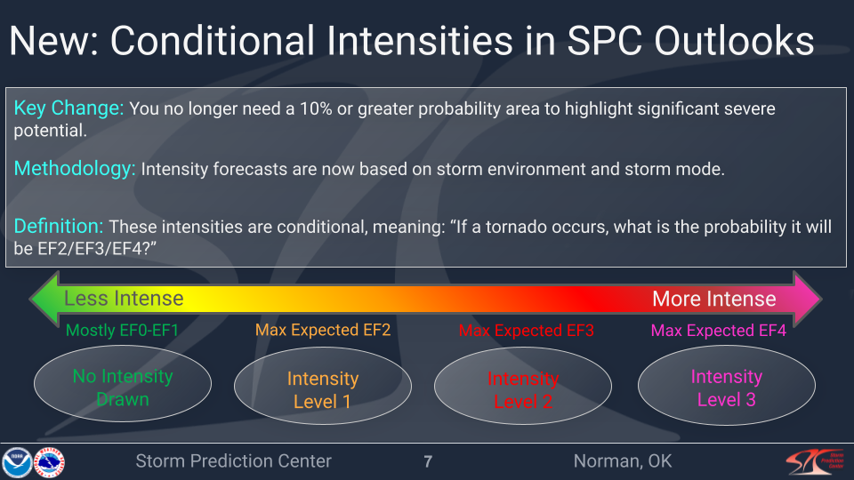
Image: Conditional Intensity information. Source: NOAA / SPC.
Where is Tornado Alley?
Springtime also means those who live in ‘Tornado Alley’ are on high alert for severe weather outbreaks. Tornado Alley is a nickname used to describe the main area of the United States that gets a high frequency of tornadoes each year.
Traditionally, Tornado Alley is found across the central and southern Plains and includes South Dakota, Nebraska, eastern Colorado, Kansas, most of Oklahoma, and northern Texas.
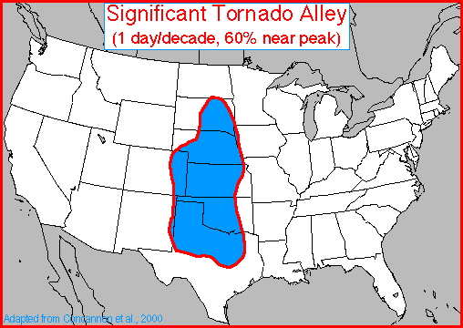
Image: Tornado Alley. Source: NOAA / NCEI.
Since Tornado Alley is just a term used to describe a region where tornadoes are most active, there are no precise boundaries. Exactly where this area is found is debatable and depends on what criteria is being used to describe the region. Frequency, intensity, and events per unit area are the most common criteria used to define Tornado Alley.
Other states that have been included in ‘Tornado Alley’ are from central Texas northward to northern Iowa and then from central Kansas/Nebraska east to western Ohio.
There is also a second region in the U.S. that gets a high frequency of tornadoes, but occurring typically in the late fall, called ‘Dixie Alley’. This area stretches along the Gulf Coast and covers the southeast U.S. and Florida.
So, while there is no strict definition for Tornado Alley, it is generally identified as the region most suited for the formation of supercell thunderstorms that can produce violent (EF-2 or greater) tornadoes.