
Coldest July day in a decade for Sydney

The temperature only reached 12.1°C in Sydney on Friday afternoon.
This was the coldest July day since 2010 until the temperature warmed slightly overnight, making 12.3°C Saturday morning. So now Friday’s maxima is the coldest July day since 2011.
Such overnight warming after a cold day confounds expected minima-at-night, maxima-during-day patterns. It occurs when a cold airmass moves away or warms overnight, and also often when it is windy. Both effects combine to outweigh normal night-time cooling mechanisms. Many times, the effect is more pronounced than the 0.2°C seen in this instance.
The cause of the cold was a trough with extensive cloud and showers. The trough has now moved offshore and a low developed near the Sydney/Hunter coast. This low is maintaining showers over the coastal fringe of Sydney in strong, cool southerly winds however showers will start to break up this afternoon, and another extreme cold day is unlikely.
The low is also driving powerful surf along the NSW coast, with maximum wave heights increasing to 6 metres offshore of Sydney this morning.
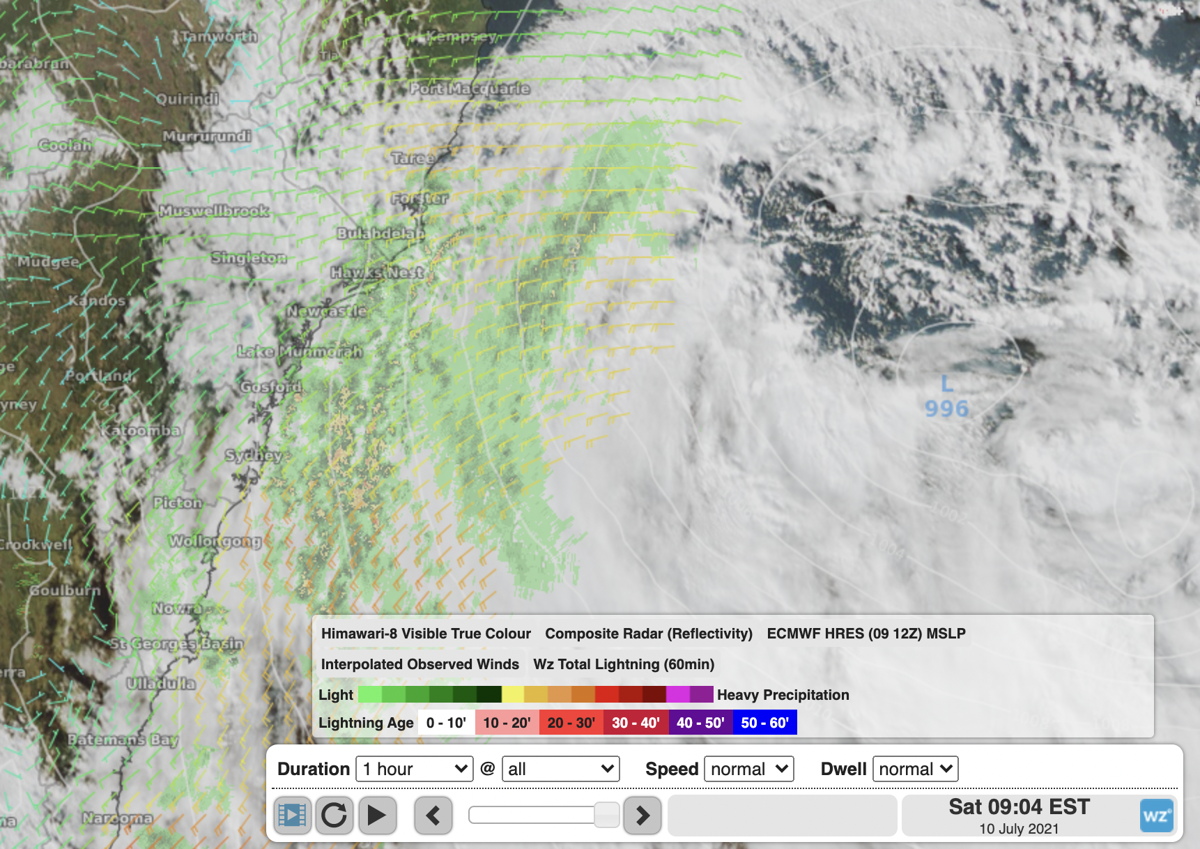
Image: Satellite, radar and wind imagery showing the low near the central NSW coast Saturday morning.