
Coldest Aussie temp of the year as widespread snow blankets southeast
It got so cold, temperatures almost reached negative double-figures.
After a couple of cold outbreaks in Tasmania, Victoria and southeast NSW earlier this autumn, a large chunk of southeast Australia copped its strongest taste of winter yet over the weekend, with frigid overnight temps, low daytime maximums, and lots of snow in the mountains as two cold fronts whipped through.
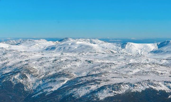
Image: The Main Range of the NSW Snowy Muntains looking somewhat resplendent after the storm. Source: @SnowyMountainsHelicopters on Instagram.
The snow was heaviest in Tasmania, where falls of up to 30 centimetres were reported in some places.
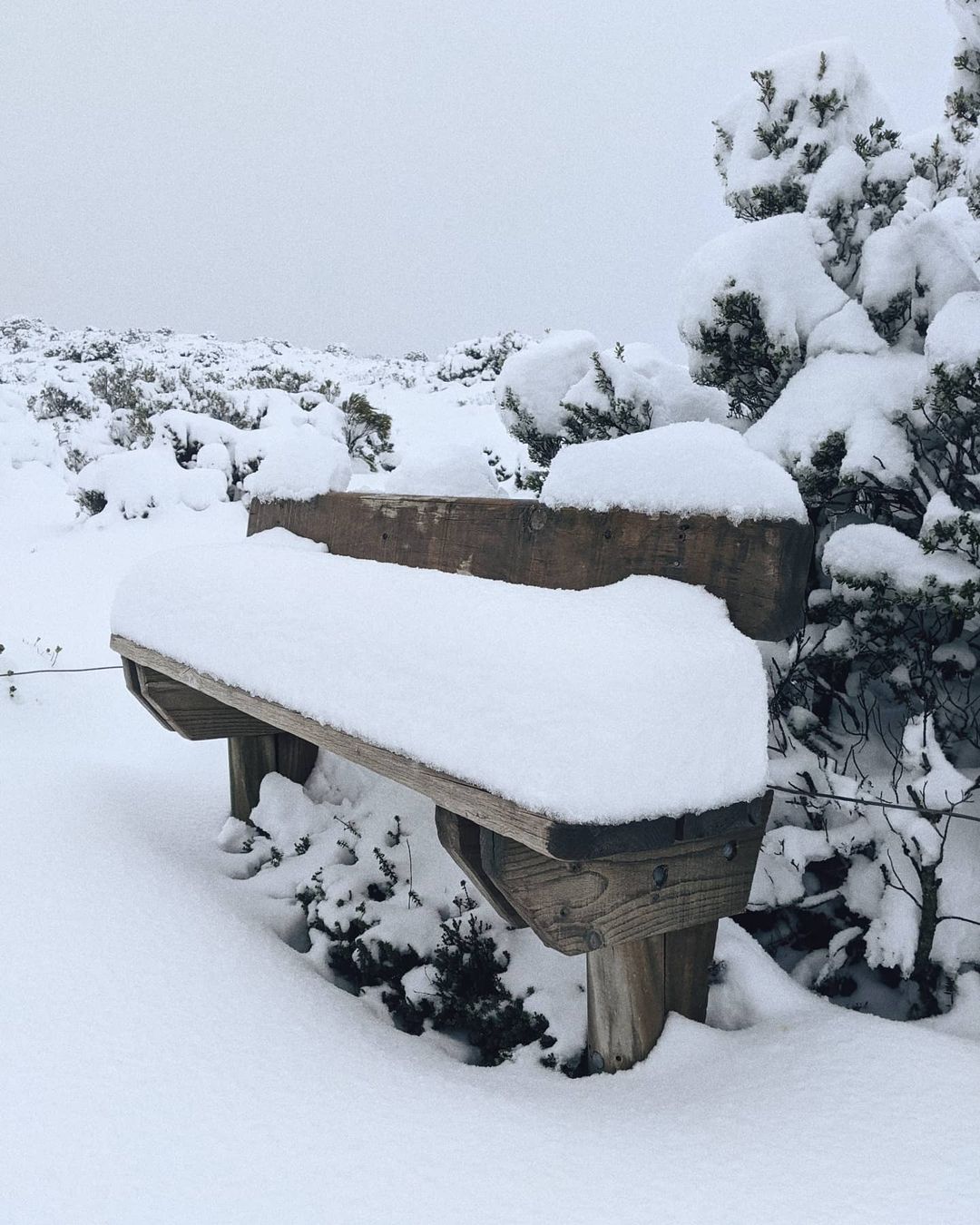
Image: This bench in the Hartz Mountains of Tassie was out of action. Source: @grace.wherrett on Instagram.
The ski fields in NSW and Victoria also received falls of between 10 and 20 centimetres, and while most of this snow will likely melt before the official season opening on Saturday June 12, it provides a good base for resorts to start snowmaking, as happened this weekend.
Good morning from #FallsCreek! Another top up of #snow overnight to add to the snowmaking â˜ƒï¸ check out the #views in the village this morning! ðŸ˜â„ï¸ #snowing #winterwonderland pic.twitter.com/0XpMFIPMNM
— Falls Creek Official (@fallsaustralia) May 16, 2021
What made this weekend cold snap remarkable was both its duration, and some of the extreme temps for the month of May.
- Perisher Valley in New South Wales dipped down to -9.4°C on Sunday morning, the coldest temperature recorded anywhere in Australia so far this year.
- That almost-but-not-quite eclipsed its May record of -9.8°C. Perisher’s May average min is -1.5°C.
- Over the hill at Thredbo, Australia’s highest weather station at an elevation of 1957 metres also recorded temps well below zero all weekend.
- As the coldest air passed through on Saturday afternoon, Thredbo Top Station was sitting on -5°C at 3 pm, which felt almost Antarctic at -14.8°C when you threw in the wind chill. Brrrr.
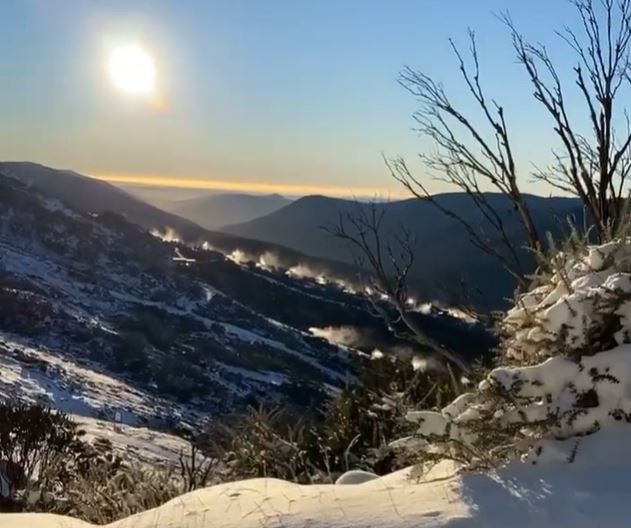
Image: It was cold enough for Thredbo's snowmaking guns to crank into action even as the morning sun rose high. Source: Thredbo.
- Victoria’s highest ski resort Mt Hotham also didn’t climb above zero all weekend.
- Hotham’s maximum was just -3.9°C on Saturday. Its coldest May max on record is -5.6°C and the average is 4.6°C.
- The Hotham weather station, at 1849 metres above sea level, is the second-highest in Australia after Thredbo Top Station.
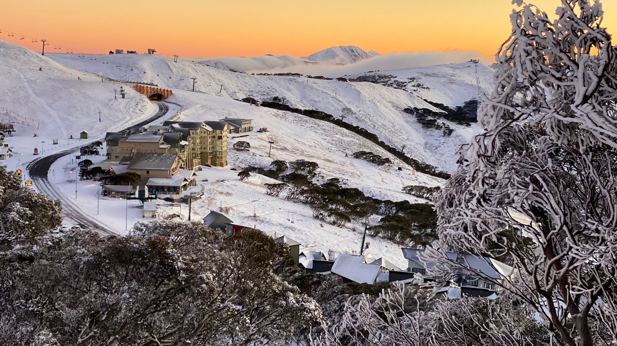
Image: We've seen worse sunrises that Sunday morning's effort at Mt Hotham. Source: Hotham.
The week ahead looks a lot better for almost all of Australia.
Perth appears set for a showery couple of days on Monday and Tuesday, but the rest of the country looks to be mostly dry, as is typical with the large high pressure systems that often follow southwesterly frontal systems.
Nights will remain cool to cold across the country. And save a thought for the brave citizens of Darwin, who just suffered through their second sub 20-degree night of the year, with a min of just 18.7°C on Monday morning.