
Cold, wet, windy weekend for southeastern Australia
A classic winter cold front will surge across southeastern Australia this weekend, with widespread showers and strong winds throughout the weekend, while snowfalls will commence in the alpine region later on Saturday.
The engine of this system is a strong low pressure system centred over the Southern Ocean, closer to Antarctica than Australia. Winds circulating clockwise around this vast system will push moisture and cold air all the way to Tasmania and the southeastern mainland.
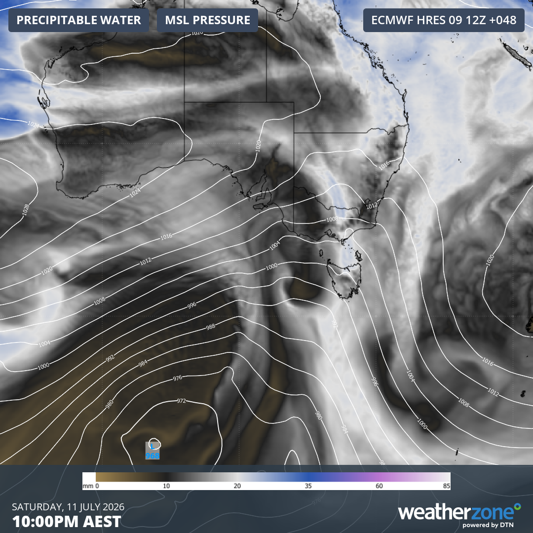
Image: Precipitable water and mean sea level pressure over southern Australia and the Southern Ocean at 10 pm (AEST) on Saturday, July 11, 2026, according to the ECMWF model. Source: Weatherzone.
The image above shows the expected position of the low’s centre a long way south of Australia on Saturday night. The main band of precipitation associated with the cold front can be seen crossing the southeast.
Weekend weather for the southeastern capitals
Adelaide will be wet and windy, with showers heaviest on Saturday and maximums around 15°C on both weekend days. Rainfall totals in the vicinity of 20 mm are likely from this event between Saturday and Monday, with heavier falls possible in the Adelaide Hills.
Melbourne is also set for some heavy showers Saturday (likely later in the day), with weekend maximums around 15°C on Saturday and 14°C on Sunday. Melbourne could gain around 10 mm from this event, with showers persisting into Monday.
Hobart will not be as wet as western Tasmania, where heavy rainfall is expected over several days. But the city should still see a few millimetres from this event. The maximum will be around 14°C on Saturday in the milder northwesterlies ahead of the front, then a chilly 11°C on Sunday.
Canberra doesn’t tend to see much rain from these events, even as clouds coat the Brindabella Range west of the city, delivering rain and/or snow all day. But the city itself should still see a shower or two on Saturday evening and Sunday morning. On Sunday, expect a cold maximum of just 9°C.
In westerly systems like this, Sydney tends to be shielded from showers by the Blue Mountains and Southern Highlands. Temperatures are also typically quite mild ahead of the front, but after a Saturday maximum around 19°C, Sunday will be a little chillier with a maximum of 17°C.
Note that all of the temperatures mentioned are expected to feel much colder due to those strong northwesterly to westerly winds.
For example, Melbourne’s apparent or "feels like" temperature is likely to remain below 10°C all weekend, while Sunday in Canberra will feel very close to 0°C all day.
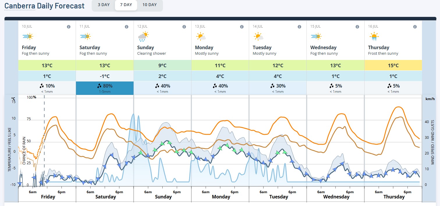
Image: The brown line is the apparent or "feels like" temperature expected for Canberra in the 7-day forecast period. Note how it is close to 0°C all day on Sunday. Source: Weatherzone.
What is the snowfall potential from this system?
We wrote on Wednesday that the early indications for this system were that it could deliver around 15 cm of snow to the mid-level of most ski resorts.
That could now be more like 20-25 cm, with the potential for even heavier snowfalls at the highest elevations over the period between Saturday afternoon and Tuesday morning.
For those visiting the snowfields, expect very strong winds in the alpine region, with the likelihood of chairlifts being placed on wind hold, especially late on Saturday and during Sunday.
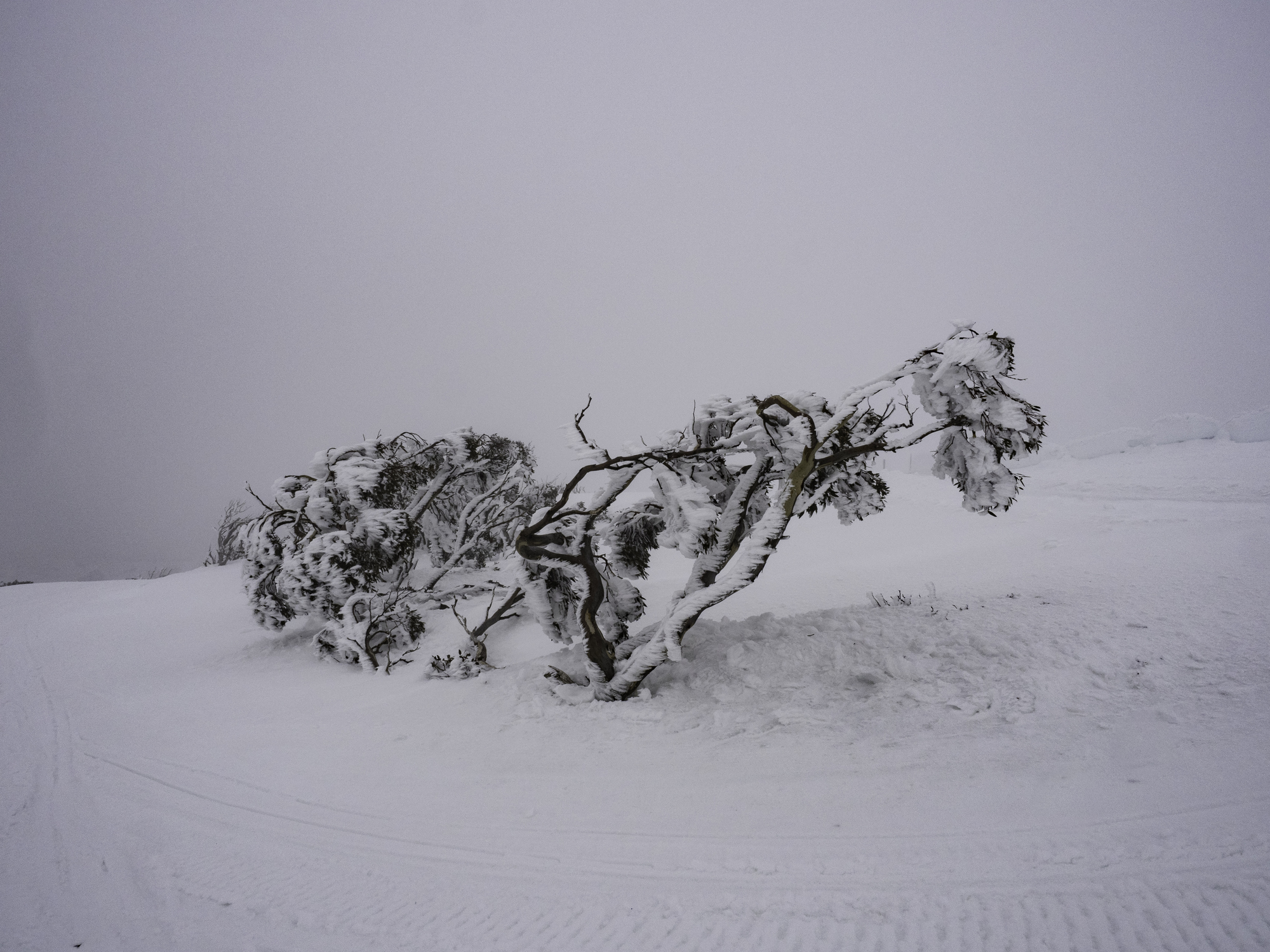
Image: An ice-encrusted snow gum in an Australian Alps blizzard of the type we will see this weekend. Source: iStock/Chris Gordon.
This is not a system with a prolonged push of polar air that will linger over the southeastern mainland for several days, but there is a brief influx of very cold air expected early on Sunday morning, with snow levels dropping to 1000 metres or slightly lower.
The snow level will start to rise on the mainland later on Sunday, with most resorts still enjoying snow showers on their upper slopes, while the lower slopes could see the dreaded "clear snow", otherwise known as rain.
But overall, this will be a very welcome top-up for the Australian snowfields, just eight days after the (belated) first significant snowfall of the 2026 ski season. It will also be a particularly snowy system for Tasmania, with snow levels dropping to 600 metres in our southernmost state by Monday.
Please check the Weatherzone snow page for the latest forecasts, live cam images and more.
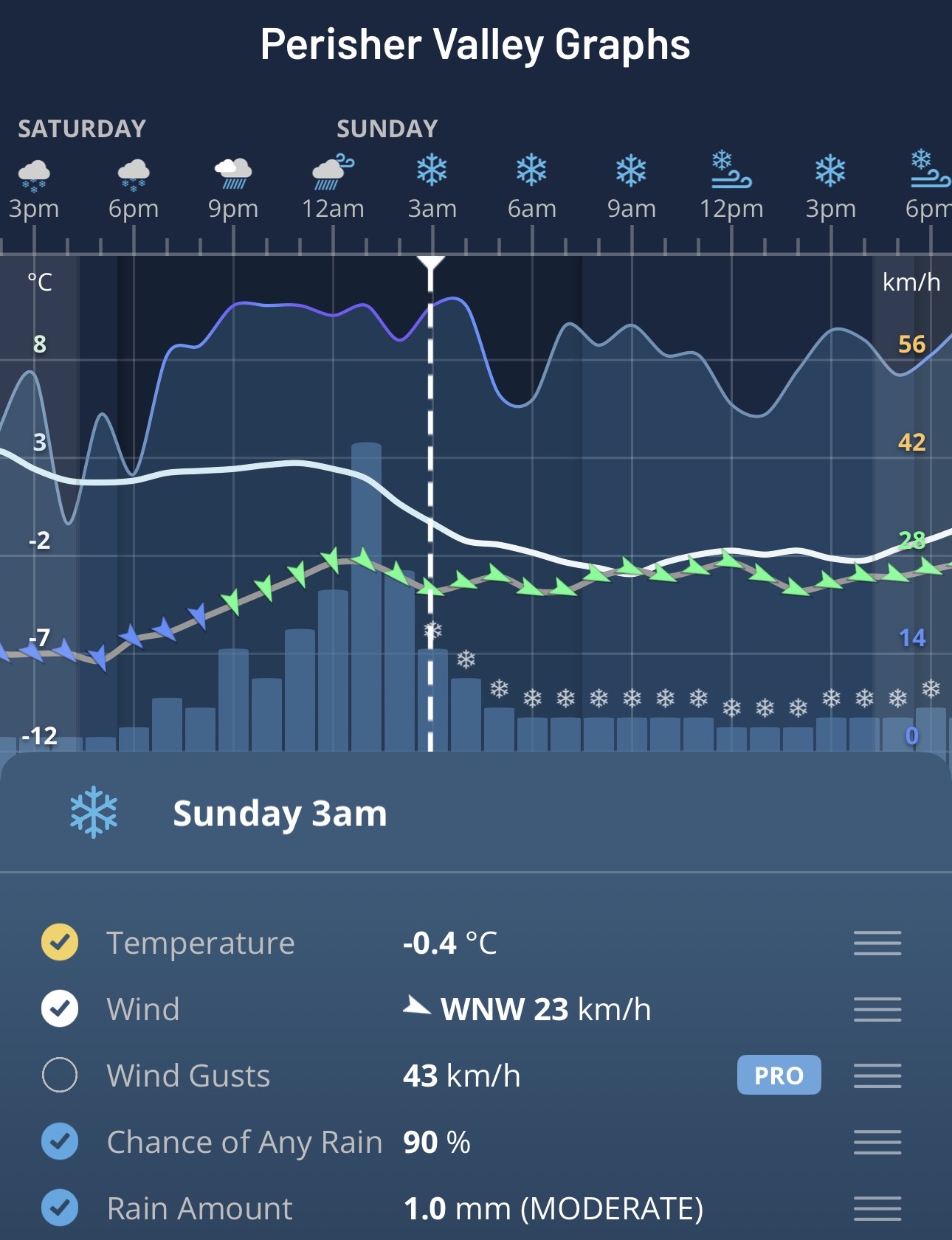
Image: Perisher Valley Graphs on the Weatherzone app.