
Cold week ahead for Australia with rain looming for east coast
A cold Southern Ocean air mass will spread across Australia this week, causing a run of wintry days and nights for much of the country before possibly culminating in heavy rain along the east coast.
The image below shows a tongue of cold air extending from the Southern Ocean towards southwestern Australia on Monday. This frigid air mass will slowly spread across the country during the remainder of this week, causing a spell of cold and wet weather.
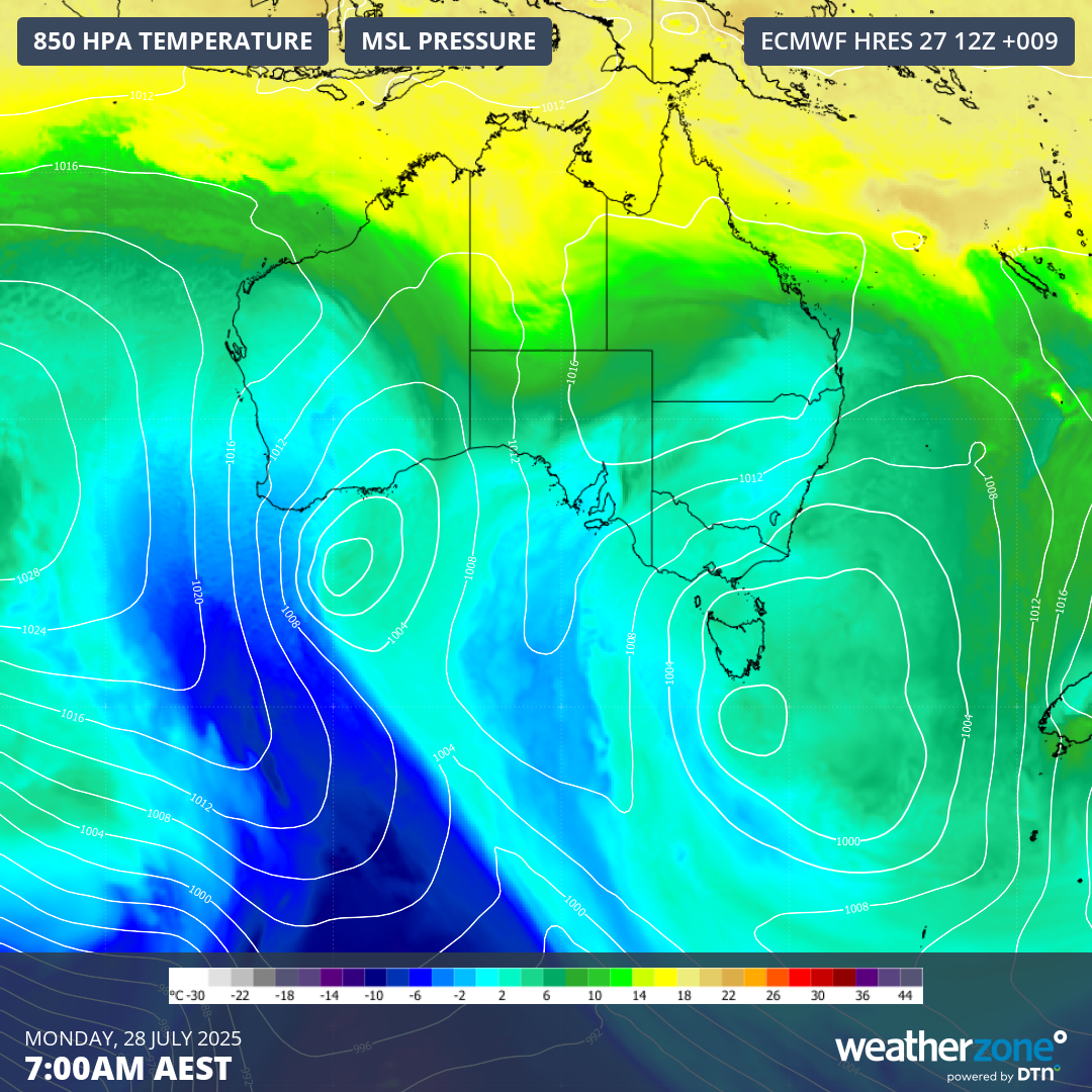
Image: Modelled 850 hPa temperature and mean sea level pressure at 7am AEST on Monday, July 28, 2025.
Perth only reached 13.9°C on Monday under the influence of the cold air mass, which was the city’s coldest day so far this year. When factoring in wind chill, most of the day felt colder than 10°C.
As this cold air spreads further east and north throughout the week, temperatures will also drop in Adelaide, Melbourne, Hobart, Canberra, Sydney and Brisbane.
Adelaide and Melbourne are both predicted to see maximum temperatures of around 13°C on several days this week, with a few overnight minimums of about 4 to 5°C. These temperatures are about 2 to 4°C below average for this time of year.
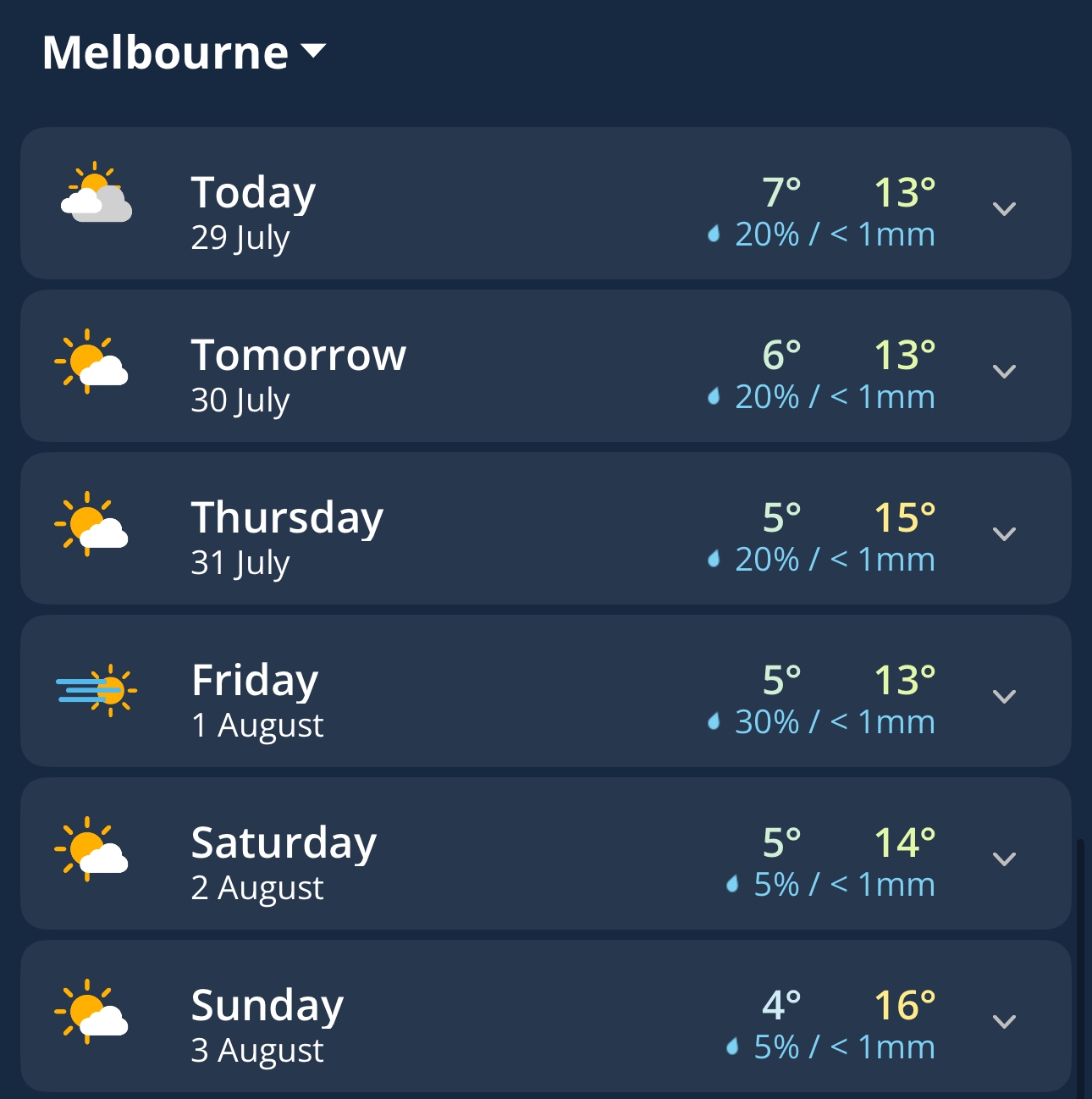
Image: Daily forecast for Melbourne, Vic, on the Weatherzone app.
When the pool of cold air reaches eastern Australia later in the week, temperatures will take a dive, but rain and wind are likely to increase over parts of NSW and Qld. There are also signs that the cold upper-level air could produce a dynamic low pressure system near the country’s east coast over the weekend, increasing the risk of heavy rain and damaging winds.
It’s too early to know where and how much rain will fall in eastern Australia later this week. At this stage, there is potential for heavy rain and damaging winds in eastern NSW and southeast Qld towards the end of the week, most likely on the weekend.
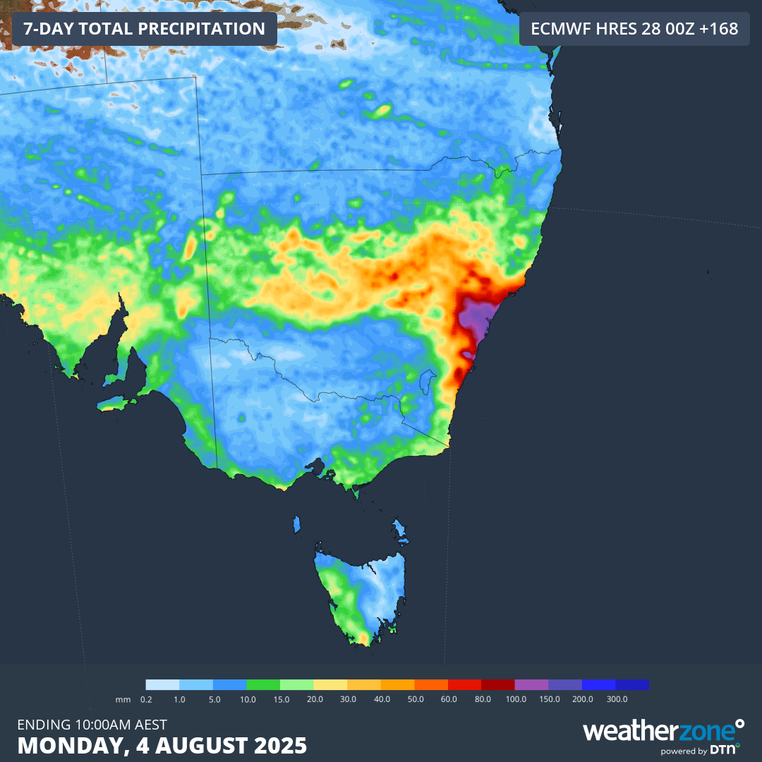
Image: Forecast accumulated rain over the 7 days starting at 10am AEST on Monday, July 28, 2025.
Be sure to keep an eye on the latest forecasts and warnings in your area throughout the week for updates on this system.