
Cold weather inbound for southern, eastern Australia
A large pool of cold air from the Southern Ocean will cause a mix of cold, wet, and windy weather across parts of southern and eastern Australia this weekend and early next week.
On Friday, showers were developing and wind strengthening over parts of southern Australia as a mass of frigid air approached the country from the south. By midday, wind gusts had reached 104km/h at Mount William in Victoria and around 70km/h at Cape Willoughby and Hindmarsh Island in South Australia.
There were also some unusual clouds spotted on Friday morning as the leading edge of the wintry weather system started moving over South Australia. This included wavy asperitas clouds and rows of undulatus clouds around Adelaide. But while these clouds were an impressive sight, they were the start of a period of more unsettled weather looming over the horizon.

Image: Undulatus clouds over Adelaide on Firday morning. Source: @red_donkey_photographic / Instagram.
A cold front will cause showers and blustery winds as it passes over South Australia and western Victoria on Friday afternoon and evening. This rain and wind-bearing front will then move over Tasmania, Victoria, and western NSW on Saturday and remaining areas of NSW and southern Queensland on Sunday. The front will also send a surge of dry and cool air through central and northern Australia on the weekend.
In the wake of the front, a complex area of low pressure will combine with the broad upper-level pool of cold air to cause showers, thunderstorms, hail, and snow across multiple states and territories during the weekend and early next week.
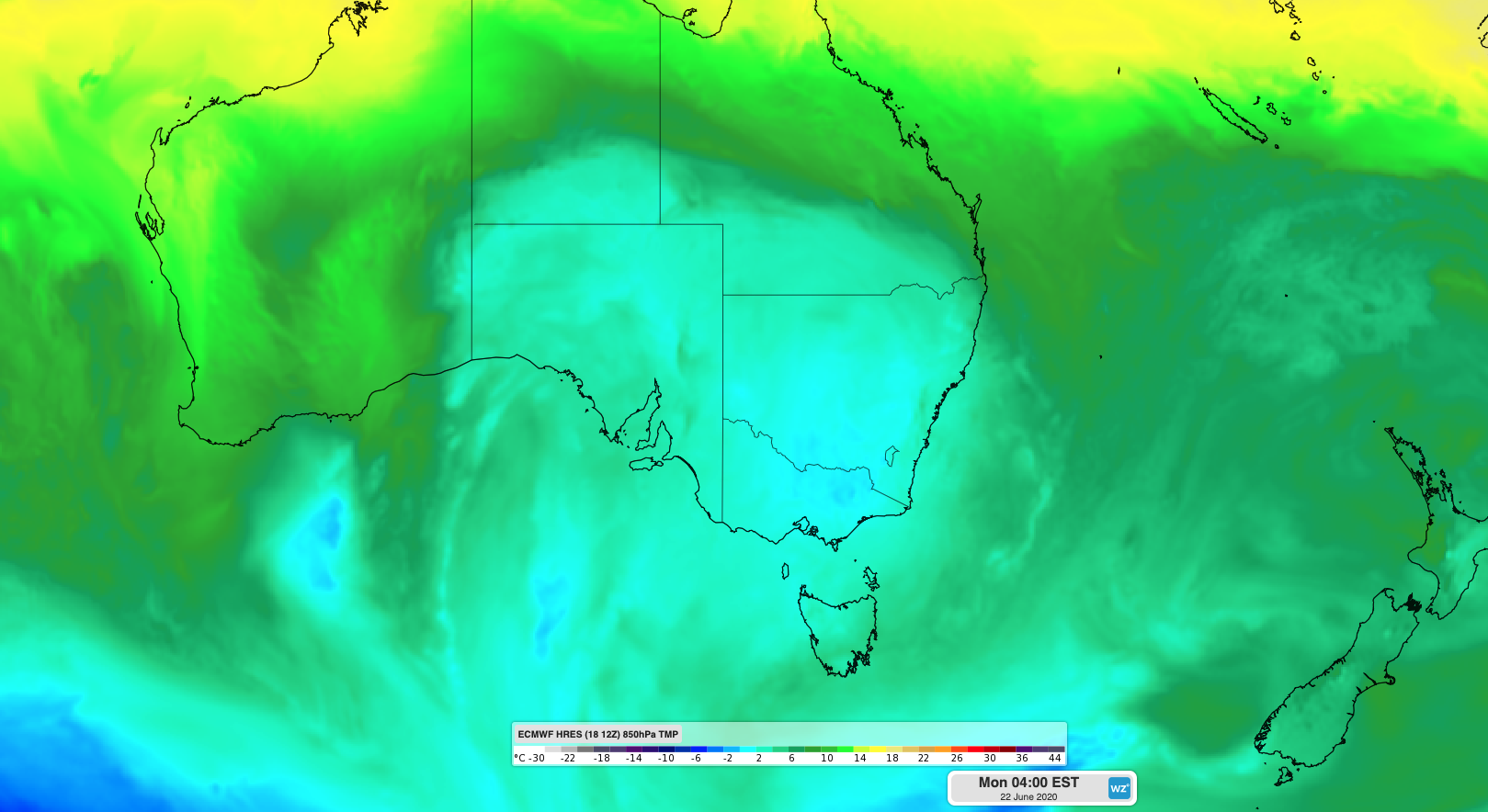
Image: A broad mass of cold air over passing over southeastern Australia on Monday morning.
The rain from this system will be widespread, although totals will vary quite a lot from place to place. The heaviest falls are likely about the exposed western and southern faces of the Great Dividing Range, along parts of the country's southern coastline and over northern and eastern Tasmania. Flood watches have been issued for some catchments in northeast Victoria and northern Tasmania.
Temperatures will drop low enough for snow to fall in parts of Victoria and NSW between Saturday and Tuesday. As the cold air spreads north, there's a good chance that snow will settle over the peaks in central NSW by Monday, and possibly in northern NSW late on Monday and on Tuesday.
This wintry weather system may make some outdoor activities dangerous during the next several days. Be sure to check the latest forecasts and warnings in your state or territory.