
Cold snap looms for southeastern Australia

Another burst of wintry weather will cause showers, thunderstorms, blustery winds and low-level snow in southeastern Australia from this weekend.
A mass of polar air will spread across the nation's southeastern states on Sunday and Monday in the wake of a strong cold front.
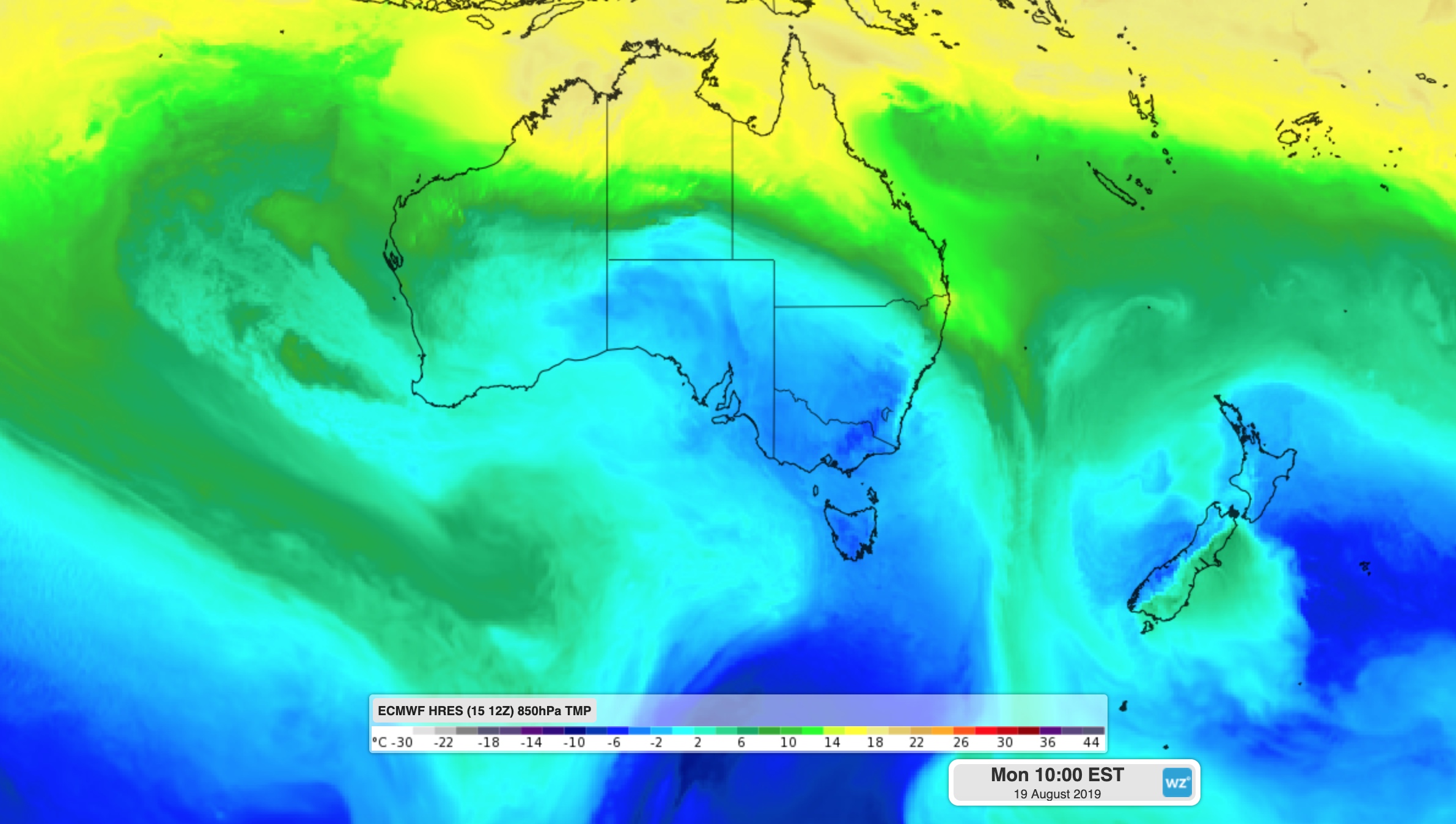
Image: Cold air over southern and southeastern Australia on Monday, August 19th.
This system will cause showers and thunderstorms to develop over southern districts of South Australia from Saturday night into Sunday. Showers and storms will then spread across across Tasmania, Victoria, southern NSW and the ACT during Sunday and Monday morning, as the front moves further east.
Damaging winds are likely to develop in alpine areas from Sunday and could also occur in other areas of southeastern Australia. Severe weather warnings will be issued in the coming days.
The impending air mass will be cold enough to cause low-level snow in some states and territories. Snow could fall down to 500 metres above sea level in Tasmania and 600 metres in Victoria and southern NSW on Monday. However, the snow from this system won't be as heavy, widespread or long-lasting as it was last week.
Another front could clip southeastern Australia on Tuesday or Wednesday, maintaining chilly winds, showers and snow into the middle of next week.