
Cold nights, warm days in classic week of autumn weather
A classic autumn pattern of cold nights and warm days is in store for much of the country this week, after a cold front swept across southeastern Australia over the weekend.
Repeated bursts of cold, moist air delivered heavy snow to elevated parts of Tasmania, with lighter falls on the highest peaks of the mainland.
The dry airmass in the wake of the weekend system is producing chilly overnight temperatures that would have had many Australians busting out the doona for the first time in months.
The coldest weekend minimums in each of the states and territories were:
- VIC -3.9°C Mt Hotham
- NSW -3.5°C Thredbo
- TAS -3°C kunanyi/Mt Wellington
- ACT -1.3°C Mt Ginini
- WA 1°C Eyre
- QLD 3.6°C Applethorpe
- SA 3.9°C Karoonda
- NT 8.1°C Alice Springs Airport
Cold weekend maximums
Australia also saw its first freezing maximums of the year on Saturday, with the mercury at Mt Hotham in Victoria peaking at just -0.6°C, kunanyi/Mt Wellington in Tasmania climbing to just -0.1°C, while Thredbo Top Station in NSW hit a high of exactly 0.0°C.
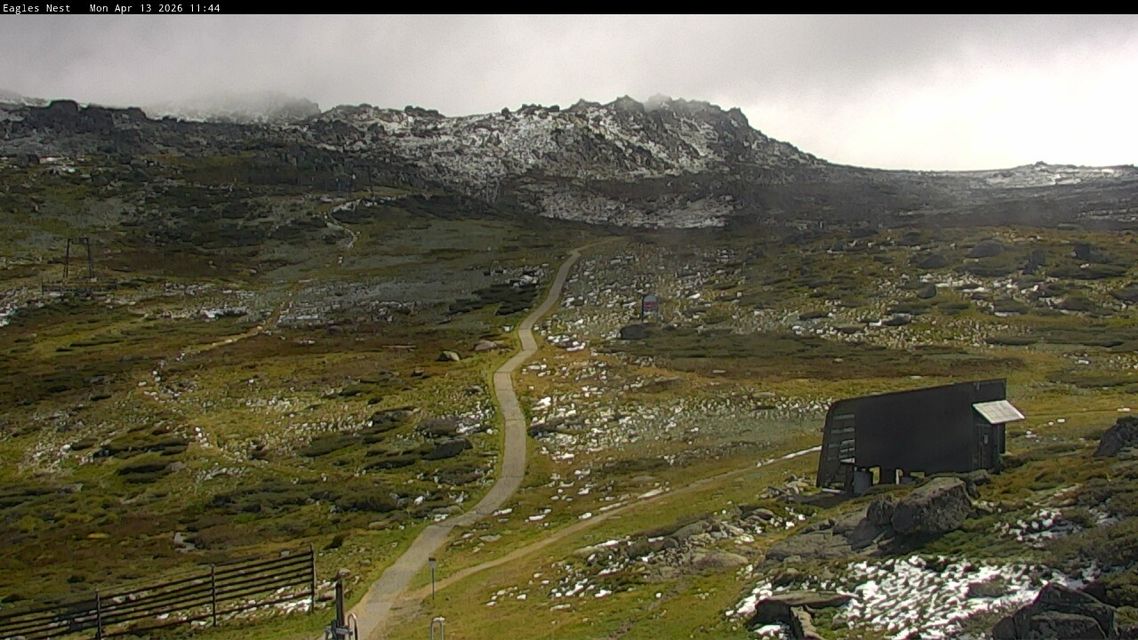
Image: Remnants of the weekend snowfall melting quickly on Monday morning at Thredbo Top Station. Source: Thredbo.com.au.
In Hobart, Saturday’s maximum of 11.5°C was by far the coldest day of the year to date. Indeed, it was colder than the average maximum of 11.9°C in July, the coldest month of the year.
Melbourne failed to reach 17°C on both days over the weekend, while even Sydney felt relatively cool on Sunday despite its mild maximum of 21.4°C, with the wind chill keeping the apparent or "feels like" temperature up to seven degrees below the official still-air reading for much of the day.
Cold nights, warm days for the week ahead
As mentioned, a large part of the country can now expect cool to cold nights with warm days for at least the first half of the working week, as a strong high pressure system centred near Adelaide becomes the dominant feature of the national weather pattern.
The national capital is a good example of conditions that can be expected across a broad area, with minimums falling towards freezing while afternoons will be close enough to T-shirt weather.
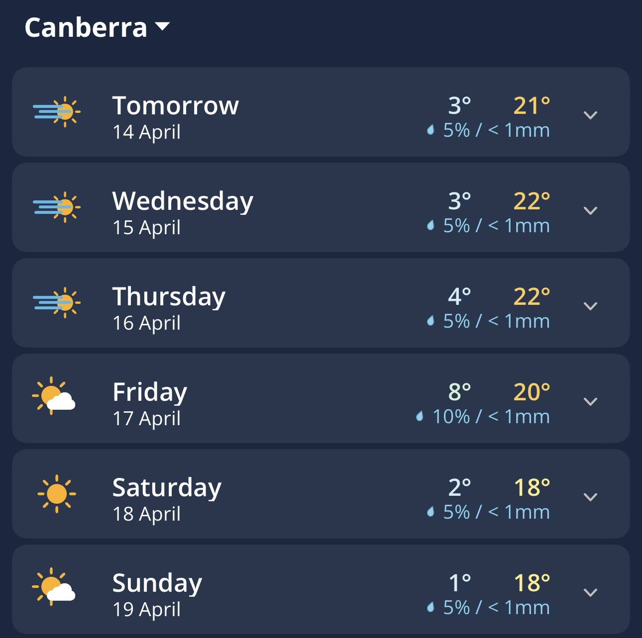
Image: Daily Forecast for Canberra on the Weatherzone app.
Another good example is Applethorpe, in southern Queensland’s elevated Granite Belt region, where mild afternoons in the mid-20s will be around 20 degrees warmer than the cool single-digit overnight minimums.
By the middle of the week, ex-Tropical Cyclone Maila will begin to impact Queensland’s weather with coastal rain that could extend well inland. Two separate cold fronts will cool things down in southwest WA and again in Tasmania as the weekend approaches.