
Cold mornings and persistent fog chills southeastern Australia
A strong high pressure system has delivered some of the coldest weather in years across parts of Australia, with many residents reaching for an extra blanket overnight as freezing mornings gripped the southeast, as well as unusually chilly conditions extended far north into Western Australia and the Northern Territory under a very dry atmosphere.
Some locations recorded their coldest morning in years, including:
- Braidwood, NSW: -6.1°C (coldest in 3 years),
- Delegate, NSW: -6.1°C (nearly 3 years),
- Dum In Mirrie, NT: 12.8°C (2 years),
- Cape Fourcroy, NT: 13.3°C (2 years),
- Kalumburu, WA: 8.3°C (2 years),
- Strathalbyn, SA: 0.6°C (2 years).
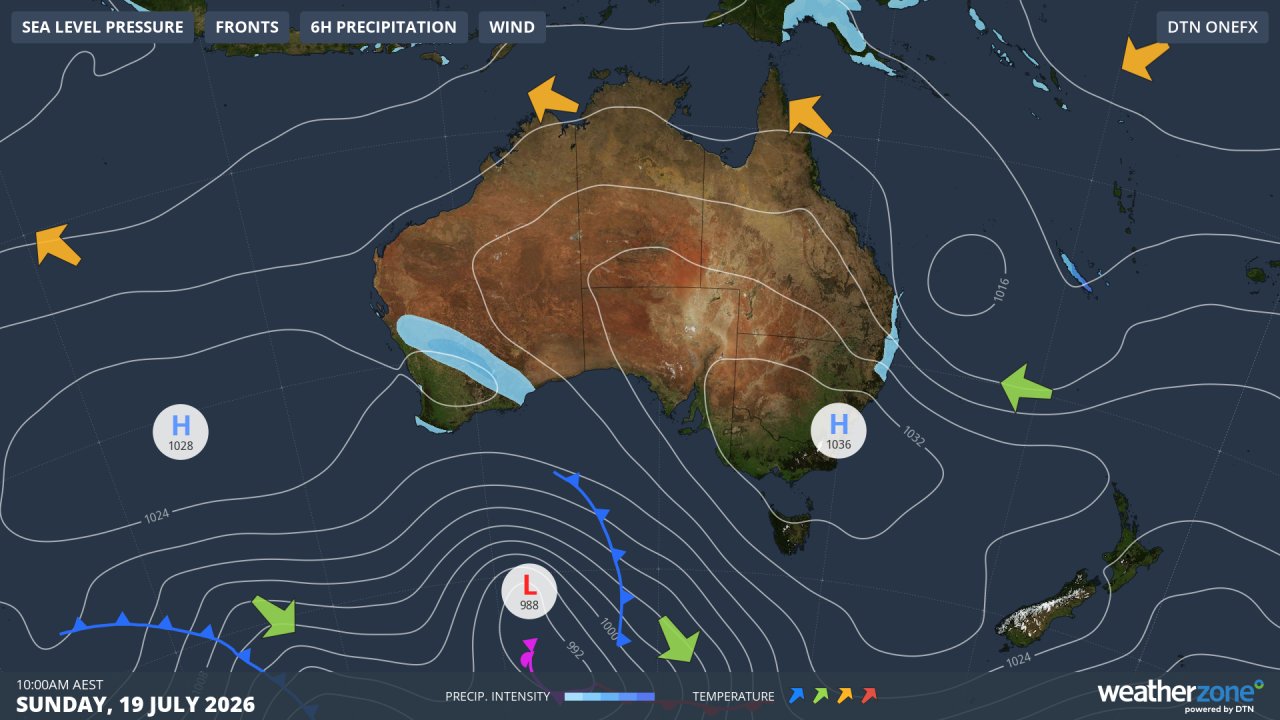
Image: Synoptic chart for Sunday, July 19, 2026. Source: Weatherzone.
The cold weather has been caused by a strong high pressure system sitting over southeastern Australia. High pressure overhead brings clear skies and light winds, allowing heat at the surface to effectively escape into space overnight. Normally, clouds act like a blanket by trapping some of the Earth's warmth, but with little cloud around, temperatures can fall rapidly after sunset.
High pressure systems also provide ideal conditions for fog to form overnight. While morning fog usually rises and clears after sunrise, parts of inland Victoria remained shrouded in fog well into the afternoon yesterday, with similarly persistent fog likely again today. The fog blocked much of the sun's warmth, keeping temperatures low throughout the day.
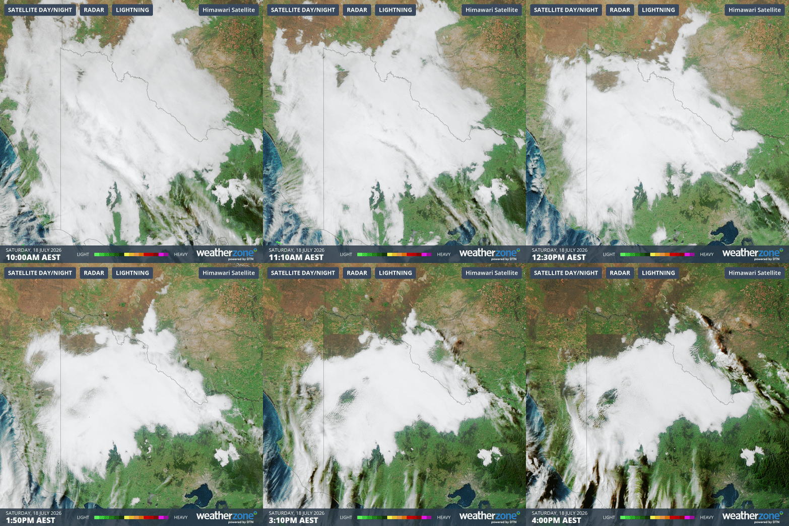
Image: Satellite image of a large fog patch lingering over inland parts of southeast Australia over the six hours to 4:00 pm AEST on Saturday, July 18, 2026. Source: Weatherzone.
As a result, several Victorian locations recorded their coldest July day in decades, including:
- Stawell: 6.9°C (coldest day on record, 30 years)
- Longerenong: 8.1°C (24 years),
- Horsham: 8.1°C (22 years),
- Edenhope: 9.1°C (10 years),
- Walpeup: 9.0°C (6 years),
- Charlton: 8.2°C (6 years),
- Hopetoun Airport: 9.4°C (6 years),
- Swan Hill Aero: 8.9°C (6 years),
- Warracknabeal Airport: 7.4°C (6 years).
Fog and low cloud is once again shielding much of northern Victoria from the sun this Sunday, bringing a second bitterly cold day in a row. The high pressure system is expected to keep conditions mostly dry and settled across southeastern Australia over the coming days, with light winds bringing further cold mornings and allowing fog to form and linger in some areas.