
Cold fronts and cloudbands to bring rain and snow in Australia this week
A series of cold fronts and northwest cloudbands will cause a mix of rain and snow across Australia this week, affecting parts of at least six states and territories.
The satellite images below show a band of cloud stretching over WA and SA on Monday, while a field of speckled cloud can be seen lying over southeastern Australia.
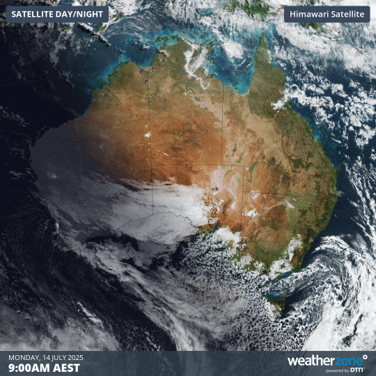
Image: Visible satellite images captured on Monday, July 14, 2025.
The speckled cloud over Australia’s southeast is associated with a cold air mass that brought snow to several states over the last 24 hours. This included snow to low levels in Tasmania and a top-up of fresh snow in the mainland Alps.
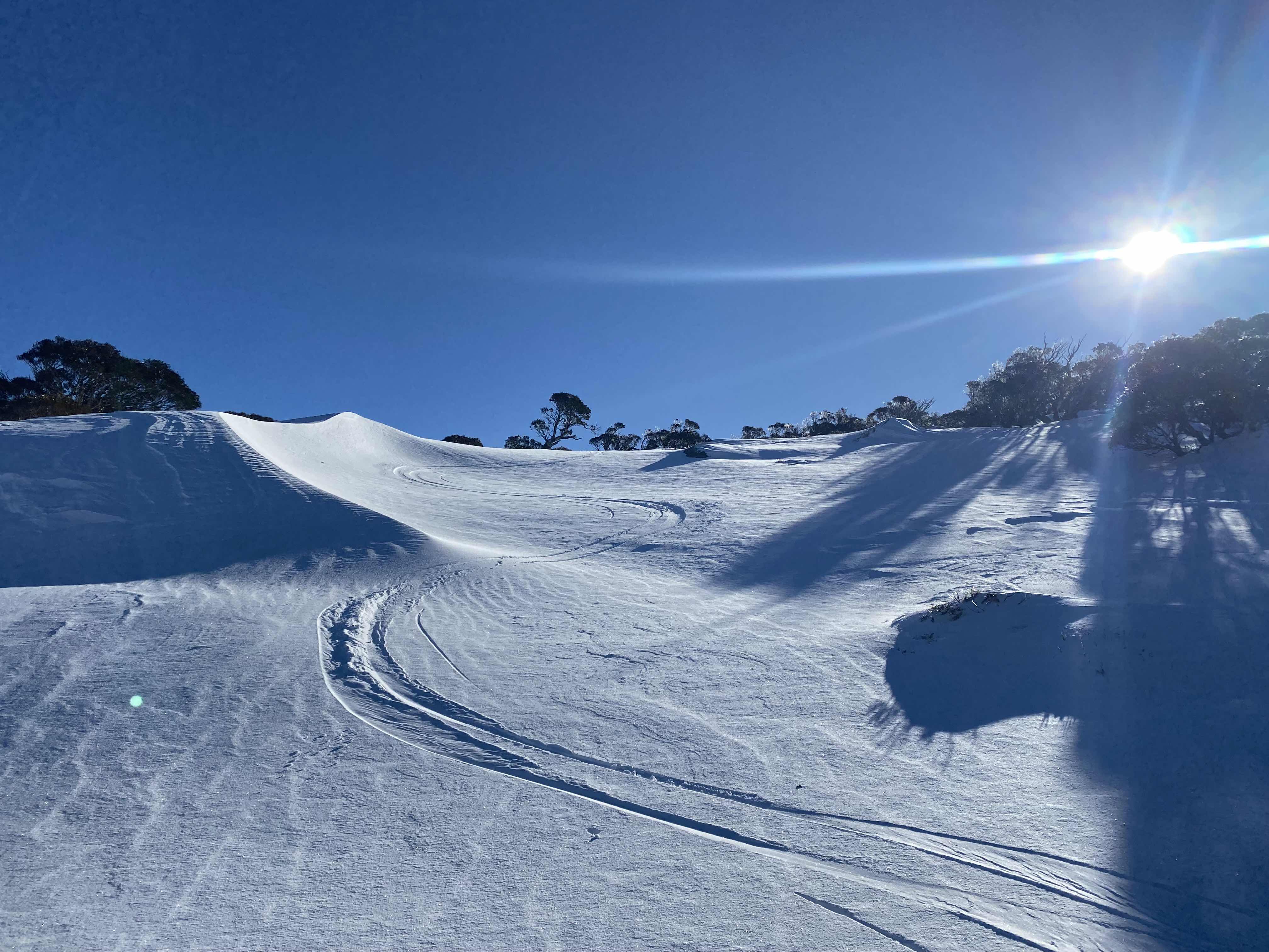
Image: Fresh tracks in the fresh snow near Perisher on Monday morning. Source: Steve Smith
While rain and snow are now clearing from southeastern Australia, the cloudband in the west is going to cause rain to spread over several states during the next two days.
The map below shows where rain is expected to fall during Monday and Tuesday combined as the cloudband drifts from west to east across the southern half Australia. The heaviest falls from this cloudband are expected to occur along a corridor stretching across SA and NSW.
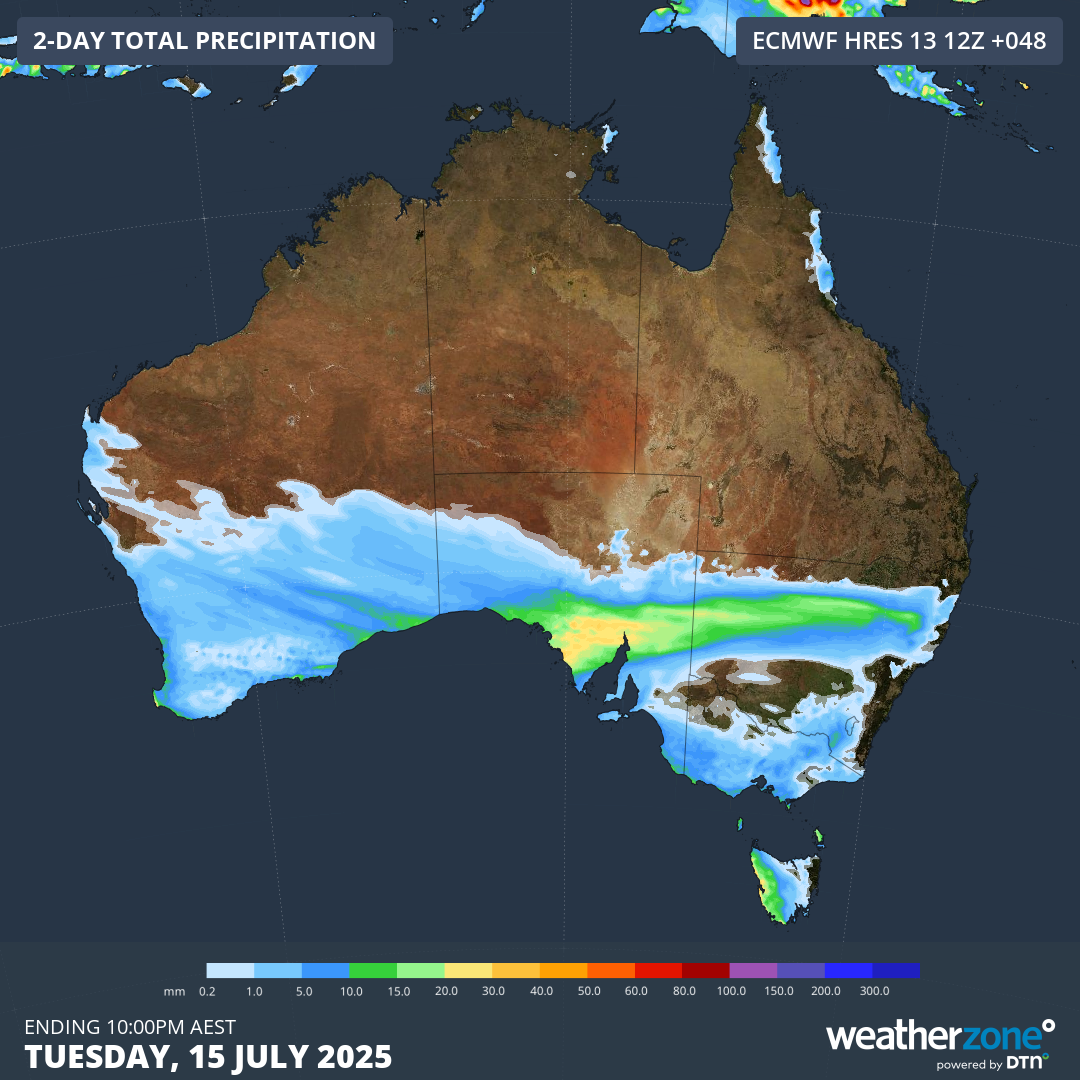
Image: Forecast accumulated rain during the 48 hours ending at 10pm AEST on Tuesday, July 14, 2025.
The thick band of cloud will also keep a cap on daytime temperatures across parts of SA and NSW on Tuesday. Broken Hill is only forecast to reach a top of 12°C on Tuesday, which is 4°C below average for this time of year. If the temperature stays below 11.8°C on Tuesday, it will be Broken Hill’s coldest day so far this year.
Sydney could also struggle to climb very far above 15°C on Tuesday as increased cloud cover restricts heating across the city.
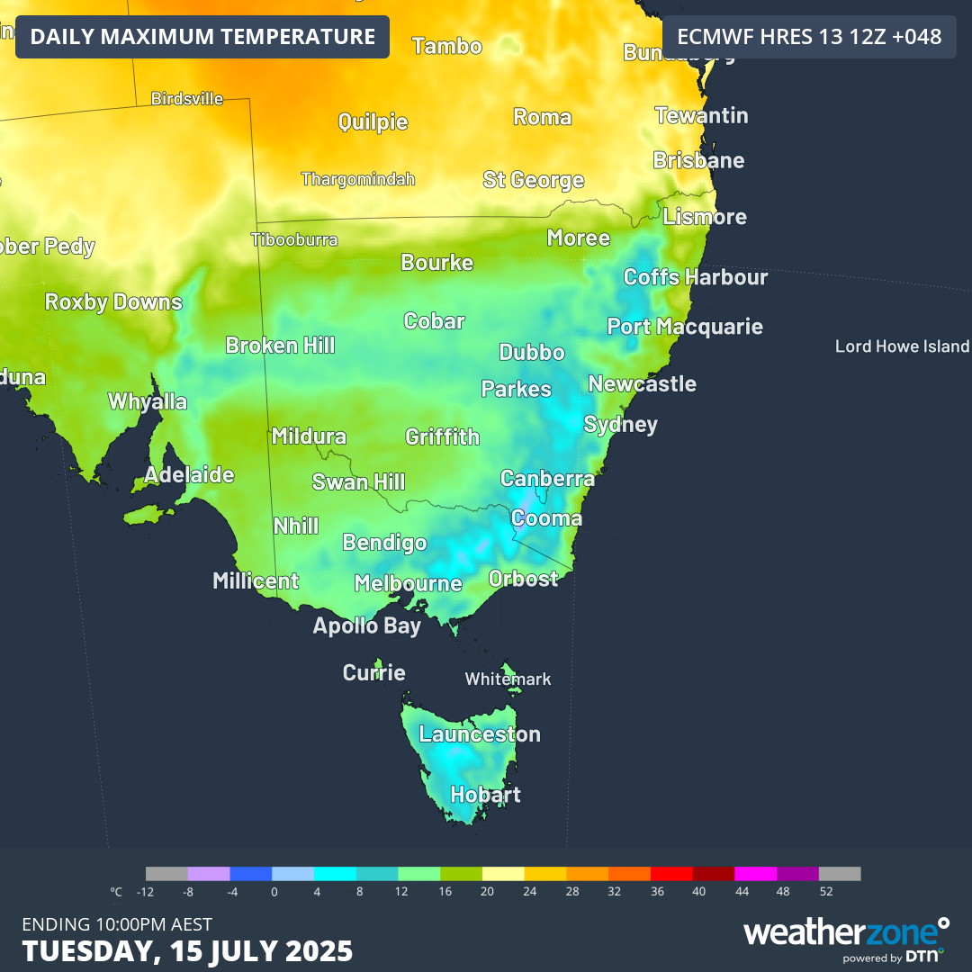
Image: Forecast maximum temperatures on Tuesday, July 15, 2025.
Cold fronts and another cloudband on the way
Later this week, two cold fronts will sweep across southern Australia and cause bursts of wind and showers in parts of WA, SA, Tas, Vic and southern NSW, along with dustings of alpine snow.
The first front will move across southern Australia from west to east between Tuesday night and Thursday. The second front will push across the country’s south in a similar fashion between Thursday night and Sunday. Both fronts will cause wintry conditions as blustery winds combine with cold air and showers.
An interesting feature associated with one of this week’s cold fronts will be a weak northwest cloudband forming over parts of Queensland and NSW on Thursday and Friday. This fleeting cloudband won’t bring widespread heavy rain, but it could deliver about 10 to 20 mm of rain to parts of central and southern Qld and northeast NSW.
This cloudband will also cause cool daytime temperatures over parts of southeast Qld and northern NSW. Brisbane is currently forecast to reach 22°C on Friday but it will struggle to get above 20°C if cloud cover gets thick enough.
This will be a week of fluctuating temperatures featuring periods of wet and cloudy weather for parts of southern and eastern Australia. Check the latest forecasts and warnings in your area throughout the week for the most up-to-date details.