
Cold front brewing up summer snow for Tasmania
A strong cold front is barrelling towards Tasmania and is set to deliver summer snow to our southernmost state.
Snow is expected to fall above about 1000 metres on Thursday as the front rushes through, which means the 1271-metre summit of kunanyi/Mt Wellington above Hobart should see a few flakes.
You can see the unseasonably cold airmass in the Southern Ocean in the satellite loop below.
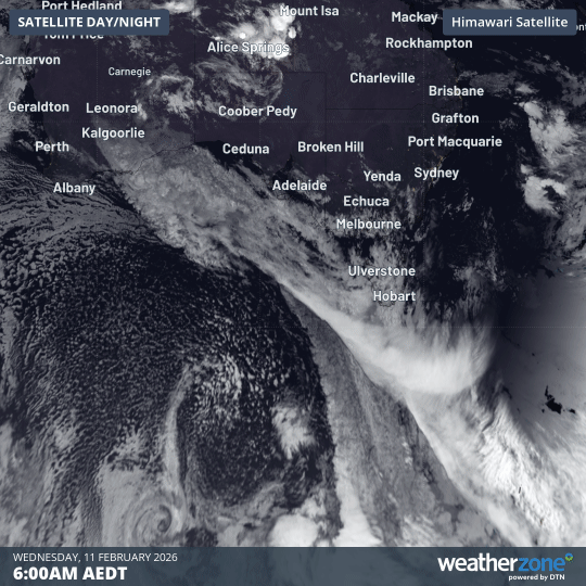
Image: Satellite loop over the Southern Ocean and southern Australia from 6am to midday (AEDT) on Wednesday, Feburary 11, 2026
Why the spectacular speckled cloud pattern?
Weatherzone meteorologist Ben Domenisno says that the speckled cloud pattern typically associated with these cold outbreaks is due to multiple individual cumulus clouds over a broad area.
"These clouds form when very cold air moves over a relatively warm area of ocean," Domensino explains.
"Each of these cloud cells can produce rain, hail, snow and thunderstorms, with patches of clear sky in between."
Showers and storms likely ahead of cold change
A cloudband is clearly visible pushing ahead of the cold front. It contains moisture from the remnants of Tropical Cyclone Mitchell, which has been dragged across the continent and Southern Ocean in a southeasterly direction.
In fact, the cloudband extends all the way to Antarctica.
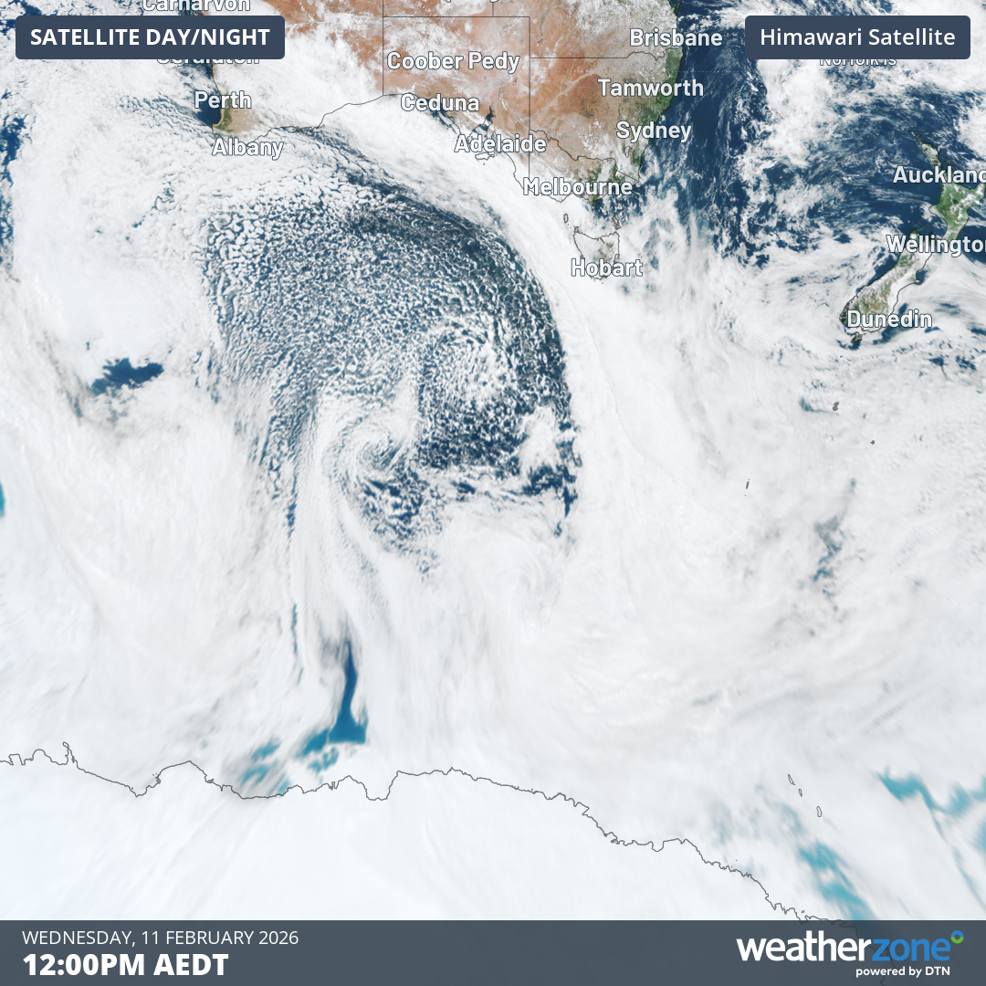
Image: Satellite view at midday on February 11, 2026 (AEDT) showing the area from Antarctica to southern Australia.
As the warm and cool airmasses interact, showers and some thunderstorms will occur, heaviest in western Tasmania.
Southern Victoria will also see a few drops here and there, however it's unlikely that Melbourne will receive its first significant rain for the year. To 9am Wednesday, February 11, Melbourne has had just 4.2mm of rainfall in 2026.