
Cold front blasts into Sydney
A powerful cold front hit Sydney late on Friday afternoon, causing damaging winds and a rapid drop in temperature.
Warm and dry northwesterly winds ahead of the approaching front saw the mercury reach 24ºC in Sydney and 25ºC at the airport. This spring warmth was occurring in Sydney as the looming front was dragging a snow-bearing cold air mass across southern and central NSW.
The front swept across the Sydney Basin roughly between 4pm and 5pm, causing conditions to rapidly deteriorated across the city. Wind gusts reached 115km/h at Camden at 4:15pm and 106km/h on Sydney Harbour at 4:55pm.
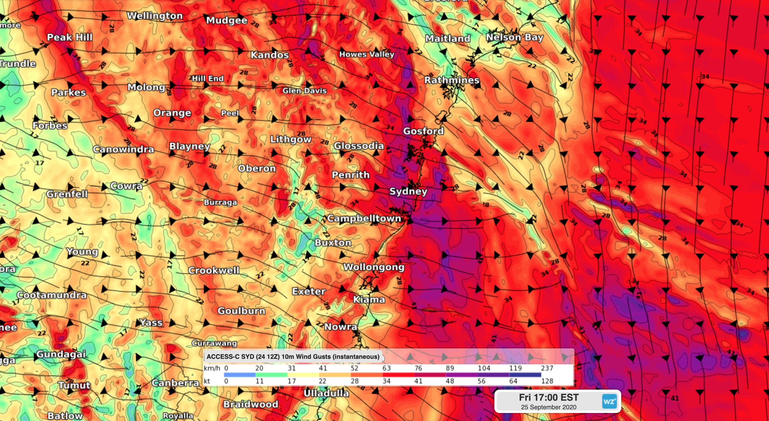
Image: Modelled wind gusts at 5pm AEST on Friday, according to the ACCESS-C model.
The arrival of the front also ushered in a cold air mass, causing the temperature to plummet. The mercury fell by 8ºC in less than half an hour at Sydney Airport shortly before 5pm. At 4:53pm, wind chill was making the air temperature feel like 0.2ºC at the airport.
At 5:30pm, a severe weather warning was still in place for damaging winds in Sydney, the Illawarra and parts of surrounding districts.