
Cold enough to freeze the clackers off these alpacas
Elevated areas of central NSW have woken to a blanket of thick snow this morning as residents along the state's southern coastline recover from a night of cyclonic winds.
Two contrasting air masses clashed over NSW during the last 48 hours. One was a surge of cold air from the south and the other was much warmer moisture-laden air from the north.
As these air masses slammed into each other, the atmosphere erupted in an outbreak of rain, thunderstorms, snow, and wild winds.
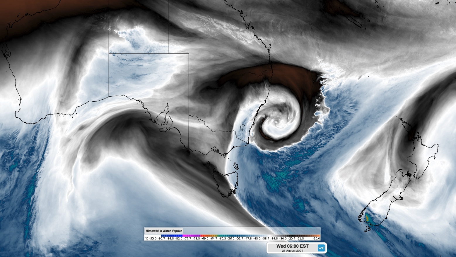
Image: Enhanced water vapour satellite image showing a low pressure system over the Tasman Sea on Wednesday morning, which formed in response to two contrasting air masses clashing near NSW.
Tuesday saw snow falling from the Alps in Victoria all the way up to Guyra in northern NSW. Some of this snow continued overnight and as the sun rose on Wednesday morning, the central ranges and tablelands in NSW resembled a ski field.
Video: It was cold, but not cold enough to miss breakfast at McKeown's Rest B&B near Oberon.
There have been reliable reports of around 25-30 cm of snow on the Oberon Plateau this morning, with close to 10cm on the ground in parts of the Blue Mountains.
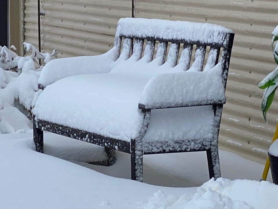
Image: Deep snow on the Oberon Plateau on Wednesday morning. Source: Blackheath Weather
This entire snow event was watched closely by local weather legend Blackheath Weather, who has been sharing great images and updates throughout this event on his Facebook and Twitter feeds.
He told Weatherzone that the snow has been a nice treat for locals during the lockdown.
"The feeling in Blackheath, is that of thankfulness, for such a lovely snowfall overnight. A wonderful blessing during lockdown. Even the newborn plover chicks survived the snow overnight, at our local gym."
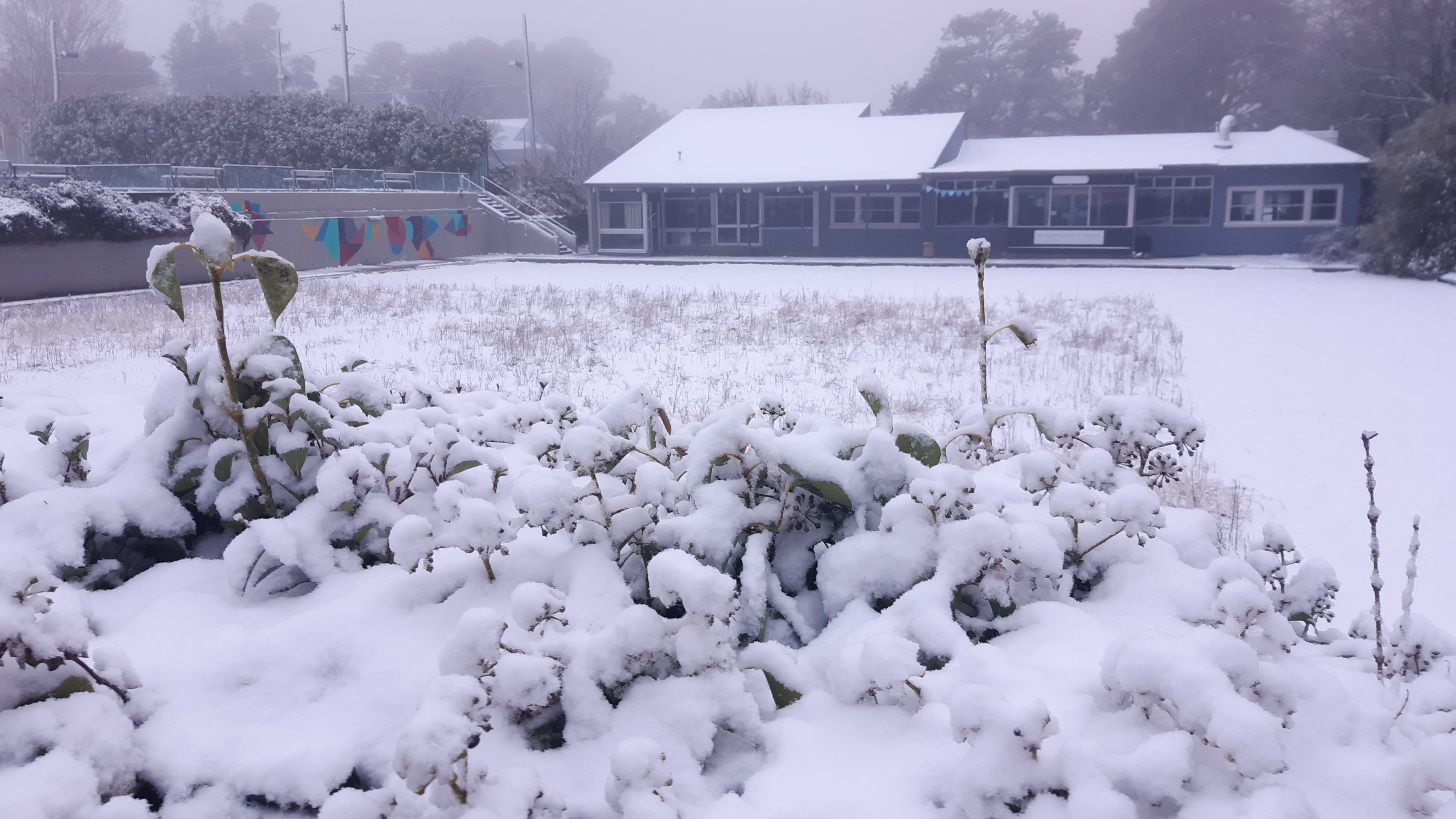
Image: The wintry scene in Blackheath on Wednesday morning. Source: Blackheath Weather
But while feelings have been running high in the mountains, this system has been battering parts of the NSW coast.
A rapidly deepening low pressure system caused wind gusts to reach up to 130km/h along the state's Illawarra coast on Tuesday night. This is the type of wind gust that you would typically see near the eye of a category two tropical cyclone.
Here are some of the strongest wind gusts that were recorded on Tuesday night.
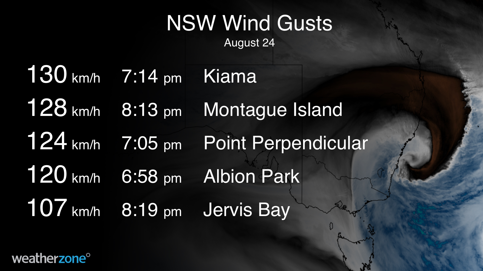
Unsurprisingly, these powerful winds caused building damage, brought down trees and cut power in some areas.
The wild winds also whipped up massive waves.
Maximum wave heights reached about 14.2 metres off the coast of Port Botany last night, with significant wave heights hitting 8.44 metres.
According to Mitchell Harley, a coastal researcher at the University of NSW, this is statistically a 1 in 50 year event for this location.
The Botany Bay wave buoy operated by Sydney Ports recorded a peak significant wave height (Hs) of 8.44 metres overnight. That's a 1 in 50 year event for that wave buoy. Maximum wave height (Hmax) reached 14.2m #SydneyWeather #SydneyStorm pic.twitter.com/uiSgbCeuxn
— Mitchell Harley (@DocHarleyMD) August 24, 2021
The big waves caused water levels to reach close to half a metre above the astronomical tide overnight, which saw water inundating some areas of the coast around last night's high tide.
While the strongest winds have likely past, damaging gusts and large waves will continue along the southern half of the NSW coast today. Check the latest severe weather warning and hazardous surf warning for up-to-date information.