
Cloud band bringing coldest string of days in more than a decade to the interior
Alice Springs rounded out the month of June with a maximum temperature of just 8.7°C on Friday, the coldest day of any month since 2014 and 11 degrees below average. Saturday is also going to be cold, forecast to make it to just 8°C, which would make Friday and Saturday the coldest pair of days since July 2010.
The cold daytime temperatures are the result of a broad and thick cloudband inhibiting daytime warming. This cloudband is forming in a deep upper trough over Australia as shown below and will edge east across the interior between now and Tuesday, taking cold maximum temperatures 10-15 degrees below average into western Queensland and New South Wales. For those east coasters craving sun after the last two years, heading west right now won't give you what you seek.
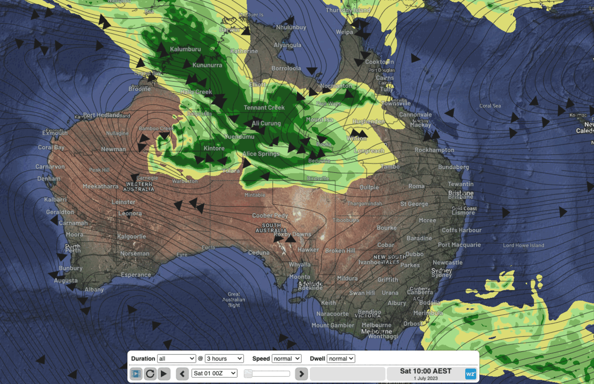
Image: Animation showing the cloudband ahead of an upper trough moving east over coming days into Qld and NSW.
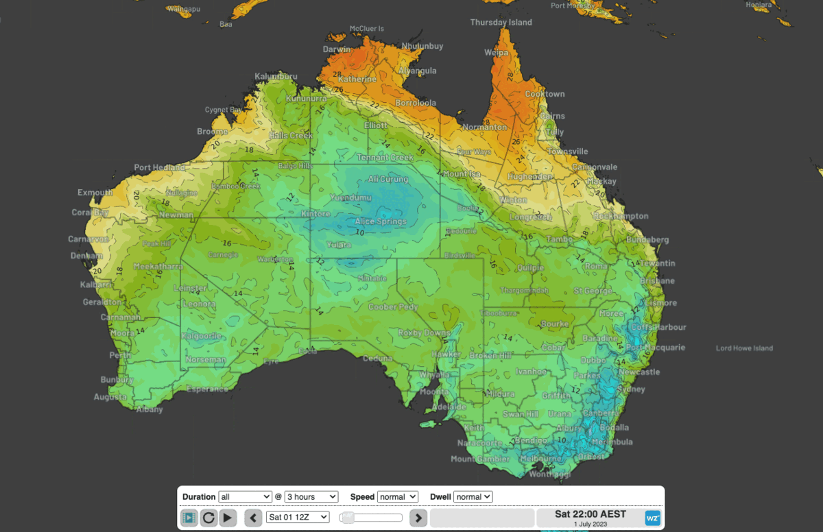
Figure 2: Forecast maximum temperatures Saturday to Monday.
The cloudband is also bringing unseasonal rain across the northern tropics as forecast here.
Top falls to 9am Saturday morning were about the western NT interior and adjacent WA, with 86mm at Bedford Downs in WA and 68mm at Lajamanu in the NT. Tennant Creek's 37.6mm was the highest Dry Season rain since July 1978.
Rainfall will edge east with the cloud over the coming 3 days, with the heaviest falls around northwestern Queensland on Sunday, then the central inland and even coast on Monday as onshore easterlies collide with the upper moisture.