
Chunky surf on the way for New South Wales
Large groundswell will move into the New South Wales and southeast Queensland coasts on Monday and Tuesday.
A deep low pressure system in the Southern Ocean to the south of Tasmania is moving into the Tasman Sea swell window. Seas to the southeast of Tasmania will reach heights of 10-12m, with most of this energy heading north towards New South Wales and southeast Queensland, but also towards New Zealand and south Pacific islands like Fiji.
 Image loop: Satellite imagery looped capturing this impressive low spinning in the Southern Ocean on Saturday March 2nd (above) and Sunday March 3rd (below), generating storm force winds and large seas.
A front extending from this low will bring a strengthening southerly wind change to parts of the New South Wales coast on Sunday afternoon and evening, reaching northern New South Wales and southeast Queensland on Monday. Wave heights will increase rapidly behind this change, reaching 3 to 3.5m. The real energy behind this powerful low will, however, quickly build over New South Wales from late Monday morning, reaching southeast Queensland by early Tuesday morning.
Long period groundswell reaching 14-16 seconds is expected for much of New South Wales, possibly stretching to 15-18 seconds further north, at the peak of this swell. Coasts exposed directly to this energy will be treacherous, with huge amounts of water and energy flowing into the coastline. Sudden, very large waves and powerful surges of water will make for dangerous conditions across rock platforms and beaches. Longer period swells carry much more energy than equivalent-height, shorter period swells, leading to sudden large movements of water, either across sudden powerful rip currents, and/or into the beaches or rock shelves.
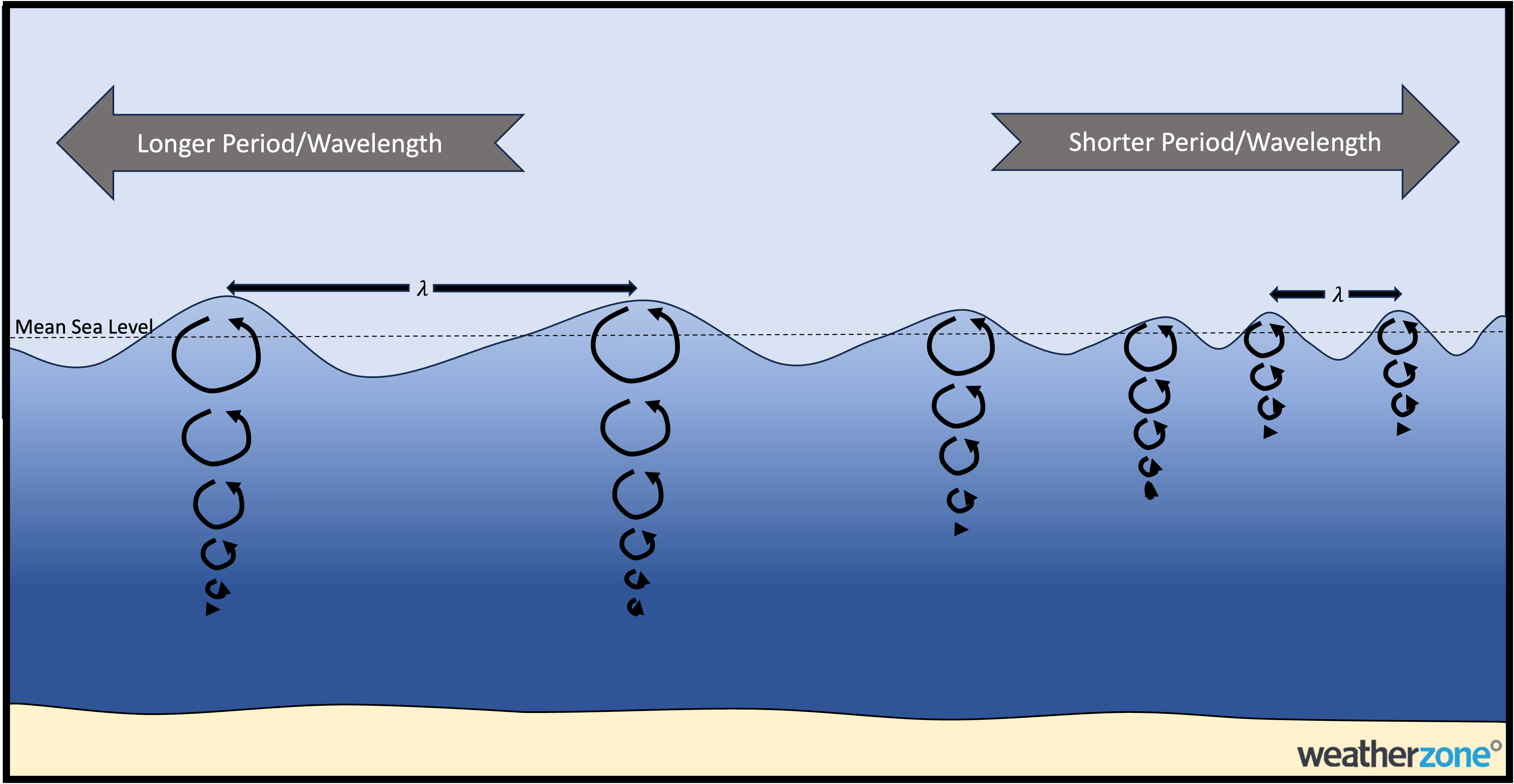
Image: A schematic showing how longer period swells carry more energy (at a greater depth) than shorter period swell.
The acute southerly direction of this large surf event will mean that north-facing coastlines and coastlines protected by points or headlands to the south will be smaller, but still sudden surges in energy are expected to move in and out of these more sheltered locations.
The large swell will gradually ease on Tuesday, but swell height should still be around 2m on Wednesday, with wave period slowly reducing to about 12-14 seconds into the middle of the week. Beach conditions will be deceiving until Wednesday or Thursday, as seemingly calm seas will be intermittently interrupted by large and powerful waves. A hazardous surf warning is currently out for all coasts of New South Wales, stretching between the Eden and Byron coasts. Please refer to the latest warning here: https://www.weatherzone.com.au/warnings