
Catastrophic Fire Danger for SA on Friday
Large parts of South Australia will experience their worst fire dangers since Black Summer, as a dangerous mix of high temperatures, low humidity and gusty winds combine on Friday.
Severe heatwave conditions have persisted since Monday over much of inland Australia, including northern parts of SA. Over the last two days, Leigh Creek has peaked above 44ºC with minimums staying above 28ºC, with a repeat expected on Friday, constituting a severe heatwave.

On Friday, this heatwave will reach its crescendo. Temperatures are forecast to reach 46ºC for Oodnadatta and Roxby Downs, with plenty of other locations forecast in the low-to-mid forties.

Humidity will be low across most of the north of the state, with relative humidity's predicted to be around 8-15%, and dew point temperatures around 3-6ºC.
While the above conditions are intense, they are reasonably common for SA during a summer hot spell. What sets this system apart, is the strength of the winds coming with the hot, dry air.
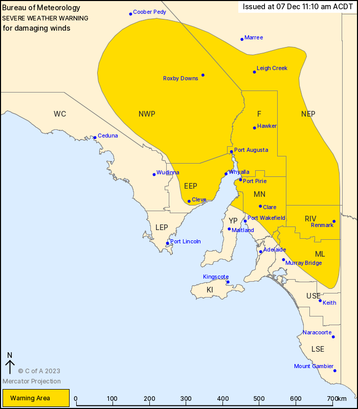
Winds gusts are expected to reach 90 to 100km/h across northern SA, with sustained winds of 60 to 70km/h predicted. Winds of this strength are uncommon during summer and are usually only seen in these areas during winter and early spring. A damaging wind warning had been issued for over half of the state. Winds may also be amplified by possible severe thunderstorms that could break-out on Friday afternoon and evening.
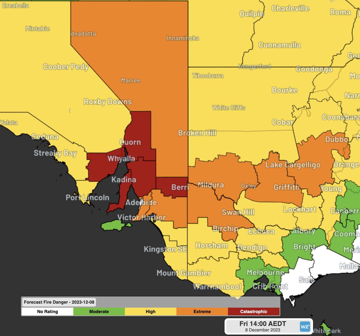
The combination of intense heat, dry air and wind has prompted catastrophic fire danger ratings for Eastern Eyre Peninsula, Flinders, Mid North, Yorke Peninsula, and Riverland, with extreme ratings for North West Pastoral, Murraylands and the Mount Lofty Ranges, extending into parts of Victoria and NSW.
For most of these areas, Friday’s conditions will be the most intense fire danger they have experienced since at least December 2019, in the heart of the Black Summer Bushfires.
Catastrophic fire danger is the highest on a 5-tier scale on how bad bushfire weather is, introduced after the infamous Black Saturday bushfires in 2009, and standardised across Australia in 2022. According to the SA fire authority CFS, catastrophic conditions mean:
- For your survival, leave bushfire risk areas.
- If a fire starts and takes hold, lives are likely to be lost.
- Homes are not built to withstand fires in these conditions.
- Protect your life by leaving early.
- Do not travel into or through high-risk areas.
- Lives and properties are likely to be lost if a fire starts.
Further complicating Friday’s weather will be a cool southerly change moving through during the late afternoon and evening. As shown earlier this year in NSW, wind changes can rapidly grow a fire front, shifting the dangers posed in a matter of seconds.
The fortunate news for SA is an unusual rain-bearing system will move over the state over the weekend and into next week, helping control any blazes that may start and grow on Friday. Even still, severe weather warnings are likely to be issued for the state over the coming days, that you can keep track of here.