
Canberra plummets to -0.3°C, its first sub-zero summer temperature on record
We all know Canberra is cold and frosty at night during late autumn, winter and early spring, but in over 100 years of records, the national capital had never recorded a night below zero in the summer months.
Until now.
- On Tuesday, December 2, 2025, at 5:50 am, the mercury at the current official city weather station at Canberra Airport fell to -0.3°C.
- The previous coldest summer temperature recorded at Canberra Airport was +0.3°C, on December 6, 2012.
- The previous coldest summer temperature recorded at any of the old official Canberra weather stations was 0°C at Acton on December 3, 1924, when Canberra’s population was barely 2000 (it was just over 450,000 at the 2021 census).
What caused the record summer chill?
An outbreak of bitterly cold polar air pushed across southeastern Australia on Monday, bringing snow to elevated parts of Tasmania and the mainland high country.
While snow was relatively heavy in the mountains, it was one of the classic systems where the airmass dried rapidly in the lee of the ranges, which meant Canberra saw just 0.4mm of rainfall.
The airmass east of the mountains continued to dry out under gusty west to northwesterly winds, and when those winds dropped to a zephyr for a brief period early on Tuesday morning, the ingredients were in place for rapid cooling.
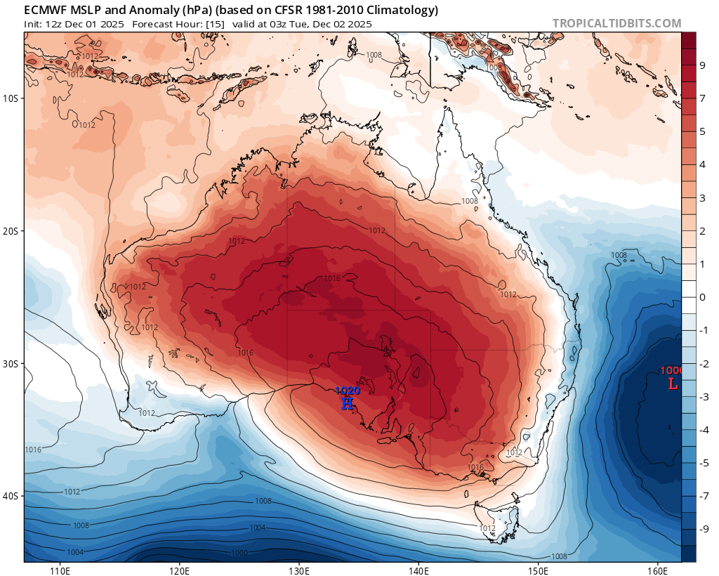
Image: Mean sea level pressure anomalies for Tuesday, December 2, 2025, showing a strong high pressure system centred over southeastern Australia, in a position more typical of winter. This contributed to the cold, still air over the ACT overnight.
Elsewhere, Thredbo Top Station recorded -4.0°C and Mt Hotham cooled to -2.8°C (Tuesday’s lowest temperatures in NSW and Vic respectively), however these were not summer records as it remained relatively windy overnight up high.
Meanwhile Canberra can expect dry weather this Tuesday with a mild maximum of 22°C. Predominantly dry conditions should last for at least the next week, with maximum temperatures rapidly rising into the low 30s from Thursday through to Saturday.
This is not ideal for the parched parks and gardens of the capital.
Canberra was roughly on par with its running average annual rainfall tally by the end of September 2025. But after only about half the monthly average rainfall in both October and November, the capital now needs an exceptionally wet December to reach its annual average of 643.1mm. So far this year it has received 497.4mm.