
California fires visible from space
Satellite images have captured massive fires erupting over northern California.
The image below shows smoke from several fires burning across northern California on Wednesday afternoon.
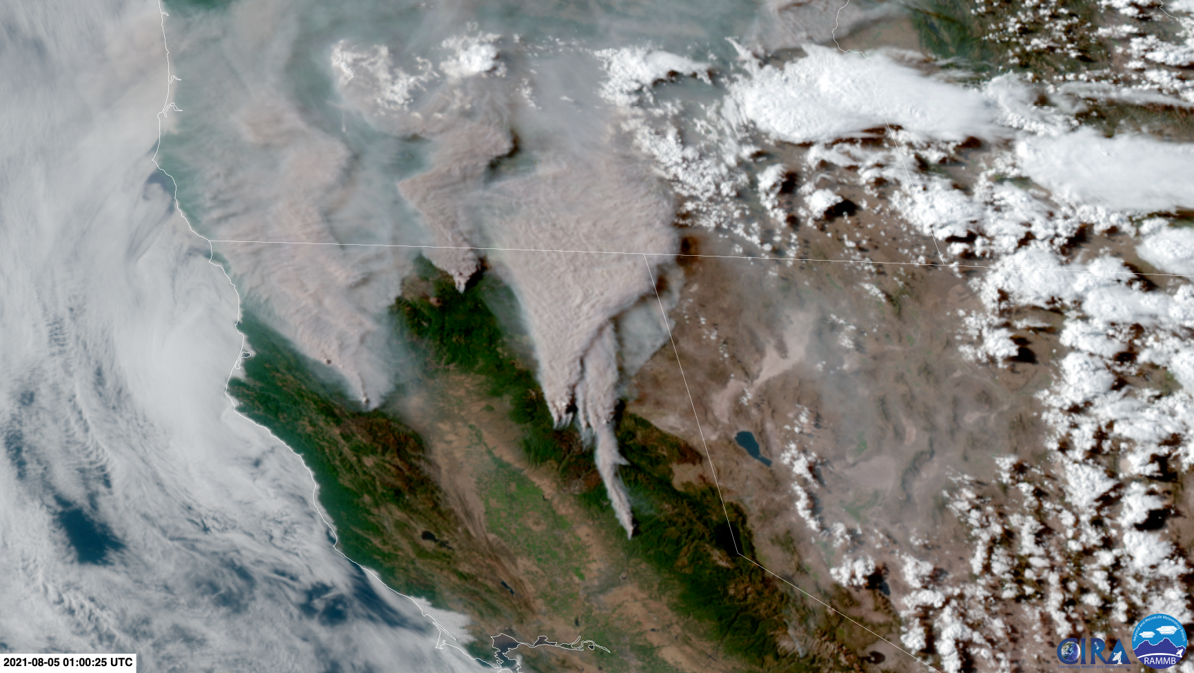
Image: Smoke from fires in California could be seen from space on Wednesday. Source: RAMMB / CIRA
One of the largest fires in the image is the Dixie Fire, which started on July 14th and has already scorched more than 270,000 acres of land. This makes it one of California's top eight largest fires in modern records.
Meanwhile, across the border to the north, Oregon's Bootleg Fire has consumed over 400,000 acres since it was started by a lightning strike in early July. This is one of Oregon's three largest fires in modern history.
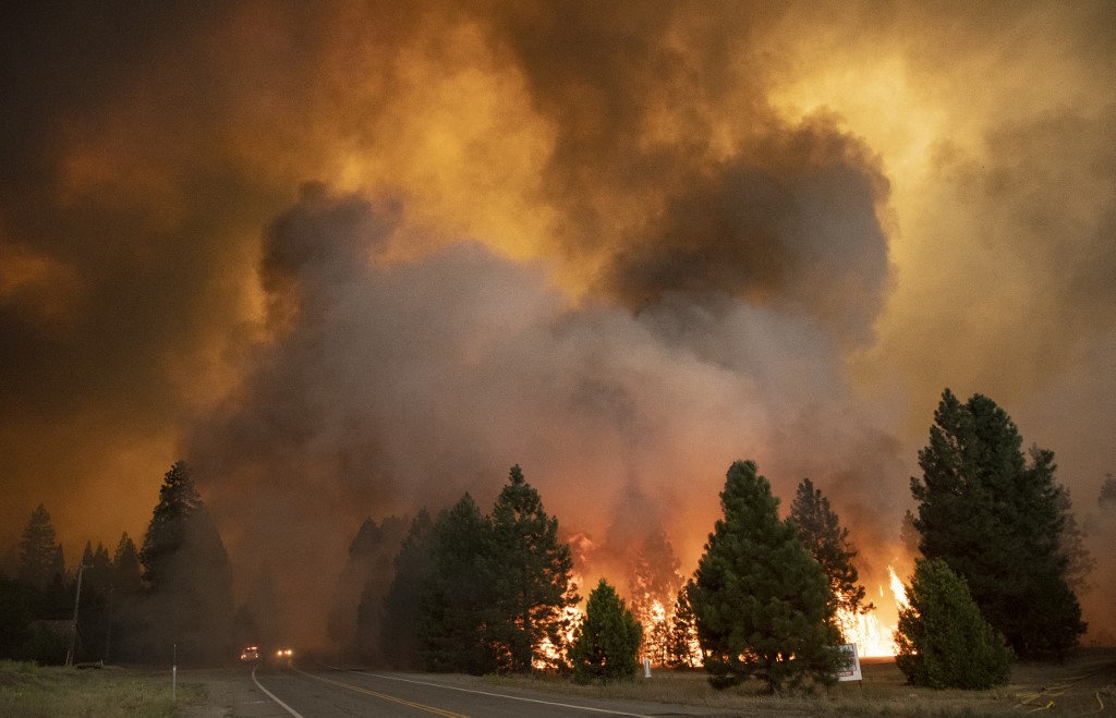
Image: Flames from the Dixie fire rip through Greenville, California on August 4, 2021. Source: Josh Edelson / AFP
This week's fires are being fuelled by hot weather, blustery winds, low soil moisture and an abundance of dry vegetation.
According to the latest US Drought Map, close to 90 percent of California was experiencing an Extreme or Exceptional drought conditions on July 27. These are the top two drought categories in a five-tiered scale.
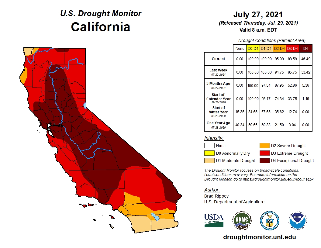
Image: US Drought classifications for Californa on June 27, 2021. Source: NOAA / NDMC