
Bursting banks in the Northern Territory
A vivid sight, and a telling sign of a hearty wet season. The cloud cleared late this week to reveal to satellites the abundant streamflow in the appropriately named 'Big Rivers' region of the central-north Northern Territory.
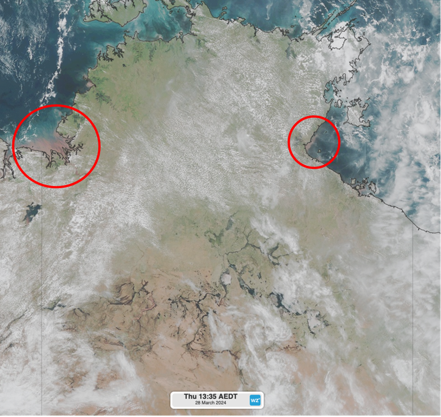
Image: Himawari satellite imagery just after midday local time on Thursday March 28th showing topped up rivers across the territory. Red circles show sediment from river runoff.
Water is expected to flow both into the Gulf of Carpentaria via tributaries into the Roper River, and into the Timor Sea via tributaries into the Victoria River. If you look closely, you can see enhanced sediment (brownish red) carried with the flow at the mouth of the rivers.
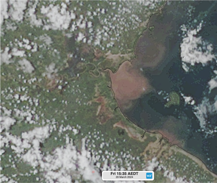
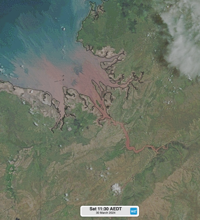
Images: Closeups of sediment at the mouths of the Roper River (top) and Victoria River (bottom) during Friday and Saturday respectively using Himawari satellite imagery.
Of course, the larger contributor to this birds-eye beauty came from Severe Tropical Cyclone Megan, which made landfall on March 18th along the Carpentaria Coast as a Category 3 system. Even before the month of March ended, as of writing this story, Groote Eylandt Airport had already smashed its March monthly totals in records dating back to 2001, with a whopping 897.4mm of rain, over three times the monthly average of 272.4mm. As of writing this story, other nearby areas in a similar situation had smashed March rainfall records before the month even ended:
- Wandie Creek – 614.6mm in March 2024, March average of 168.1mm in records going back to 1984
- Murganella Airstrip – 609.6mm in March 2024, March average of 135.2mm in records back to 2013
- Birrindudu – 594.0mm in March 2024, March average of 68.8mm in records back to 1990
- Borroloola – 504.6mm in March 2024, March average of 158.6mm in records back to 1987
Ex-Tropical Cyclone Megan lingered for up to one week after her landfall, staying alive with a humid monsoonal flow, which assisted in pounding the Top End with persistent rainfall. Inland flooding further south has prompted flood watches for central-eastern parts of the Territory. A more positive outcome of this, however, was a distinct greening of vegetation which accompanied the deluges.
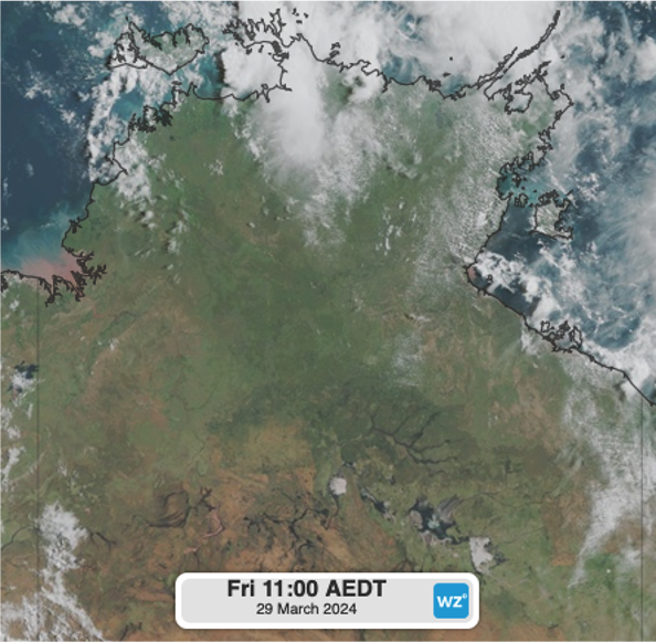
Image: Himawari satellite imagery at 9:30am local time on Friday March 29th. Vegetation is thriving after heavy rainfall.
Whilst being a significant month for rainfall in the Northern Territory, we can expect the end of the wet season to start approaching in the next month. Keep an eye on weather forecasts here.