
Bundaberg's record-challenging heat
Parts of central Queensland had an exceptionally warm day on Monday, with Bundaberg registering its highest temperature in more than a century.
Hot inland air was driven towards Queensland's central coast on Monday by west to southwesterly winds flowing across the state. These offshore winds were caused by a large low pressure system moving over the Tasman Sea.

Image: Visible satellite image showing cloud spiralling around a large low pressure system over the Tasman Sea on Monday.
Bundaberg Airport registered a maximum temperature 38.6ºC on Monday afternoon. This was 8.2ºC above the long-term average and the highest temperature on record at the airport. It's also the highest temperature since 1903 from records taken at Bundaberg's old Post Office site, which ran from 1892 to 1990.
Further north, Rockhampton Airport's 41.4ºC on Monday was a whopping 10ºC above average for this time of year. It was also the site's highest February temperature since 1969.
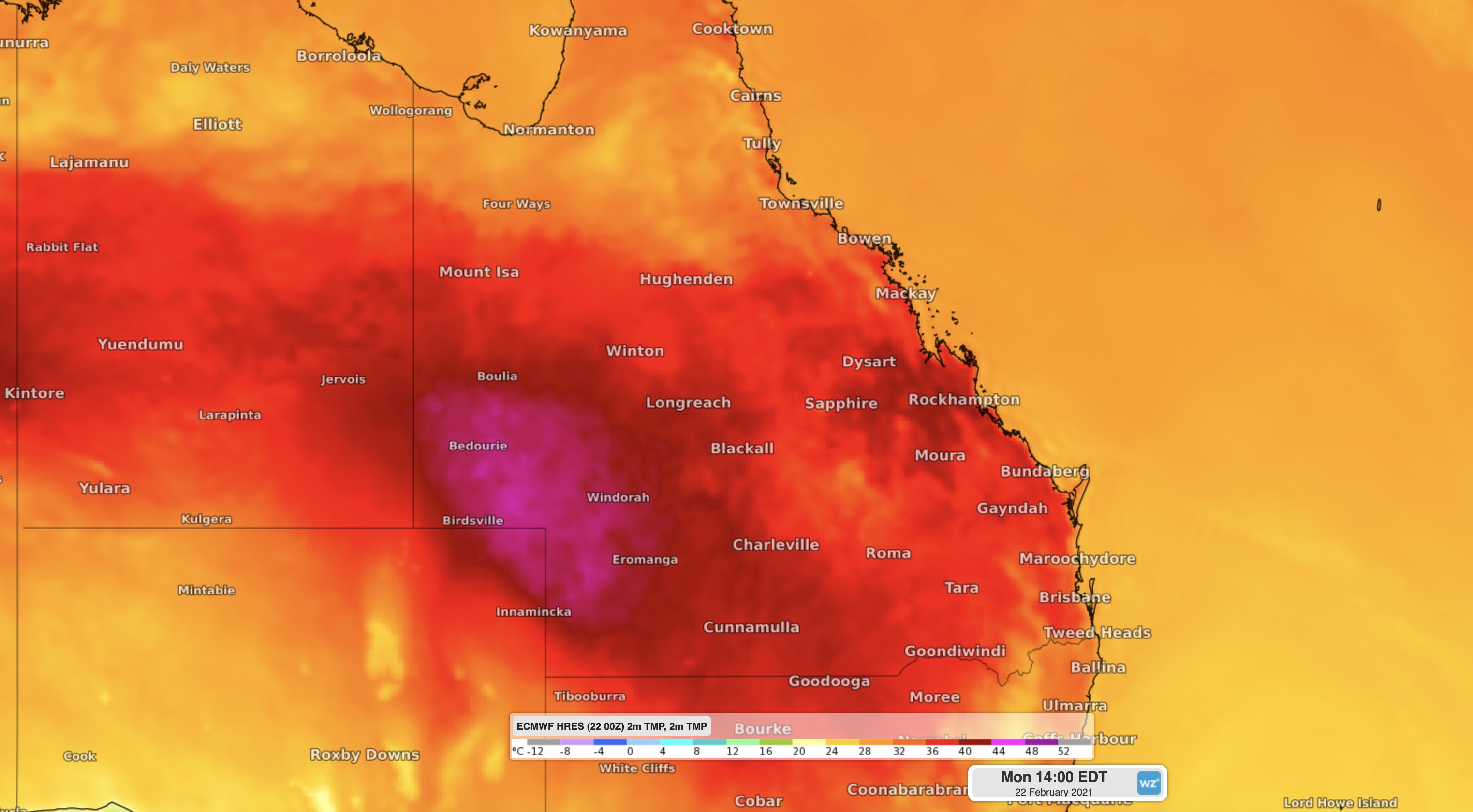
Image: Modelled air temperature over Queensland on Monday afternoon, showing heat stretching from the state's western inlnad across to the east coast.
Tuesday will be another hot and humid day in eastern Queensland, although not as hot as Monday is Bundaberg and Rockhampton.
However, one thing Tuesday will feature more than Monday in central and southeast Queensland is thunderstorms, which could become severe in some areas, but bring some afternoon cooling.