
Brrrrrr! Here comes the first snowy blast of autumn for SE Aust
Break out the winter warmies, because the first cold blast of autumn is heading for Victoria and southern New South Wales this weekend, with snow for mountains districts and bitterly cold winds and showers elsewhere.
It'll be a rude shock compared to last weekend, when Melbourne reached 31.6°C on Saturday, and Hobart basked in 32.3°C, which smashed the old April high temp record of 31°C.
So is the coming weekend payback from a vengeful weather god?
Well, that's one way to read it, but it's more like plain old seasonal shift. As we move towards winter, Southern Ocean cold fronts play a more active role in southern Australia's weather, and that's the pattern that's kicking in this week.
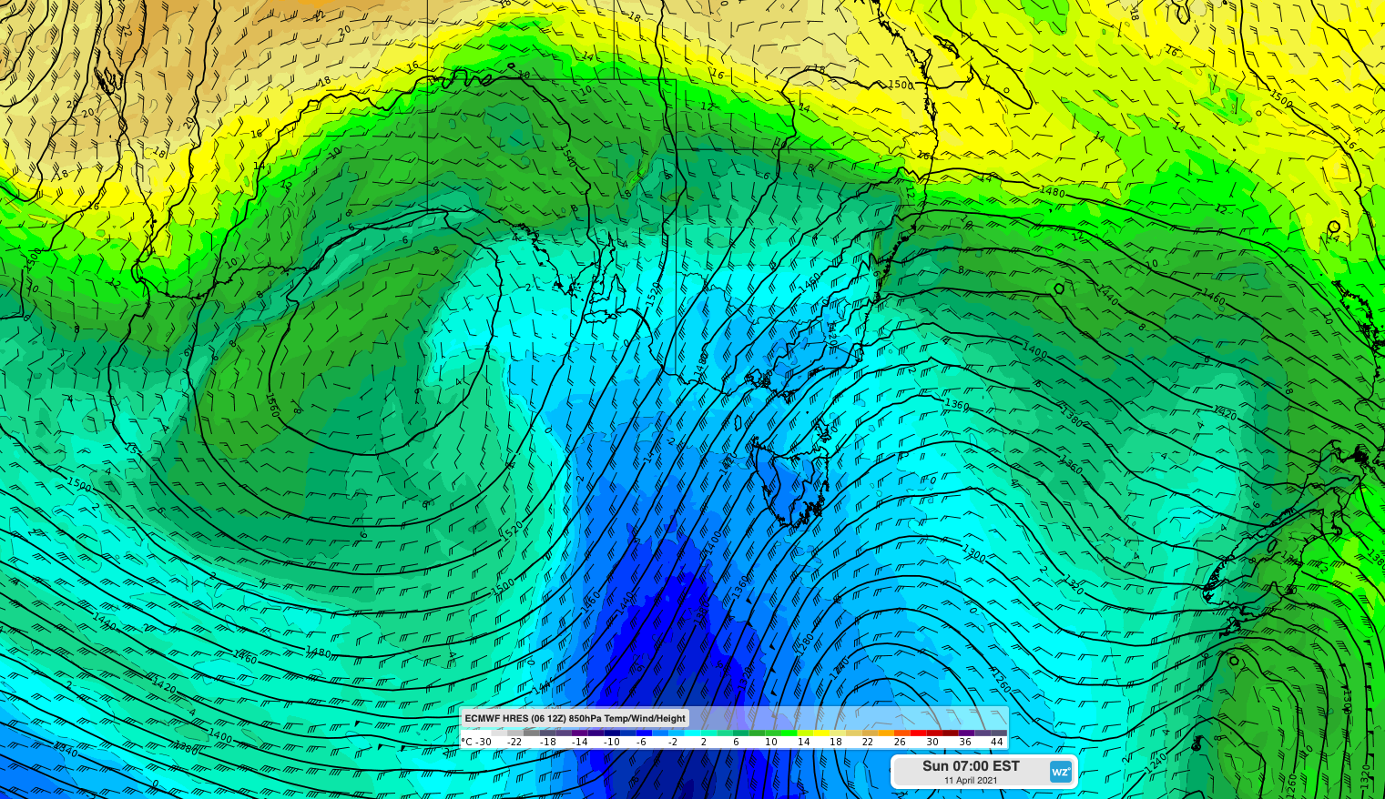
Image: Sunday morning in Victoria and Tassie is going to feel a lot like mid-July
Two cold fronts will cross the southeast of the continent in coming days. The first front will whip through Tasmania and clip southern Victoria on Thursday evening into Friday.
- Hobart's maximum temp should dip from a predicted top of 24°C on Thursday to just 16°C on Friday
- Melbourne will likely see a ten-degree drop, from 28°C on Thursday to 18°C on Friday.
But it's Saturday night when things get really serious...
The second front is much stronger and in the wake of its passage on Saturday night, Sunday maximum temps should struggle their way to 15°C in Melbourne, 13°C in Hobart and 16°C in Canberra.
Cold, dry air in the wake of the front should bring Canberra’s first decent frost for the year, with a minimum temp around 0°C
As for the mountains, it's hard to say how much snow will fall, or how low. But this looks to be the sort of system where more snow will fall at southern Victorian resorts like Mt Baw Baw and Mt Buller than at resorts further north like Mt Hotham or the NSW ski fields.
Accumulations in the range of 5 to 10 cm are possible at the southern resorts, and snow should fall to at least 1200 metres, and possibly a little lower.
Now, it just so happens that this reporter will be camping in the southern mountain districts of Victoria this weekend. So yeah, not such great timing.
For the rest of you, it'll still feel chilly on Sunday anywhere south of about Sydney (where Sunday should peak at 23°C), so maybe throw on a scarf regardless of whether you're going to the footy.