
Brisbane's coldest May evenings in two years
As winter edges closer, Brisbane has been handed an early, crisp preview of the season ahead. Over the first ten days of May, each evening has seen feels-like temperatures dip into the high teens, marking the coldest start to May in terms of evening apparent temperature since 2023. It's a chill that even the most seasoned Brisbanites are starting to notice.
You might be thinking, “Isn't this typical for Brisbane in May?”
Well, sort of—but this drop feels noticeably different. Gusty winds and the ongoing presence of strong high pressure ridges have shaped much of May's weather. To illustrate what has been going on, today's synoptic chart shows a strong ridge settled over eastern Queensland, which has been causing the notably cold evenings by Brisbane's standards.
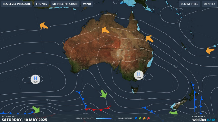
Image: Synoptic chart for the Australian region for Saturday, May 10, 2025.
As autumn deepens, Brisbane's weather starts to shift, with southerly-component winds and high pressure ridges taking the lead. These winds bring in cool, dry gusts from inland Australia during the evenings and early mornings, while the days are dominated by breezier southeasterlies.
An analysis of long-term wind patterns, based on morning wind rose data, reveals that southerly and southwesterly winds are prevalent throughout May. Although these readings are from the morning hours, they offer a good indication of the broader trend that typically persist into the evening when high pressure is at the helm.
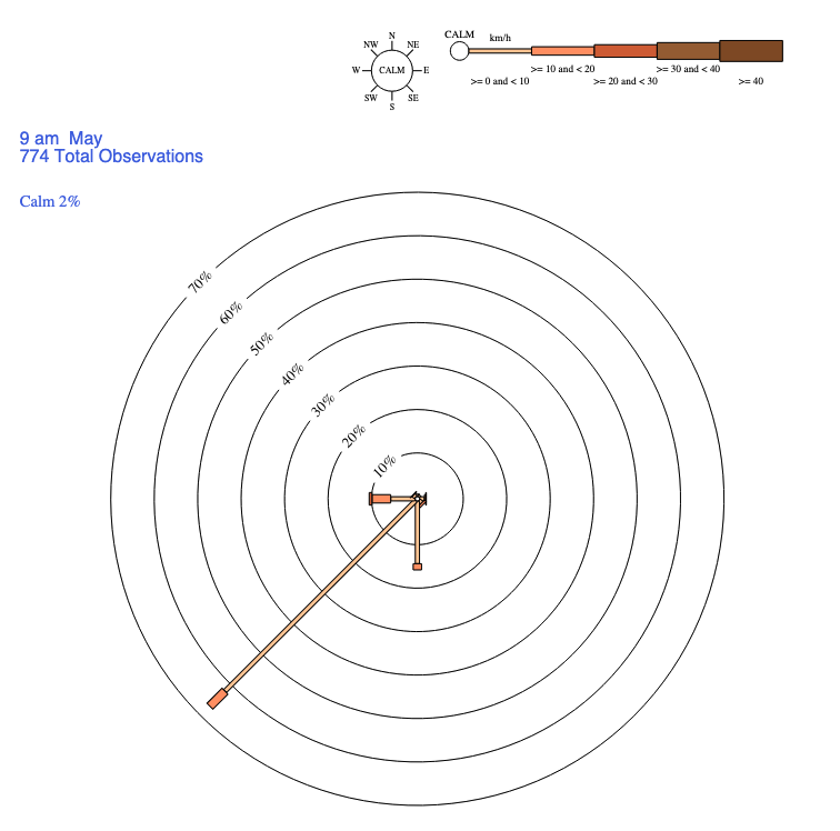
Image: Wind rose (km/h) for May, based on climatological data from 1 December 1999 to 11 August 2024. Source: BoM.
What’s next?
The cool pattern isn’t backing off anytime soon. The gusty southeasterlies will continue during the day, while colder SW/WSW winds will keep the nights noticeably cooler well into next week.
A coastal trough could bring rain by Thursday, with the southerly winds behind it keeping feels-like temperatures on the lower side, keeping that wintry edge in the air.
So yes, Brisbane—winter is knocking early, and these "crisp" evenings are just the beginning.