
Bonsoy Gold Coast Pro surf forecast
After an emotional mid-year cut at the Margaret River Pro surf competition in Western Australia last week, surfers that fell below the cut line, along with up-and-coming talent, will be battling it out on the Gold Coast from this weekend onwards.
The first stop on the Challenger Series (the lesser format of the Championship Tour) will take place along the Gold Coast’s premier surf point breaks, starting this morning and running to Saturday May 4th. While forecasting the appearance of recently “retired” GOAT Kelly Slater is quite the challenge until he actually hits the water (even following his confirmed spot on the events draw), the forecast for the actual surf is a little bit more straightforward.
This weekend will see chest-to-maybe-head-high waves pealing along the sand bottom points as a combination of a medium sized south swell wraps around the point (loosing size in doing so), with a smaller background east swell also running in the background, biggest on Saturday and a touch smaller on Sunday. Conditions will be good with southerly winds keeping the wave face on the cleaner side. Showers will also increase on Saturday, persisting on Sunday, so pack an umbrella if you plan on going down to see some of the action this weekend.
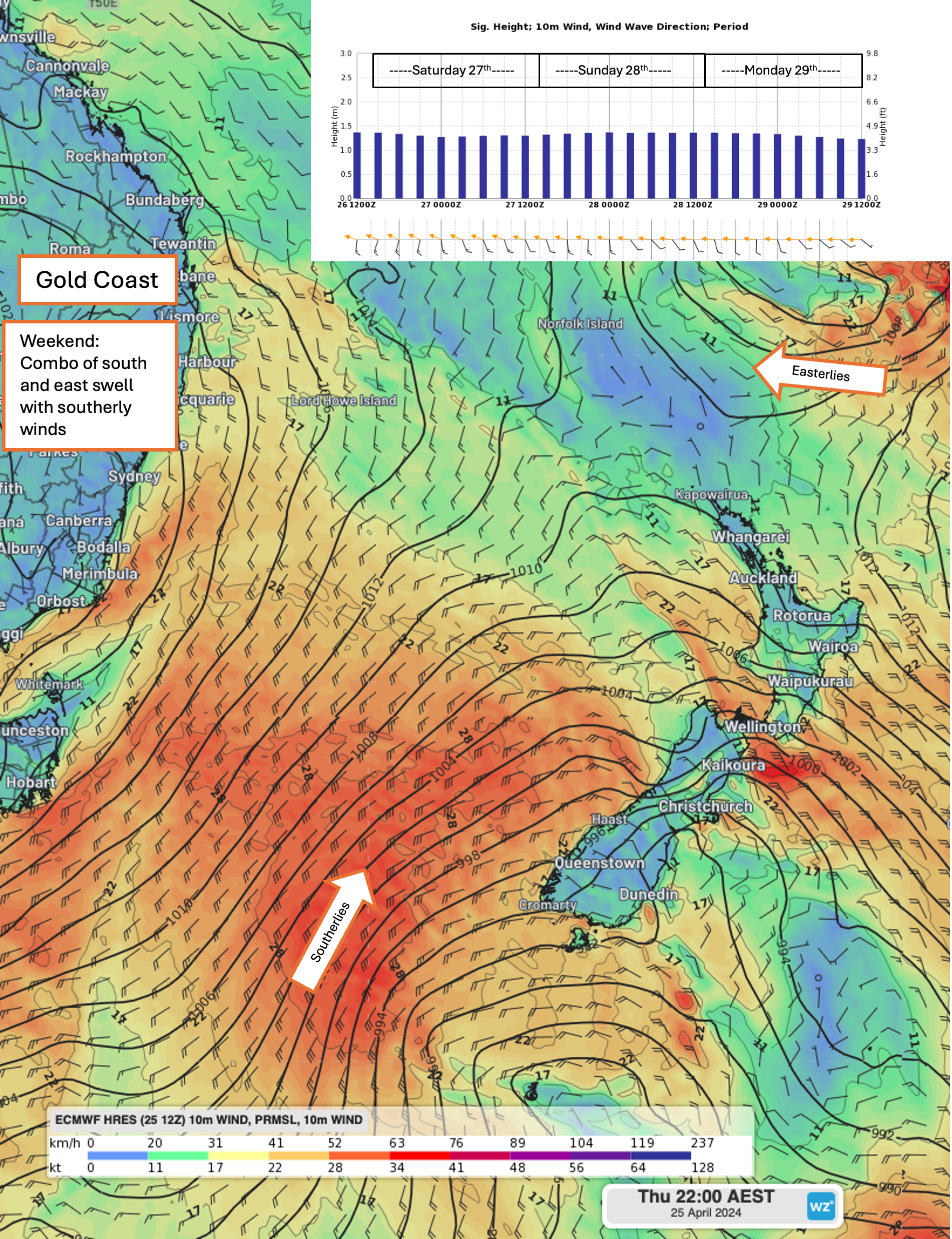
Image of modeled Mean Sea Level Pressure (MSLP) and surface winds according to ECMWF showing the various swell being generated late this week for the weekend, with a larger south swell and smaller east swell providing ample surf for the start of the competition.
Next week will see the south swell ease off, with easterly trade swell generally persisting in the small range. Smaller waves will prove more of a challenge for competitors, but enough energy should push into the point to keep competition going over the early-to-mid-week. Winds will become much lighter on Monday and Tuesday, with possibly more easterly seabreezes bringing a ruffle to the waves in the afternoons, before the return of southerly winds from Wednesday or Thursday onwards. Showers will also ease off, with some warmer temperatures making way for more pleasant conditions for spectators.
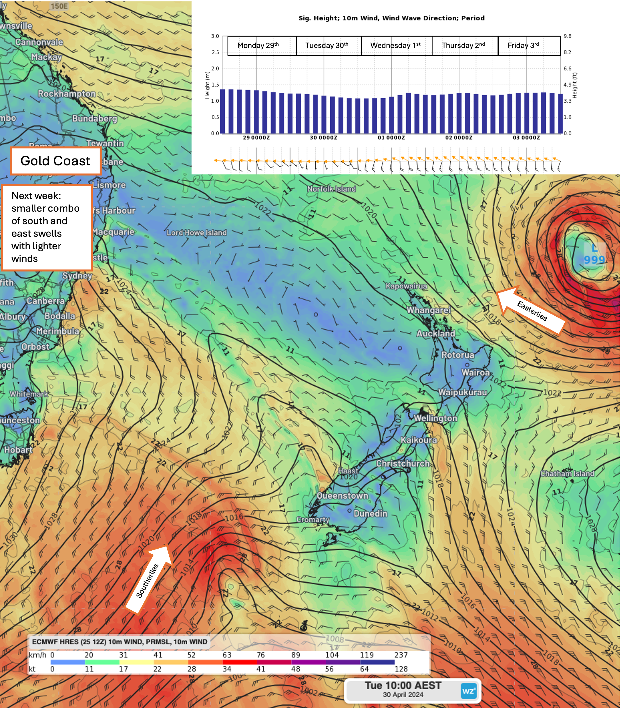
Image of modeled MSLP and surface winds on Tuesday 30th according to ECMWF showing the various swell being generated next week, with a few weaker south and east swell in the mix, providing smaller surf with lighter winds.
The latter half of the competition window is much more uncertain, but some models have a low spinning up in the Tasman Sea, bringing the possibility of larger waves to close off this year's Gold Coast Pro. The size of the surf wrapping into the points will depend on the location of any developing low, with the closest proximity providing the most size. Competitors and organizers will keep a keen eye on the forecast for the possibility of larger surf on finals day.
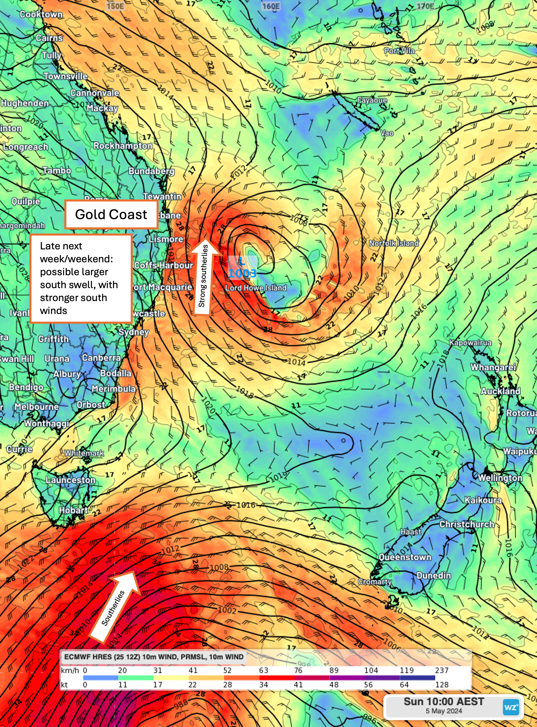
Image of modeled MSLP and surface winds next weekend according to ECMWF showing the prospect for larger southerly swell being generated late next week and into next weekend.