
Blocking high over the southeast
Weather systems in the mid-latitudes tend to move around the earth from west to east. A system that passes across Western Australia often moves across eastern Australia several days later. However, sometimes a weather system, such as a high, becomes stationary and stays in place for several days.
Such a feature is called an atmospheric block because it blocks the usual west-to-east flow of the atmosphere. That is what we are currently seeing with a high centered near Tasmania, which became established around Thursday 19. This pattern is called a blocking high and can be seen in today’s MSLP chart.
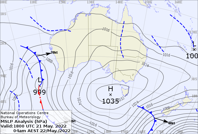
Image: Analysis chart for 4 am EST 22 May 2022 courtesy BOM
Different atmospheric blocking events can cause a variety of impacts ranging from cold spells to heat waves, and from floods to short droughts. The current blocking high has been causing cold mornings in the southeast, favorable for fog and frost, with the BOM issuing frost warnings for Victoria and Tasmania over the past two mornings. At the same time, it has caused mild-to-warm conditions for the north and west of Australia. This can be seen in the following chart which shows the minimum temperature anomaly for Friday May 20.
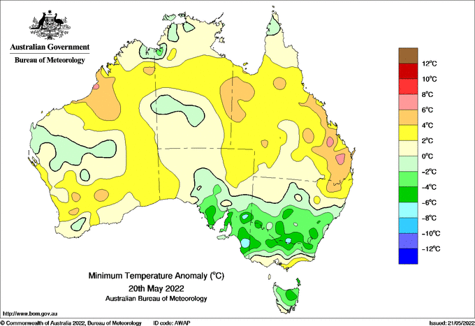
Image: Minimum temperature anomaly for 20th May courtesy BOM
The high is also blocking cold fronts in the southeast, forcing them to move further south, keeping the southeast dry. At the same time, it is directing moist easterly winds from the Tasman and Coral Seas onto the east coast, fuelling showers, storms and rain. This can be seen in the rainfall totals of Saturday May 21 shown below.
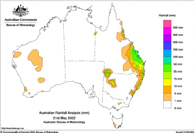
Image: Rainfall for 21st May courtesy BOM
This high is expected to remain in place until a powerful cold front forces the high eastward over the Tasman Sea during Wednesday 25th and Thursday 26th, allowing subsequent troughs and cold fronts to cross the southeast again and bring rain.
You can read more about blocking highs and other climate influences at the BOM: http://www.bom.gov.au/watl/about-weather-and-climate/australian-climate-influences.shtml?bookmark=introduction