
Blizzard kicks of snowy spell in the alps

More than half a metre of fresh snow is likely to hit some of Australia's ski resorts by the start of next week.
A strong cold front caused a blizzard as it swept over the alps on Wednesday night. Wind gusts reached 115km/h at Thredbo and 106km/h at Cooma during the early hours of Thursday morning. By 9am, some ski resorts had received around 20cm of fresh snow.
This was the start of a five day snowy spell that should see some ski resorts collect at least 50cm of snow by the end of Monday.
Snow showers and strong westerly winds will continue in the alps on Thursday, behind last night's front. Warming air will see the snow retreat to higher terrain in the alps on Friday, before the next front arrives in the evening.
Snow will become heavier and fall to lower levels with the passage of the front from Friday night and during Saturday. This system could bring another 20-40cm of snow on its own.
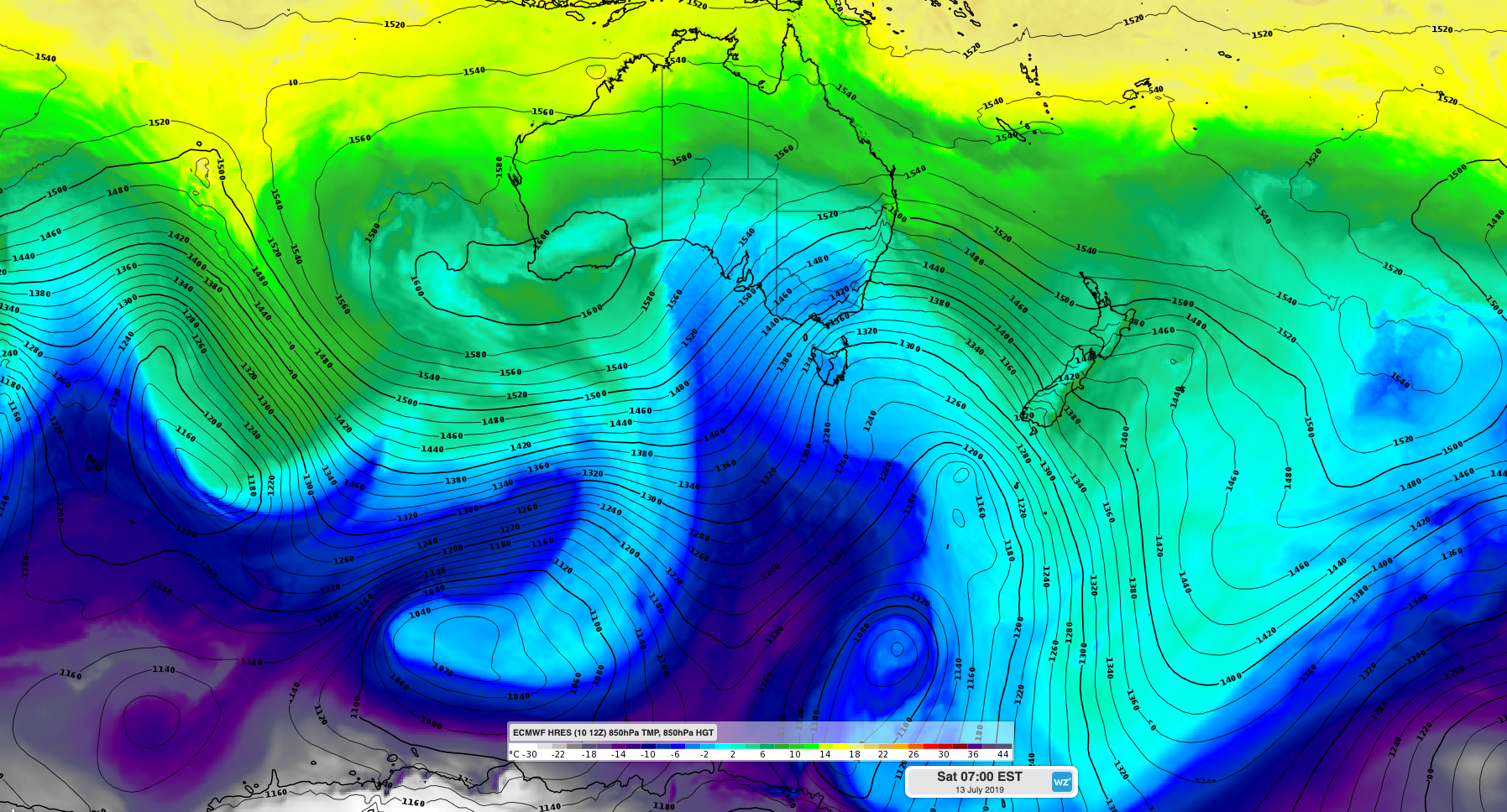
Image: Cold Southern Ocean air spreading over southeastern Australia on Saturday morning.
Another pulse of cold air and showers will deliver even more snow on Sunday and Monday, with a few flakes lingering on Tuesday.
All up, areas of the alps that are exposed to westerly winds could see close to one metre of snow from this sequence of fronts. Most of the main ski resorts should pick up at least 30-50cm of cover by early next week.
Be mindful of slippery roads and damaging winds if you are planning a trip into the alps during the next few days.