
Bitterly cold airmass brings snow, freezing temperatures to southeast Australia
Frigid temperatures have set in across southeastern Australia, with showers, small hail, snowfalls and icy winds all part of the mix on what promises to be the coldest day of 2026 to date in many locations.
After a cold front ushered in a polar airmass overnight, this was the scene in the village square at Victoria’s Mt Buller ski resort, about three hours northeast of Melbourne, just after 9am.
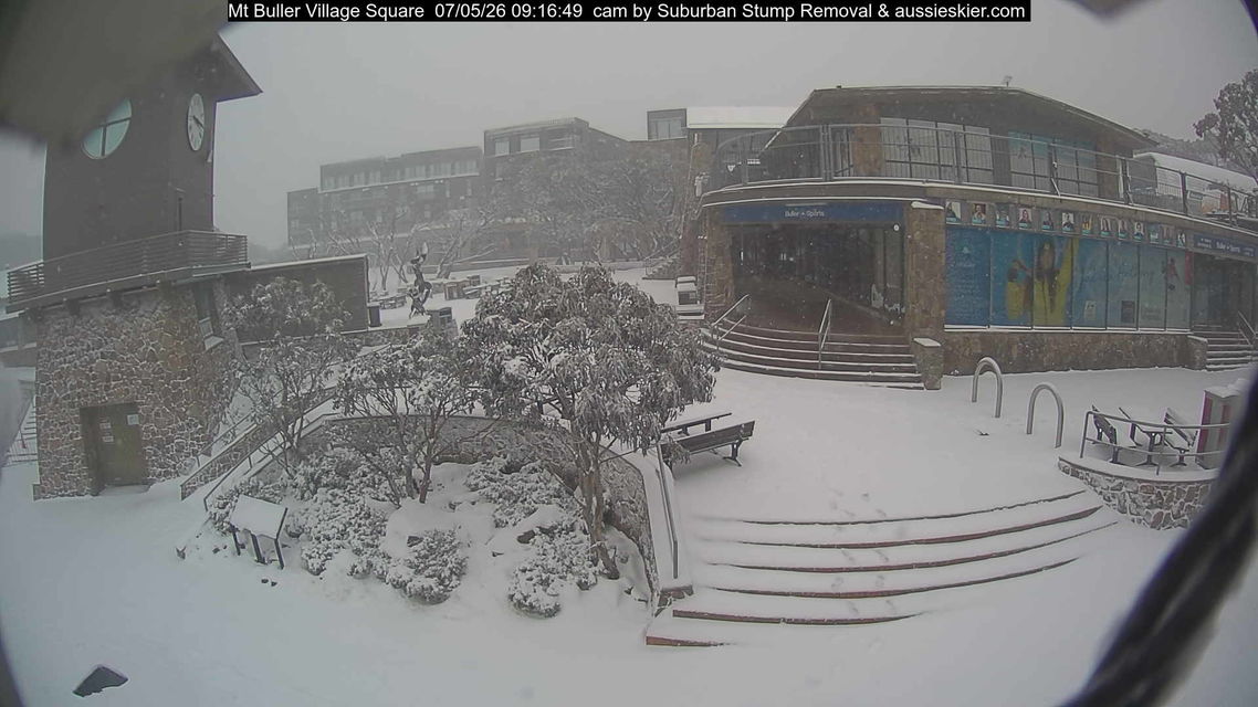
Image: Around 5cm of snow on the ground at Mt Buller on Thursday, May 7, 2026. Source: ski.com.au.
How cold is it this Thursday morning?
At 9am this Thursday, May 7, many temperature readings in Tasmania and the southeastern mainland were similar to what you’d expect on the coldest days of winter. For example:
Notable Victorian 9am temperatures
- Mt Hotham was -5.3°C with an apparent or "feels like" temperature of -14.1°C due to strong southwesterly winds.
- Melbourne Airport was 6.2°C, with an apparent temperature of -0.2°C.
- Melbourne was 7.1°C with an apparent temperature of 3.7°C.
Notable New South Wales 9am temperatures
- Thredbo Top Station was -6.2°C with an apparent temperature of -15.3°C. The site recorded Australia’s lowest overnight minimum of -6.5°C just after 8am.
- Cooma Airport was 1.1°C with an apparent temperature of -4.0°C. Snow was falling in the area at the time (elevation 930m), with a few flakes even reported down in the town of Cooma itself at 800m.
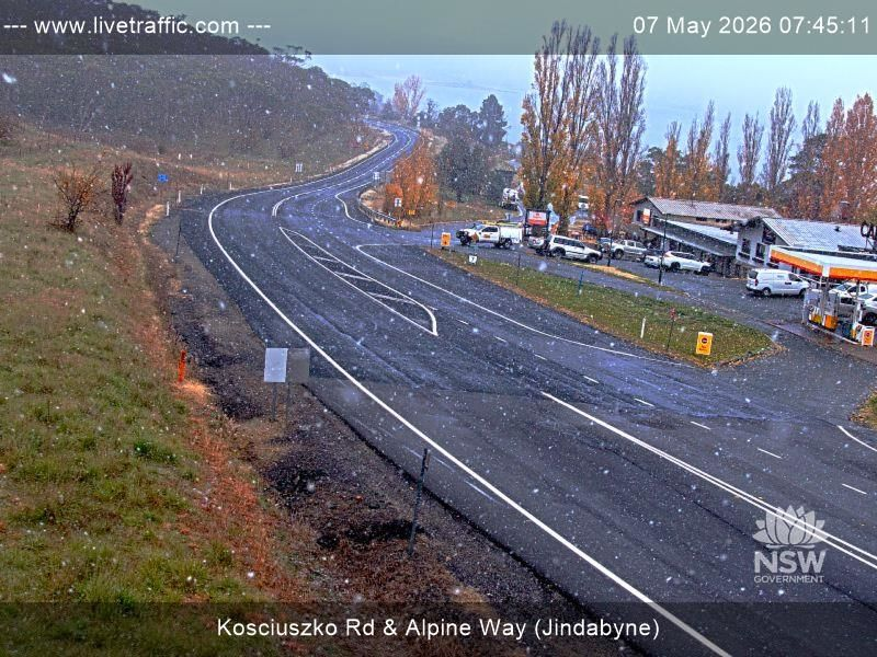
Image: Snow also fell to lake level in Jindabyne, NSW (elevation 930m), the gateway town at the foot of the Snowy Mountains, where snow is quite rare even in midwinter. Source: NSW Live Traffic.
Notable ACT 9am temperatures
- Mt Ginini was -4.2°C with an apparent temperature of -10.6°C.
Notable Tasmanian 9am temperatures
- kunanyi/Mt Wellington was -3°C with an apparent temperature of -6.2°C.
- The tiny town of Liawenee was -0.9°C with an apparent temperature of -8°C.
How long will this cold outbreak last?
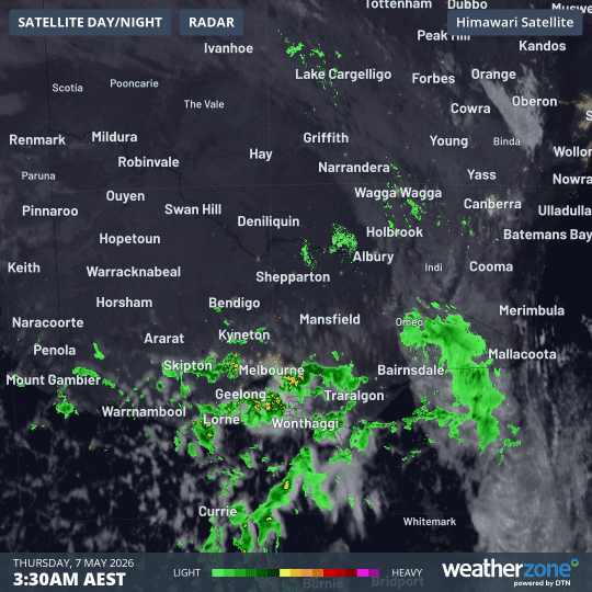
Image: Combined satellite and radar loop for Victoria and nearby areas for the six hours to 9:30am on Thursday, May 7, 2026. Source: Weatherzone.
This is quite a powerful system for autumn, and a very cold one, but it was never destined to be a long-lived weather event.
While showers and snowfalls can be expected to persist through Thursday and into Friday in Tasmania and southern Victoria, conditions will clear rapidly north of the Murray River.
Indeed, steady snowfalls have already eased at Thredbo in NSW, while heavy snow showers are persisting this Thursday morning in Victoria’s southernmost two ski areas, Mt Buller and Mt Baw Baw.
Heavier snowfalls at the southern mainland ski resorts are typical for snowy systems that come out of the southwest or south, where systems with a more westerly or northwesterly aspect tend to dump heavier snow at places like Thredbo, Perisher, Falls Creek and Mt Hotham.
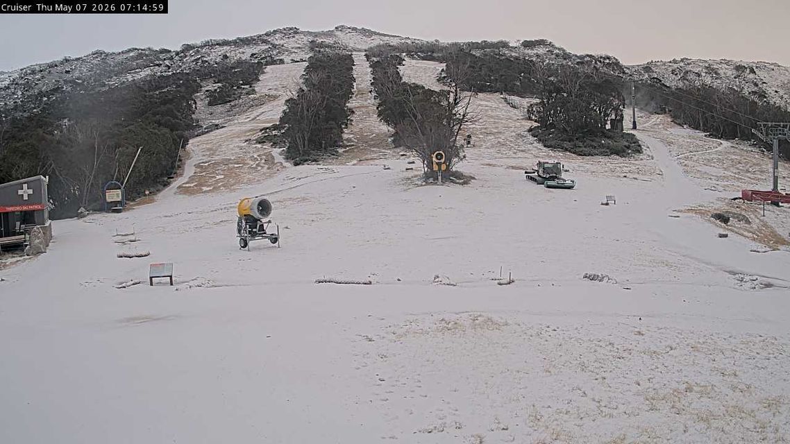
Image: Ski slopes at Thredbo just before 10am on Thursday, May 7, 2026. Source: Thredbo.com.au.
What about the southeastern mainland capital cities?
Melbourne was still sitting on just 7.6°C at 10am on a day when it looks like it could struggle to reach the forecast maximum of 14°C, especially if showers stick around.
Melbourne received 11mm of rainfall overnight, its heaviest daily total since March. Between 9am and 10am, a further 1mm landed in the gauge.
The Canberra region saw only brief light showers overnight, with no rain officially recorded in the city itself. A maximum of 12°C is forecast for today, with a string of frosty nights ahead.
Adelaide is set for its chilliest day of the year to date, with a high of 17°C forecast.
In Sydney, it started off as one of those typical days when locals wonder what the fuss is about down south. Then a brisk wind kicked in with a light shower in some suburbs around mid-morning, and a pleasant day with maximums in the high teens suddenly felt much cooler as the northwesterly swung around to a southwesterly.