
Bitter cold snap catches kangaroos on the hop
A strong cold front is making its way north through New South Wales, having passed through Victoria overnight, accompanied by rain, strong winds and snow to low levels.
These kangaroos were caught on the hop by the heaviest snowfalls of the year outside the mountains, with up to 20 cm on the ground.
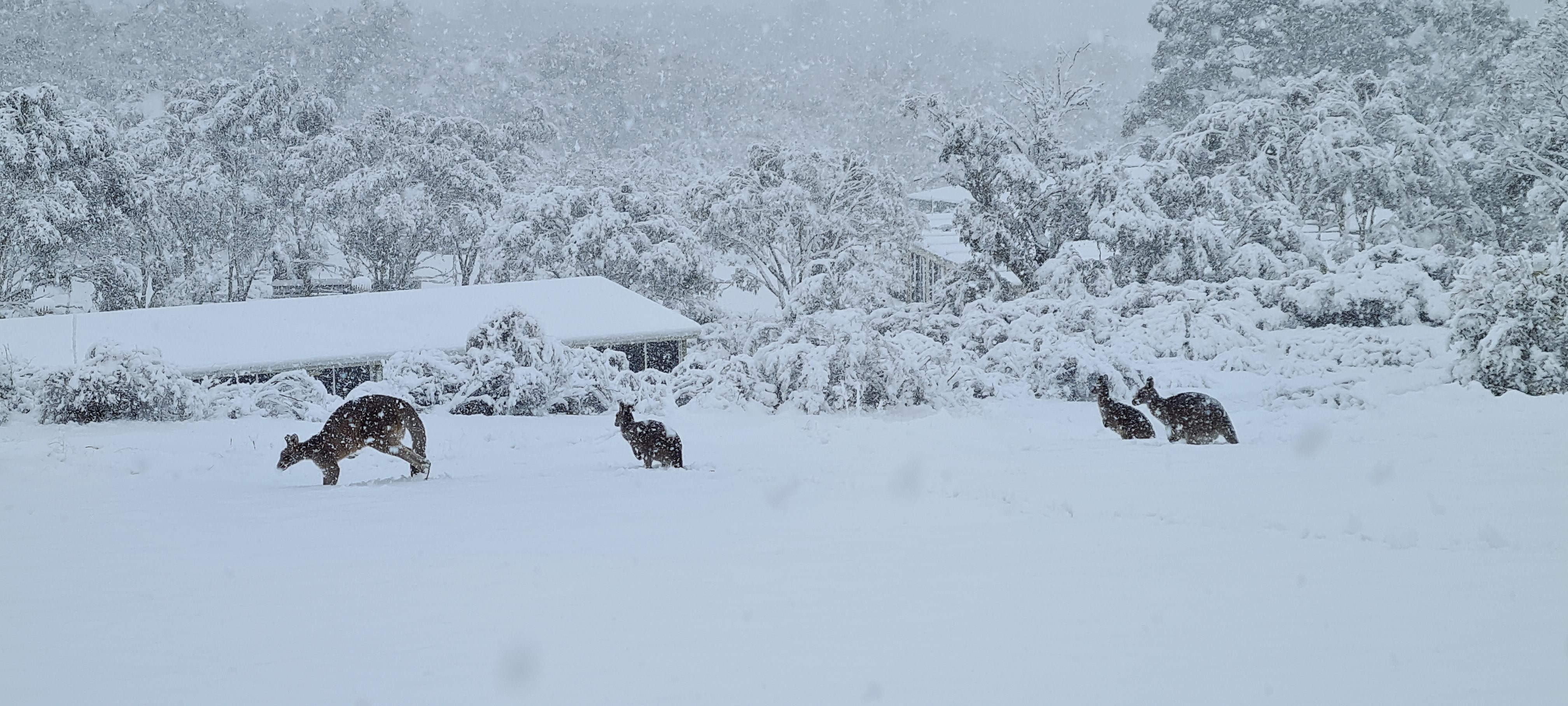
Image: Hey Skip, where did all the grass go? Source: Phil Richmond.
The picture was taken by a local at about 1100m above sea level on a property between the NSW towns of Berridale and Jindabyne – and while you associate Jindabyne with snow, the town lies below the regular winter snowline, and the snow doesn’t normally start until a good 10 or 15 km out of town as you head up to Thredbo or Perisher.
But this morning, some super cold air has enabled snow to fall to much lower levels. We told you yesterday that snow could fall to the following levels today:
- Around 300 metres above sea level in Tasmania on Monday night into Tuesday morning
- Around 500 metres in Victoria on Tuesday morning
- Around 700 metres in southern NSW and the ACT late on Tuesday
- 900 to 1000 metres in central and northern NSW late on Tuesday
The first three of those predictions appear to have come to fruition, with snow falling to exactly 300 metres, according to a Hobart local who spoke to Weatherzone, although it wasn't settling on the ground until about 400 metres.

Image: Near Tarraleah, in the Tas Central Highlands at around 450m on Tuesday morning. Source: supplied.
Meanwhile Canberra dropped almost five degrees in less than an hour as the cold front passed through this morning. As we write this story just before 10 am, it is a chilly 4°C with steady rain. Most of Canberra sits at or around 600 metres above sea level, so with snow forecast down to about 700 m, a few flakes in the capital are not out of the question.
As you'd expect from a cold, moisture-laden system like this, there has been heavy snow reported in the snowfields, with around 15 to 20 cm overnight at all resorts. As ever, the picnic-table-o-meter at Mt Hotham in Victoria tells the tale.

Image: Snow is on today's breakfast, lunch and dinner specials board. Source: Hothamalpineresort Instagram.
As for Australia's two most populous cities, Melbourne got a decent drop of rain with 8.8 mm overnight. It'll stay cold all day, with the mercury reluctantly edging its way towards double digits. A top of 12°C is expected.
You can reverse the numbers for Sydney, where a top of 21°C is expected with the mercury already reaching 20°C in suburbs by 10 am in bright sunshine. That'll change later today with a cold change and rain expected, so if you're in Sydney, enjoy the warmth while it lasts.