
Big waves from Tropical Cyclone Uesi to hit eastern Australia

Tropical Cyclone Uesi will send big waves towards Australia's east coast later this week.
At 10am AEST on Wednesday, Tropical Cyclone Uesi was a category two system located just under 400km west of Noumea, New Caledonia. That's roughly 1000km away from southeast Queensland.
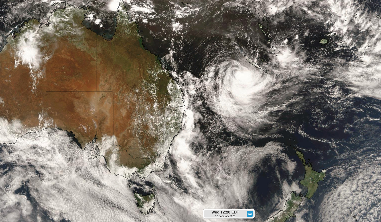
Image: Satellite image of Tropical Cyclone Uesi shortly after midday AEDT on Wednesday.
Over the next 48 hours, Cyclone Uesi will move in a southwesterly direction, towards Lord Howe Island, while weakening. Based on the latest models, the remnants of Uesi should pass near Lord Howe Island on Friday morning as an extratropical cyclone (also known as a mid-latitude low pressure system), before turning away from Australia and travelling towards New Zealand on the weekend.
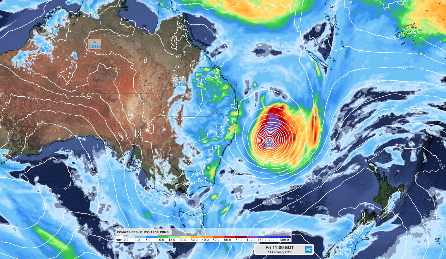
Image: Mean sea level pressure and 24-hour accumulated rainfall at 11am AEDT on Friday.
Uesi's remnant low pressure system should stay at least 400km away from Australia's east coast as it travels through the Tasman Sea during the second half of this week. While this could cause severe weather on Lord Howe Island, it's far enough away to spare mainland Australia from the system's strongest winds and heavy rain. However, it is still close enough to cause big waves along the nation's east coast.
A large and potentially damaging swell will affect beaches from southeast Queensland down to eastern Tasmania between Thursday and Sunday. Significant wave heights could reach four to five metres as the peak of the swell spreads from north to south during this three-to-four day period.
This episode of large swell could be problematic for parts of eastern NSW that experienced significant coastal erosion during the passage of a deep coastal trough over the last week.
But while the impending swell is considered bad news for some, experienced surfers will be relishing the opportunity to ride the cyclonic swell. Anyone going down to the coast to watch waves or surfers later this week should take extra care as conditions will be dangerous along the coastal fringe.