
Big day for severe storms in QLD and NSW
Very dangerous thunderstorms will affect parts of Queensland and northern NSW today.
Moisture-laden air feeding into a low pressure trough and interacting with an upper-level cold-pool will trigger a large number of thunderstorms between central Queensland and central NSW on Wednesday.
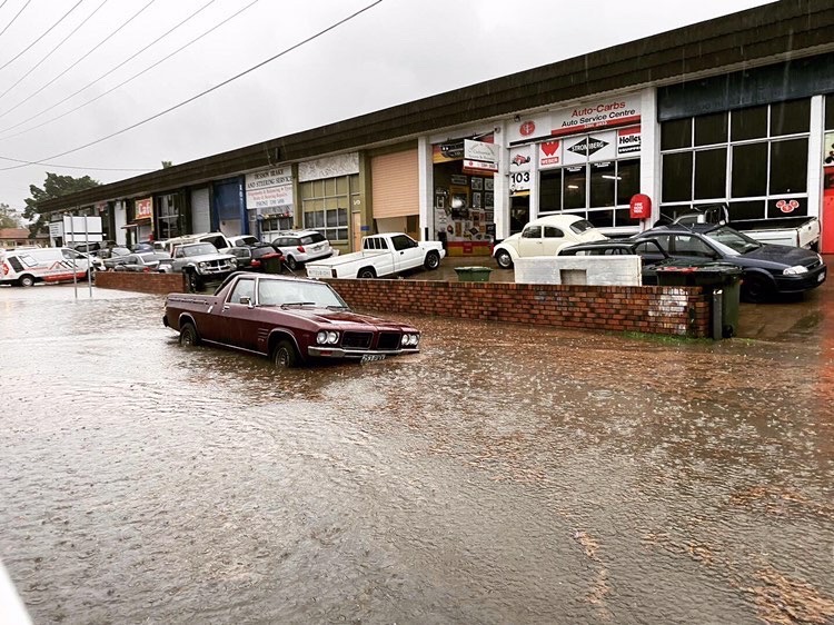
Image: Severe tunderstorms passing over southeast Queensland on Tuesday delivered over 50mm of rain in 30 minutes in Brisbane. Source: @maddimarti_ni
Storms will develop from the late morning and become more widespread and intense during the afternoon, with some storms even persisting into the evening.
Thunderstorms are likely to develop over a broad area stretching from about Townsville in Queensland down to the Central West Slopes and Plains in NSW.
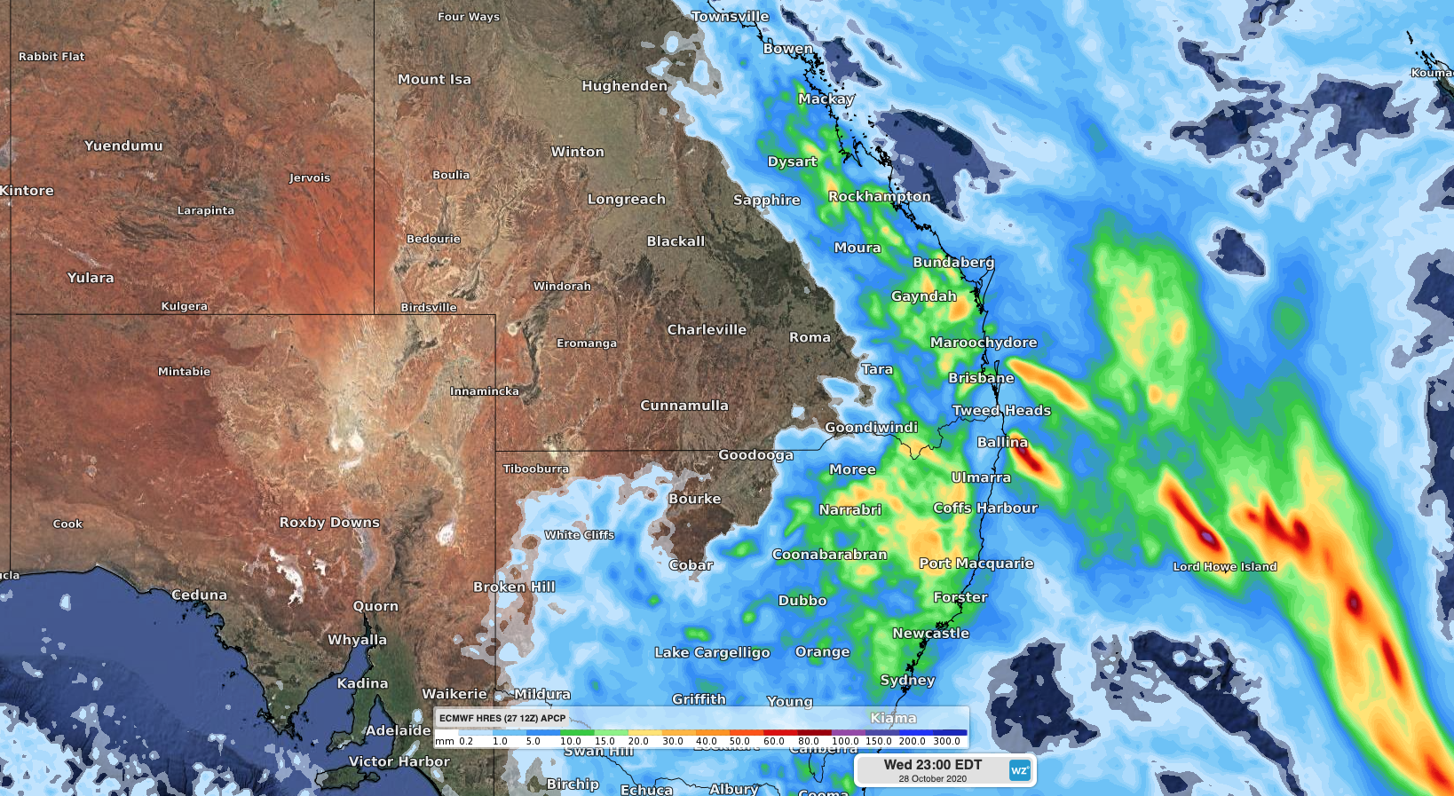
Image: Forecast accumulated rain on Wednesday according to the ECMWF model, showing the areas of NSW and QLD that are most likely to see showers and thunderstorms.
The most violent thunderstorms, which could develop into supercells, will emerge over central and southeast Queensland and northeast NSW, roughly between Rockhampton and Coonabarabran. These storms could produce damaging-to-destructive winds, large-to-giant hail and heavy rain causing flash flooding.
Keep track of the Weatherzone radar and the latest severe thunderstorm warnings for the most up-to-date information on today’s storms.