
Barely a blip on the national radar
Take at the look at the national radar image this Friday morning. Notice anything? No? That’s exactly the point.
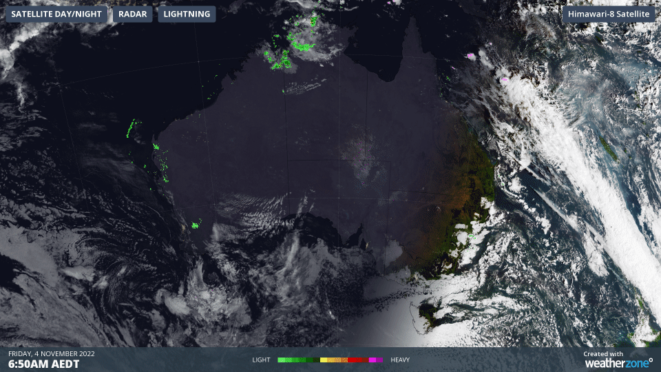
For the first time in ages, there’s is almost no rain or shower activity visible across the whole country, including Tasmania.
Sure, there’s a speck or two of precipitation in the Top End, the Hunter, Sydney metro and Mid North Coast regions of NSW, as well as the Gascoyne and Kimberley forecast districts of WA.
But there's barely enough activity in any of those places to wet the ground, and in a rare occurrence in the very soggy spring of 2022, the second-driest continent on earth (Antarctica is first) is acting like it.
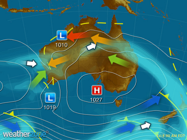
The synoptic chart below helps you understand why. That big high pressure centred near Kangaroo Island south of Adelaide is keeping things mostly calm across the country, with just a faint hint of onshore flow to the east coast rather than the gushing torrent of Coral Sea moisture we’ve seen so often in recent times.
The other main chart feature is the low in northwestern WA. There’s actually a heatwave underway in our northern tropics, and showers and storms will develop in northern parts of WA and the NT this afternoon.
Apart from that, no significant rain is expected anywhere today, which makes a welcome change for most people after a very wet period across virtually the entire country.
For the two-thirds of our national population who live in Australia’s eight capital cities, the weekend outlook is dry.
Sydney and Melbourne should be mostly fine with top temps in the low-to-mid twenties.
Canberra and Hobart will be a few degrees cooler, but also mostly fine with just the chance of a light shower in both cities.
Adelaide and Perth look the goods, with mostly clear skies and tops in the mid-twenties, edging up the high twenties by Sunday.
Brisbane also looks in for a lovely weekend with tops in the mid-twenties both days, while Darwin will be hot even by its lofty standards, with tops in the mid-thirties.
Wherever you are, we hope you’re lucky enough to enjoy a rare spell of fine weather this weekend.