
Balmy water spreading down NSW coast
A combination of local weather patterns, broadscale climate drivers and background climate change are causing record-challenging warm water to spread down the NSW coast this month.
While January is climatologically the hottest month of the year in eastern NSW, the warmest water usually occurs near the state’s coastline in February or March.
This month, however, has seen an injection of unusually warm water venturing down the state’s coastline. The map below shows sea surface temperature anomalies to the north and east of Australia on Monday, January 3rd. The map shows a pool of water off the central coast of NSW that’s about 2 to 3 degrees warmer than usual for this time of year.
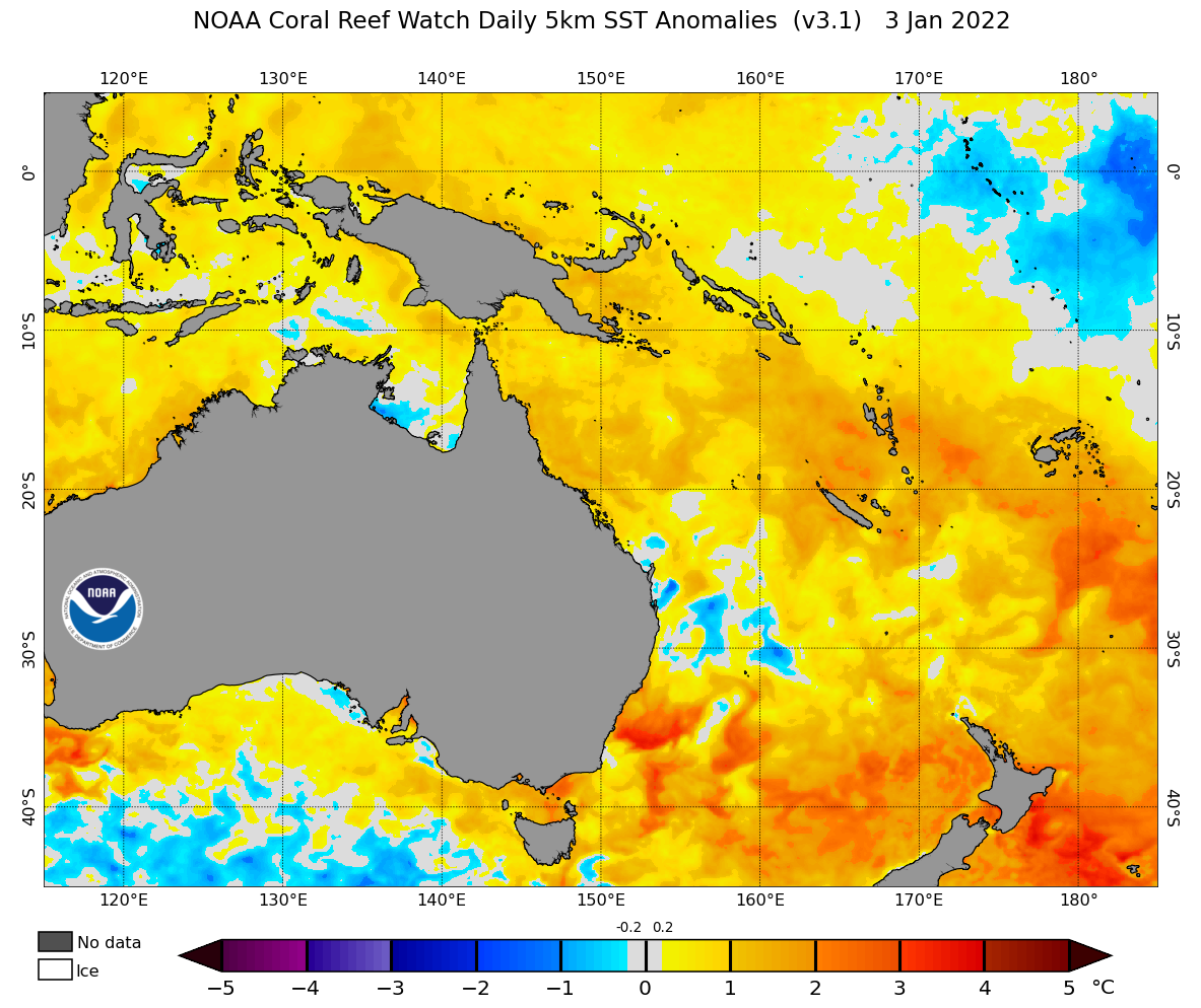
Image: Sea surface temperature anomalies on January 3, 2022. Source: NOAA.
This unusually warm water has been sitting off the central coast of NSW for about a month, following a rapid increase in water temperature near Sydney in early-December.
Data on the Australian Integrated Marine Observing System’s website revels that water temperatures off the central NSW coast are currently ranking in the top 10 percent of historical records for this time of year.
According to Professor Moninya Roughan, an oceanographer with the University of NSW, these sea surface temperatures are likely to be some of the warmest on record near Sydney in January.
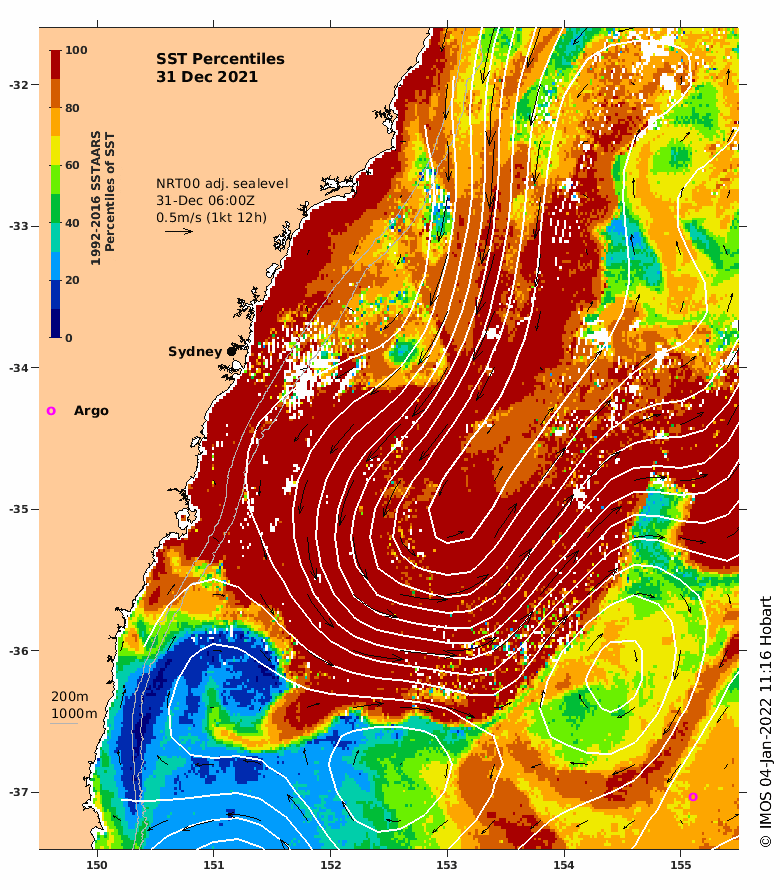
Image: Sea surface temperature percentiles off the NSW coast on December 31, 2021. The dark red area shows sea surface temperatures that are in the top 10 percent of historical records for this time of year. Source: IMOS
The oceanic warmth has made for pleasant swimming at many NSW beaches during the busy holiday period in the last few weeks. However, the marine heatwave is likely to be having a detrimental effect on some animals and ecosystems in the Tasman Sea.
Why is the water so warm?
A combination of local and broad-scale influences have teamed up to create this marine heatwave in the Tasman Sea:
- La Niña has caused warmer-than-usual water to build up over the western Pacific Ocean during the last few months.
- This unusually warm water has been transported south by the Eastern Australia Current, which travels down the coast from the Great Barrier Reef towards Sydney.
- A lack of strong and persistent northerly component winds in recent weeks has prevented any significant upwelling along the NSW coast, allowing warm water to linger near the shoreline.
- Climate change has warmed the Tasman Sea in recent decades, making it easier for marine heatwaves like this to occur.
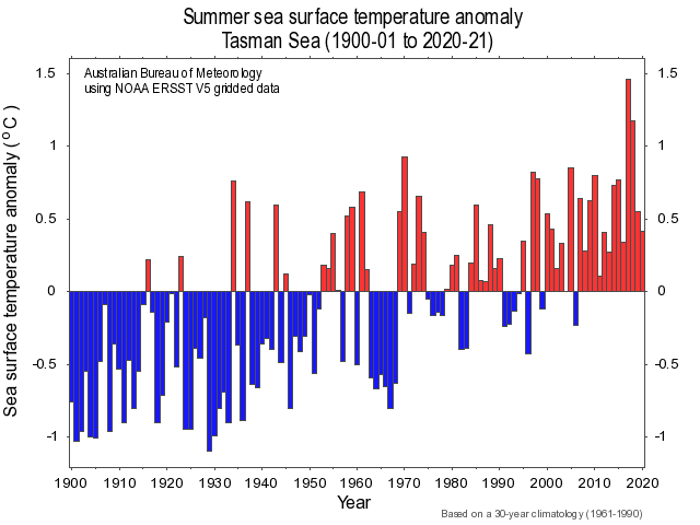
Image: Summer sea surface temperature anomalies in the Tasman Sea between 1900 and 2021. Source: Bureau of Meteorology.
While heatwaves over land usually last for days, it takes longer for heatwaves to abate in the ocean. Water in the Tasma Sea may stay significantly warmer than average for the next few months.