
Balmy seas set to peak in New South Wales
A tongue of very warm waters off the New South Wales coast is pushing towards the mainland, leading to the warmest sea surface temperatures in over 2 years.
Sea surface temperatures will generally lag behind the atmospheric temperatures by about a month or two due to the extra amount of energy required to heat water, compared to air. The summertime peak in water temperatures off the New South Wales coast will usually occur in February or March, and it’s occurring now.
The famous East Australian Current (EAC) feeds balmy waters from the tropical latitudes south, reaching as far as Tasmania in the Southern Ocean. Eddies and branches of this current will shift east and west, bringing these warm waters away and closer to the New South Wales coastline. A tongue of this warm water is reaching out towards the coast this weekend, mainly from Sydney and northwards, leading to the likely hottest sea surface temperatures of the current season.
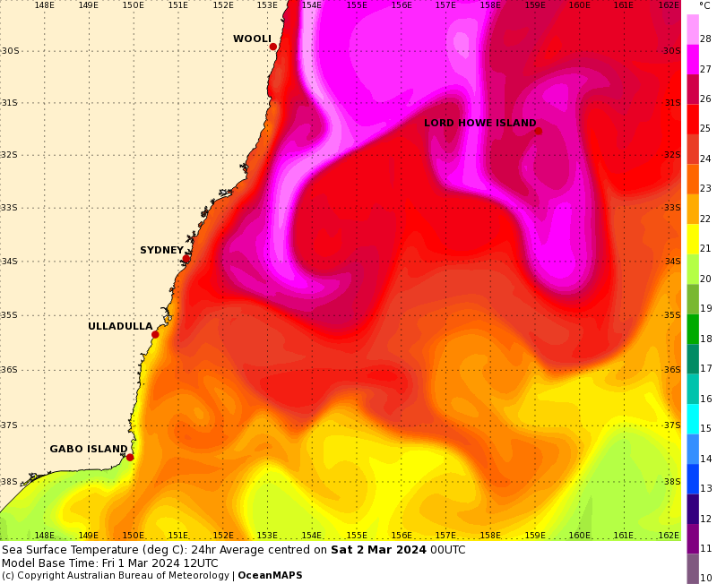
Image: Forecast Sea Surface Temperatures on Saturday March 2nd off the New South Wales coast reaching the high-20s. Source: BOM
The Sydney WaveRider buoy that sits about 5km off the Northern Beaches of Sydney recorded sea surface temperatures of 26.5°C on Friday afternoon. This is the warmest reading the buoy has recorded this season, falling just shy of the record value of 26.6°C recorded in February 2022. Elsewhere in New South Wales, the Byron Bay buoy’s latest reading of 28.4°C suggests waters off the Northern Rivers are warm enough to support a tropical cyclone.
While these readings are taken around 5 to 10km offshore, local winds will cause this water to push away or towards the near coastal areas (including the beach and surf zone). A surge of southerly winds in the coming days will however help move this warm surface water towards the coast, through a process called Ekman Transport. This process, through the friction of wind along the surface and the Coriolis Force, results in the top layer of water moving to the left of the wind direction (in the southern hemisphere).
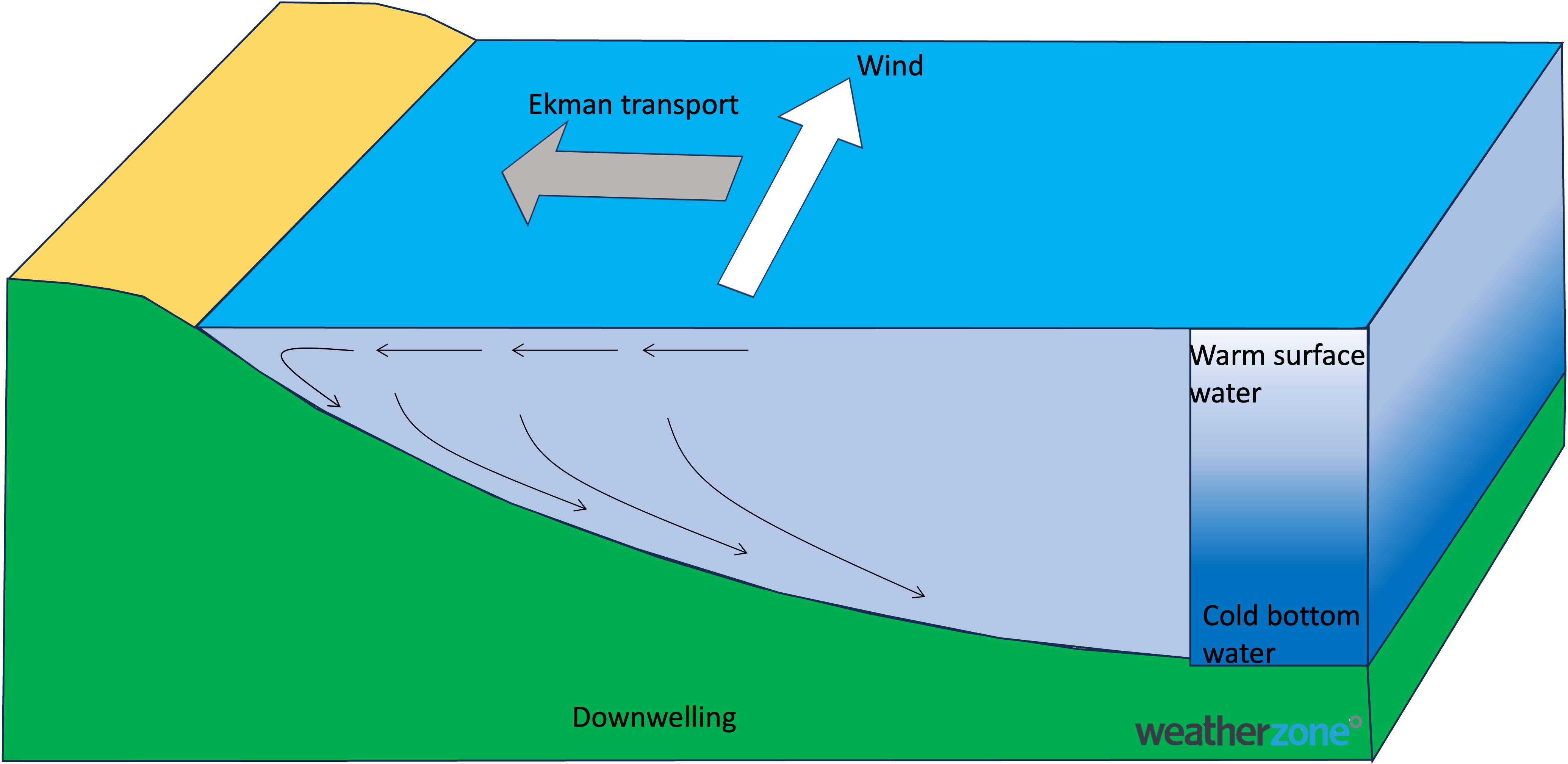
Image: A schematic of Ekman transport moving warm surface water towards the coast in a southerly wind (in the southern Hemisphere).
A brisk and cool southerly wind might not signify the best beach weather, but this warm water could linger near the coast well into the coming week, bringing the potential for more humidity pushing into eastern New South Wales.