
Bad week for solar power, good week for wind power
The combination of a thick northwest cloud band and a strong low pressure system have caused a mixed week for renewable energy production in Australia.
Moisture-laden air from the Indian Ocean caused a large northwest cloud band to sweep across Australia this week. This northwest cloud band has been dragged southeast across the country by a deep low-pressure system.
The combination of the low-pressure system and the northwest cloud band have brought low solar output, chilly air, high wind power and thunderstorms across southeastern Australia.
LOW SOLAR OUTPUT
The thick cloud has reduced solar output in parts of WA, SA and the NT earlier this week as it moved across the country from the west.
The cloud band then moved into the NEM on Wednesday and is expected to hang around eastern Australia for another day or two.
The band of cloud will progress to northeast NSW and southeast Queensland on Friday before moving over the Tasman Sea and heading away from Australia.
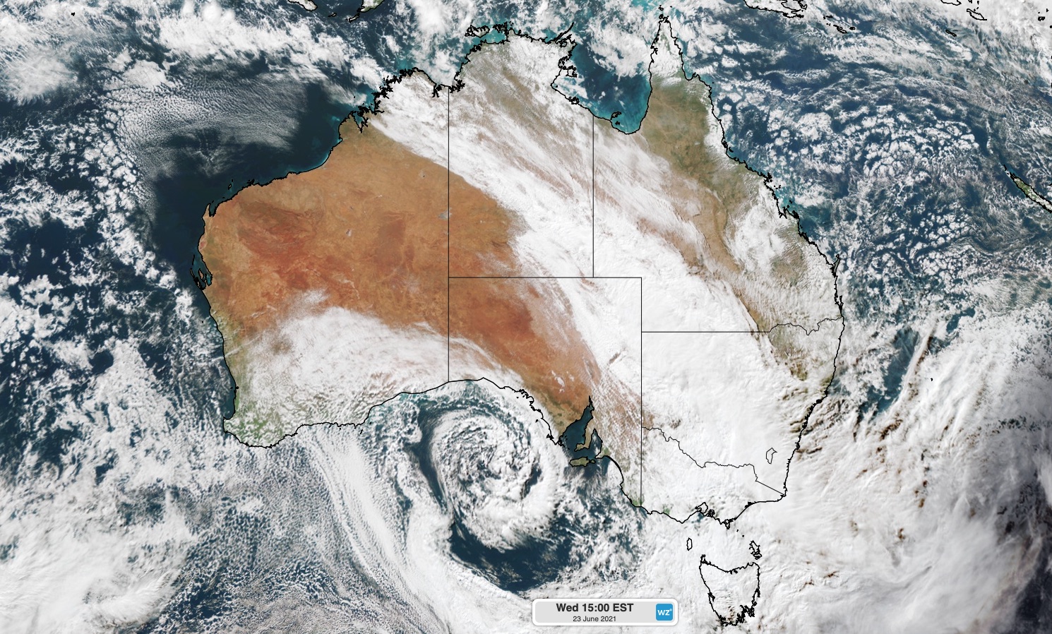
Image: Visible satellite image on Wednesday, June 23 and 3:00pm AEST.
WIND POWER
While the cloud band has been reducing solar capacity, the low-pressure system has well and truly increased wind power capacity across southeastern Australia.
On Thursday, the low-pressure system was generating damaging winds across South Australia’s southern districts.
While the winds from this system will remain below damaging criteria across most other areas of southeastern Australia, wind will be strong enough to generate high wind power across most states.
Winds are expected to ease by Saturday as a high-pressure system moves into the southeastern Australia in the wake of the low.
For more information about Weatherzone’s energy forecasts and consultation, please contact us at business@weatherzone.com.au.