
Back-to-back large south swells to smash coastal NSW
A powerful Tasman low and vigorous cold front are generating two strong south swells that will bring large waves to coastal NSW in the coming days.
The satellite loop below shows a deep Tasman low spinning halfway between NSW and New Zealand. The satellite imagery also shows a powerful cold front crossing well to the south of Australia in the Southern Ocean.
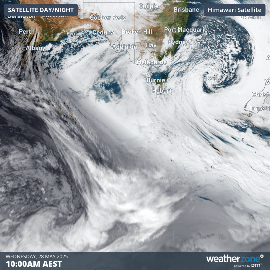
Image: Satellite loop on Wednesday, May 28, showing a deep Tasman low and powerful Southern Ocean cold front.
These two systems will be responsible for two large south swells coming in rapid succession between now and the weekend. As seen in the waverider buoy observations below, wave height has already jumped up significantly from dawn.
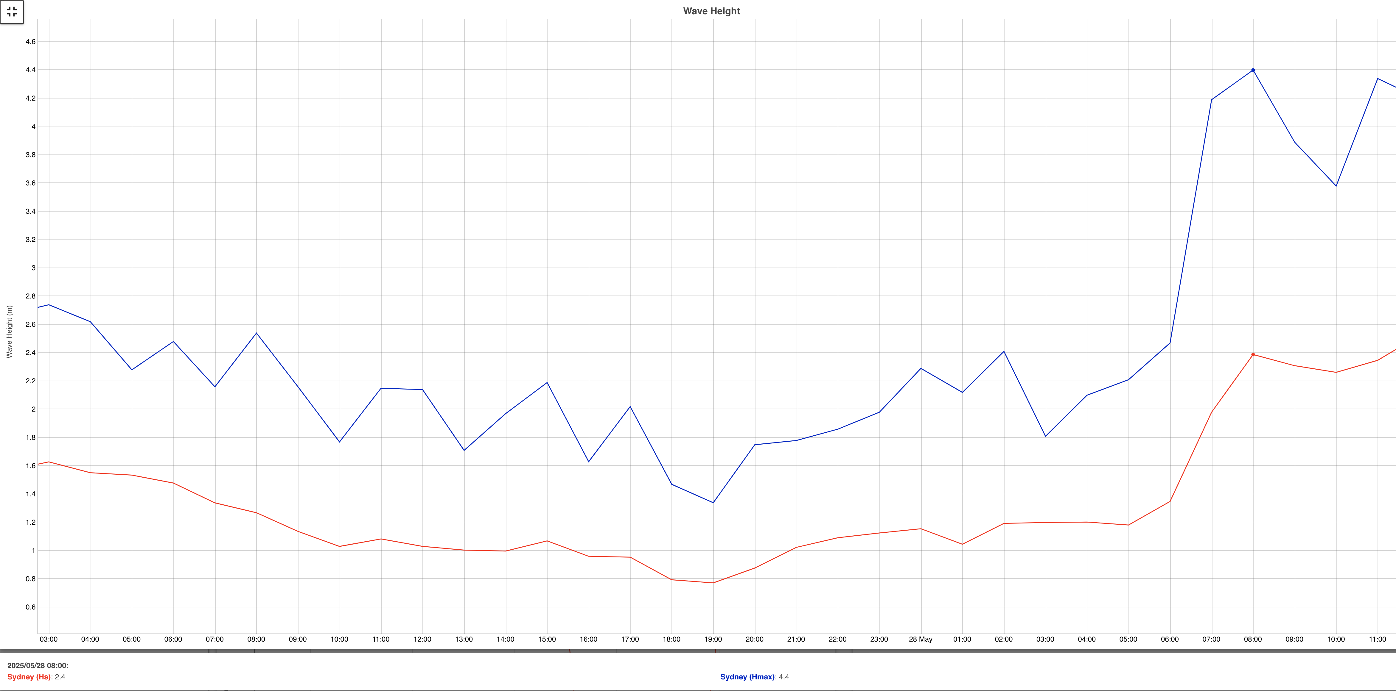
Image: observed wave heights off the Sydney coast. Source: Manly Hydraulics Laboratory
Significant wave heights of around 1 metre quickly rose to above 2 metres within a couple hours following sunrise around Sydney.
The animation below shows forecast 10 metre winds across the Tasman Sea and Southern Ocean between now and late on Friday, May 30.
Video: 10 metre wind forecasts between Wednesday, May 28, and Friday, May 30, according to the ECMWF computer model.
Tasman Low swell on Thursday
The deep low currently spinning in the Tasman Sea is generating gale to storm force winds over a broad area of the ocean. As seen below, the forecast significant wave heights overnight into Thursday, May 29, is expected to peak around 8 to 9 metres over a large swath of the Tasman.
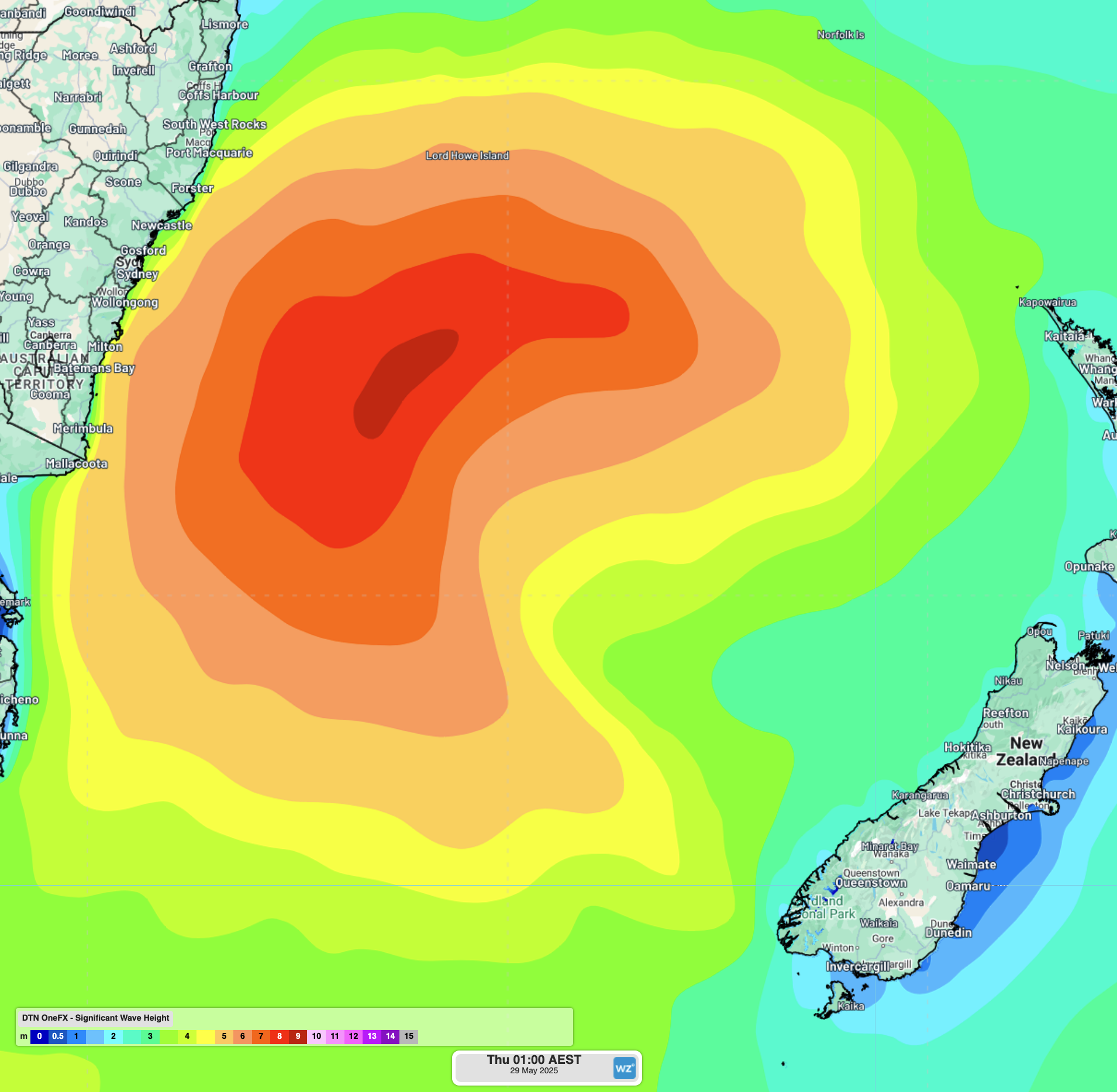
Image: OneFX significant wave height forecast for early morning on Thursday, May 29.
Significant wave height is the average of the largest 1/3 waves recorded over the measuring period – a value used to represent the noticeable ocean conditions for mariners.
For coastal NSW, wave height decay will likely result in a peak on Thursday morning near 4.5 to 5 metres along coastal parts of the lower Mid North Coast, Hunter, Sydney and Illawarra. Maximum wave heights could exceed 10 metres across some locations as well.
While the swell direction is expected to be quite south, most likely greater than 170°, the peak wave period should remain above 12 seconds throughout most of the day, peaking around 15 seconds early on Thursday. Large and hazardous surf will impact parts of the NSW coast, especially across south-facing beaches and coastlines. Coastal erosion is expected in some places, especially after several large swell events over the past three months and large high tides on Wednesday and Thursday evenings.
Swell height will decrease later on Thursday, with 1.5-2 metre swell expected on Friday and into Saturday.
Deep Southern Ocean long period swell on Saturday
Very long and powerful lines of swell from deep in the Southern Ocean are forecast to reach the NSW coast on Saturday. A front crossing to the south of Australia at the moment is bringing storm force winds and generating swell heights of up to 9-10 metres over 2,500 kilometres south of the NSW coast.
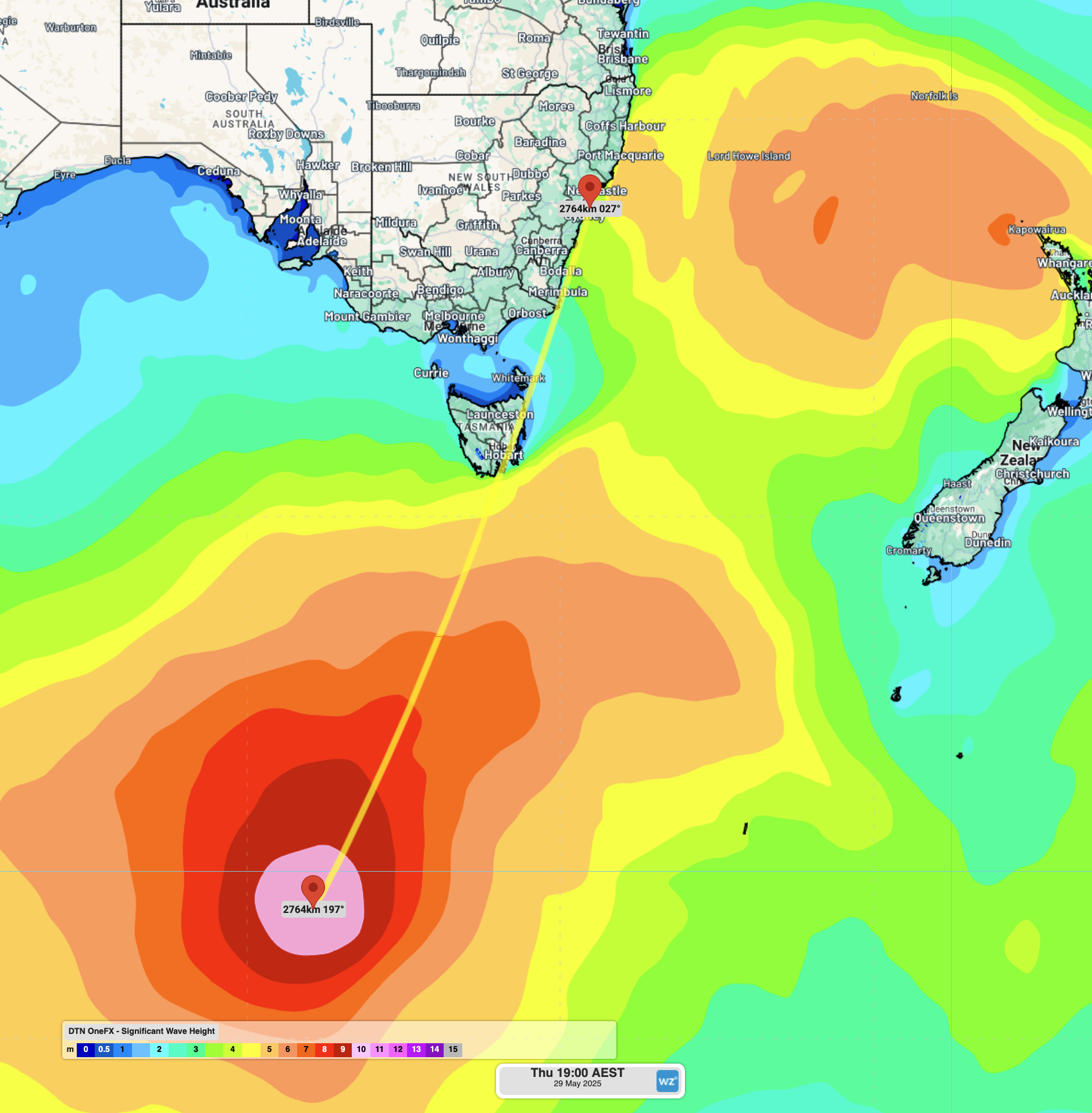
Image: OneFX significant wave height forecast on Thursday, May 29.
With thousands of kilometres to travel, the swell will dissipate in size to around 2 metres, but lengthen in period, maintaining much of its energy deep underwater. As seen in the animation below, the swell is expected to move over coastal NSW from Saturday afternoon, with wave period likely peaking around 17 to 18 seconds before gradually shortening.
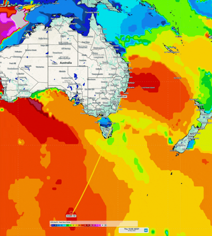
Image: OneFX peak wave period forecast between Thursday, May 29, and Monday, June 2.
While the swell height will peak 2-3 metres less than Thursday’s swell, the long period nature of the swell will mean waves reach 100-150 metres deeper into the ocean. All this energy will make for deceptively powerful surf along the coastline, with wave energy wrapping around into more protected beaches and bays.
On the beaches, the distant nature of these waves will lead to lulls with relatively calm ocean conditions. Every 5-10 minutes, abnormally large and powerful waves will break across the coast. Stronger rips may also suddenly form as swimmers enjoy the mostly sunny conditions.