
Australia's tropics remaining active over the coming week
A monsoon trough will hang around far northern Australia in the coming week, bringing plenty of wet and stormy weather.
The monsoon trough is currently stretching across the northern tropics, triggering widespread rain and storms. Northern parts of Queensland and the NT are receiving plenty of thundery showers, whilst parts of northern WA just got drenched with a tropical low.
The trough is not going anywhere in the short term, and may actually become more active in the next few days. A couple of weak tropical lows may form over the Gulf of Carpentaria and Joseph Bonaparte Gulf by early next week, increasing the chance of heavy rain. There is also the chance of a deep tropical low or cyclone in the northeastern tropics later next week.
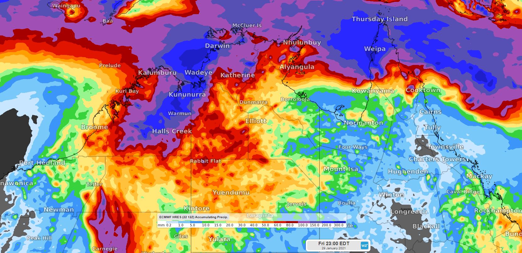 Image: potential for plenty of heavy rain across the northern tropics this week, using the ECMWF forecast model.
Currently, much of southern and eastern Australia is in the midst of a heatwave, typical of times when the tropics are relatively inactive. The increased tropical activity will, after this heatwave ends, limit the chances of another one developing in the short term.
So it's a very wet week ahead for far northern Australia, with a couple of possible tropical lows thrown in the mix, so avoid floodwaters and take care up there.