
Australia's southeast slips back to shivery nights
Friday won’t go down in the record books as a historically cold morning in the southeastern states, but it was definitely chilly enough to give a frosty reminder that winter was not left behind too long ago.
After a cold front quickly passed over Victoria and South Australia on Thursday and dragged cold air behind it, high pressure parted the clouds and allowed what little heat there was from the day to escape into the atmosphere. What it left behind was overnight temperatures that dropped well below average for this time of year.
The high-pressure system was predominantly centered over South Australia and so the lightest winds and clearest skies occurred here. As a result, the mercury dropped about 4-8 degrees across the state. It was the coldest October night for:
- Elliston (2.9oC) since 2007
- Edithburgh (2.5oC) since 2013
- Ceduna (1.6oC) since 2014
- Yunta (1.8oC) since 2016
In Victoria, the effect of the high was lessened, although this did not stop temperatures from dipping to about 3-6 degrees below average for a lot of locations.
Looking ahead, another cold front arriving on Saturday cold drop temperatures on Sunday and Monday to similar levels as seen on Thursday and Friday for both Victoria and South Australia.
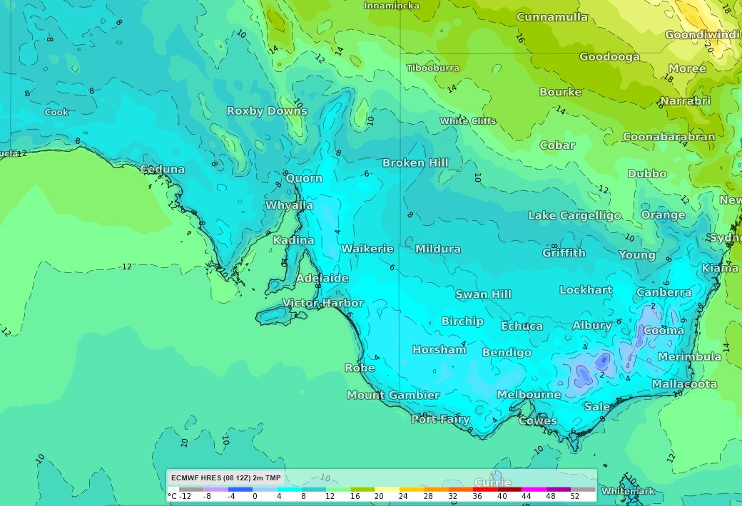
Image: ECMWF model showing forecast surface temperature at Monday 5am EDT