
Australia's early-season snow seen from space
NASA satellites captured images of extensive early season snow in the Australian alps on Tuesday.
A burst of cold weather during the second half of last week caused widespread and heavy snow over the high mountains of NSW and Victoria.
As storm clouds cleared this week, satellites passing over Australia captured images of the snow they left behind.
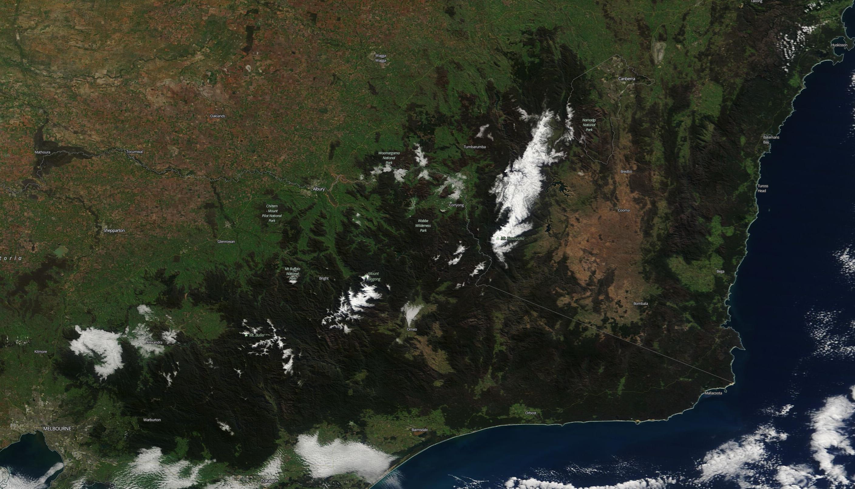
Image: Visible true colour satellite image showing snow in the Australian alps on Tuesday, May 5th. Source: NASA/Terrra MODIS
High resolution images taken by NASA's Terra satellite on Tuesday, May 5th show that there's still quite a lot of snow left in the alps.
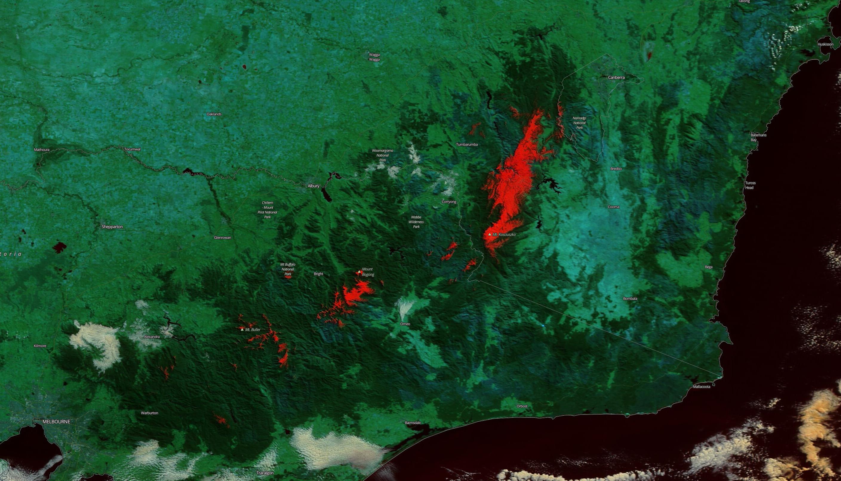
Image: Enhanced 'false colour' satellite image showing snow (coloured red) in the Australian alps on Tuesday, May 5th. Source: NASA/Terrra MODIS
While snow that falls in early May typically melts pretty quickly, last week's system brought more than half a metre of snow-cover in some parts of the alps. Snow this thick will take some time to melt, even in May.
Tuesday's satellite images of snow-covered mountains are a more pleasant sight than the smoke-filled skies that plagued the alps and surrounding areas of Victoria and NSW earlier in the year.
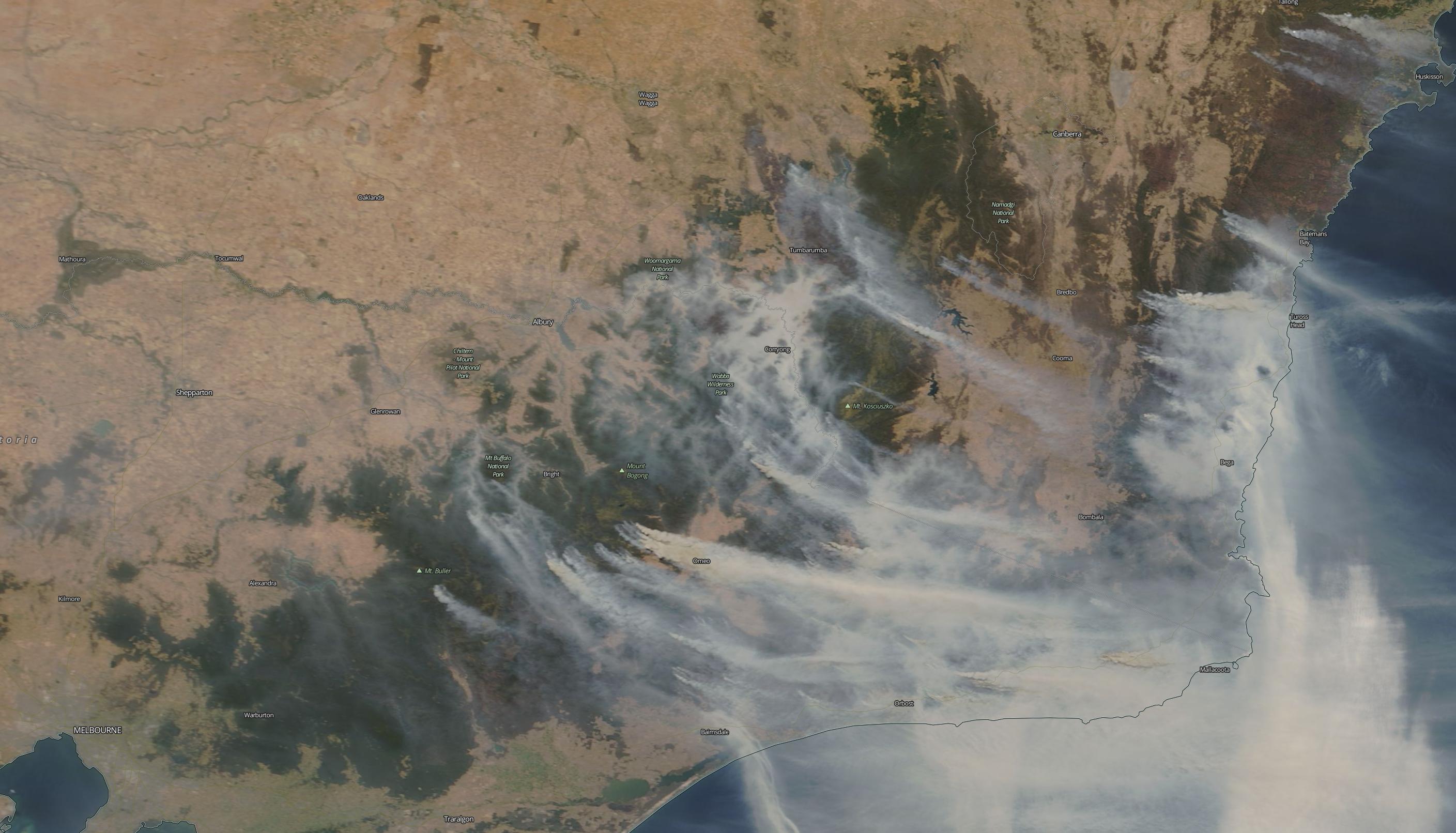
Image: Visible true colour satellite image showing copious smoke over southeastern Australian on January 4th, 2020. Source: NASA/Terrra MODIS
Temperatures will continue to climb in Australia's alps between now and Friday, before another snow-bearing cold front arrives on the weekend. However, this system won't bring as much snow as last week.