
Australia's capital suffering scorching conditions
Canberra, like much of southeast Australia, is in the middle of a very hot spell. Saturday saw temperatures rear up, with severe-to-extreme heatwave conditions expected to continue through to Wednesday for much of NSW.
A low pressure trough is responsible for dragging this very hot airmass into the southeast. A high pressure system over the Tasman is also helping to prevent the heat from escaping.
Canberra Airport reached 36 degrees on Saturday, it's hottest day since February last year. However, it has been a relatively cool start to the year in Canberra. The running average maximum temperature this January is more than two degrees lower than normal. This was helped by a string of nine days below average at the start of the year. In comparison, January 2020 only had 11 below average maximums for the whole month.
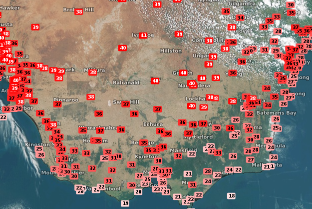
Image: Satellite (Himawari-8) imagery with temperature observation overlay at 3:30pm EDT on Saturday
The colder start to 2021 in Canberra looks likely to change in the next coming days. Clear skies and hot winds are expected to bring the mercury up to 38 degrees on Sunday and Monday. However, clouds will begin to roll over on Tuesday with an approaching cold front, but temperatures are still forecast to reach 37 degrees. This would be four consecutive days of maximums above 35 degrees which did not occur in Canberra at all in 2020.
Later in the week, after the cold front hits, temperatures start to become a little more manageable with a few showers to help beat the heat.