
Australia's 2025-26 tropical cyclone outlook
The Australian region is primed for severe tropical cyclones this season, despite an ongoing trend of reduced tropical cyclone activity over Australian waters in recent decades.
Australia’s tropical cyclone season officially runs from the start of November to the end of April. During this six-month period, the Australian region usually sees around 9 to 10 tropical cyclones, with about five of these becoming severe tropical cyclones (category three or higher) and four systems making landfall.
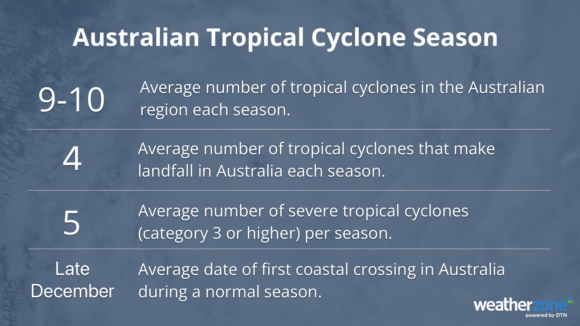
Image: Tropical cyclone season averages for the Australian region.
Tropical cyclone activity decreasing near Australia
The number of tropical cyclones that form in the Australian region each season has decreased in recent decades.
Since 1980, the total number of tropical cyclones per season has been reduced by about one system every 11 years. However, there has not been a similar drop in the number of severe tropical cyclones, which means the proportion of systems that become severe tropical cyclones (category three or higher) in each season has increased.
Seasonal tropical cyclone numbers are also influenced by El Niño and La Niña, with La Niña years typically producing more tropical cyclones near Australia and El Niño years often bringing fewer Australian cyclones.
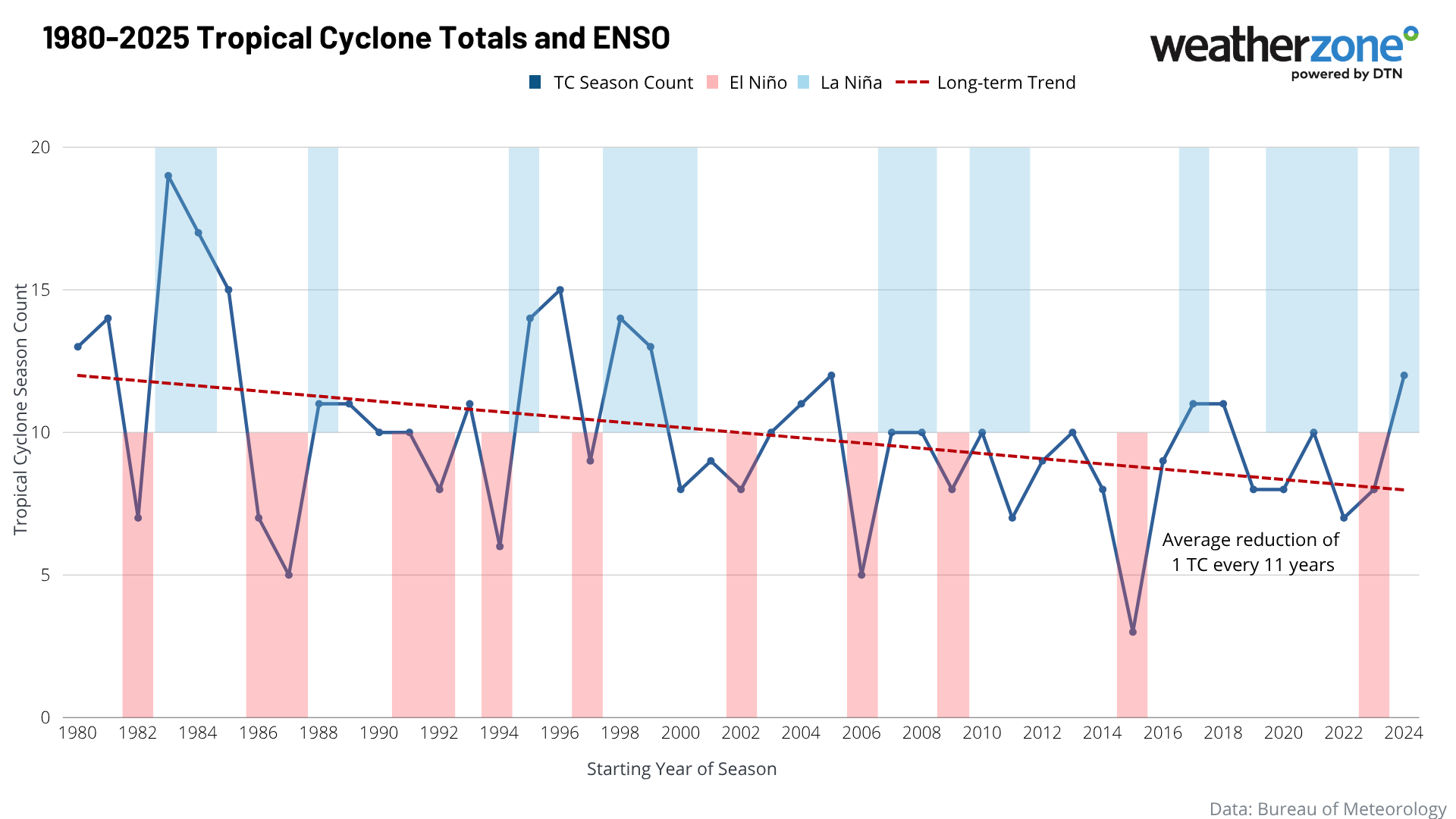
Image: Tropical cyclone activity in the Australian region between 1980 and 2024, including the long-term trend in cyclone activity and identification of La Niña and El Niño seasons.
The cause of Australia’s declining tropical cyclone activity in recent decades is an active area of research. It is likely due to a combination of natural variability and climate change.
What to expect this season
Tropical cyclone seasonal forecasts are difficult because there is usually a lot of variability from season to season. However, looking at how readily available the key ingredients for tropical cyclone formation will be in the season ahead can provide useful insights into what to expect.
The key ingredients for tropical cyclone formation are:
- Warm sea surface temperatures of 26.5°C or higher
- Low wind shear, meaning wind speed and direction doesn’t change too much with height
- An existing area of low pressure and convective activity (a cluster of thunderstorms)
This season will have plenty of warm water and convective activity to spawn tropical cyclones, thanks to above average sea surface temperatures surrounding most of northern Australia. A weak La Niña-like pattern and the tail end of a negative Indian Ocean dipole will also help maintain this abnormally warm tropical water near Australia early in the season.
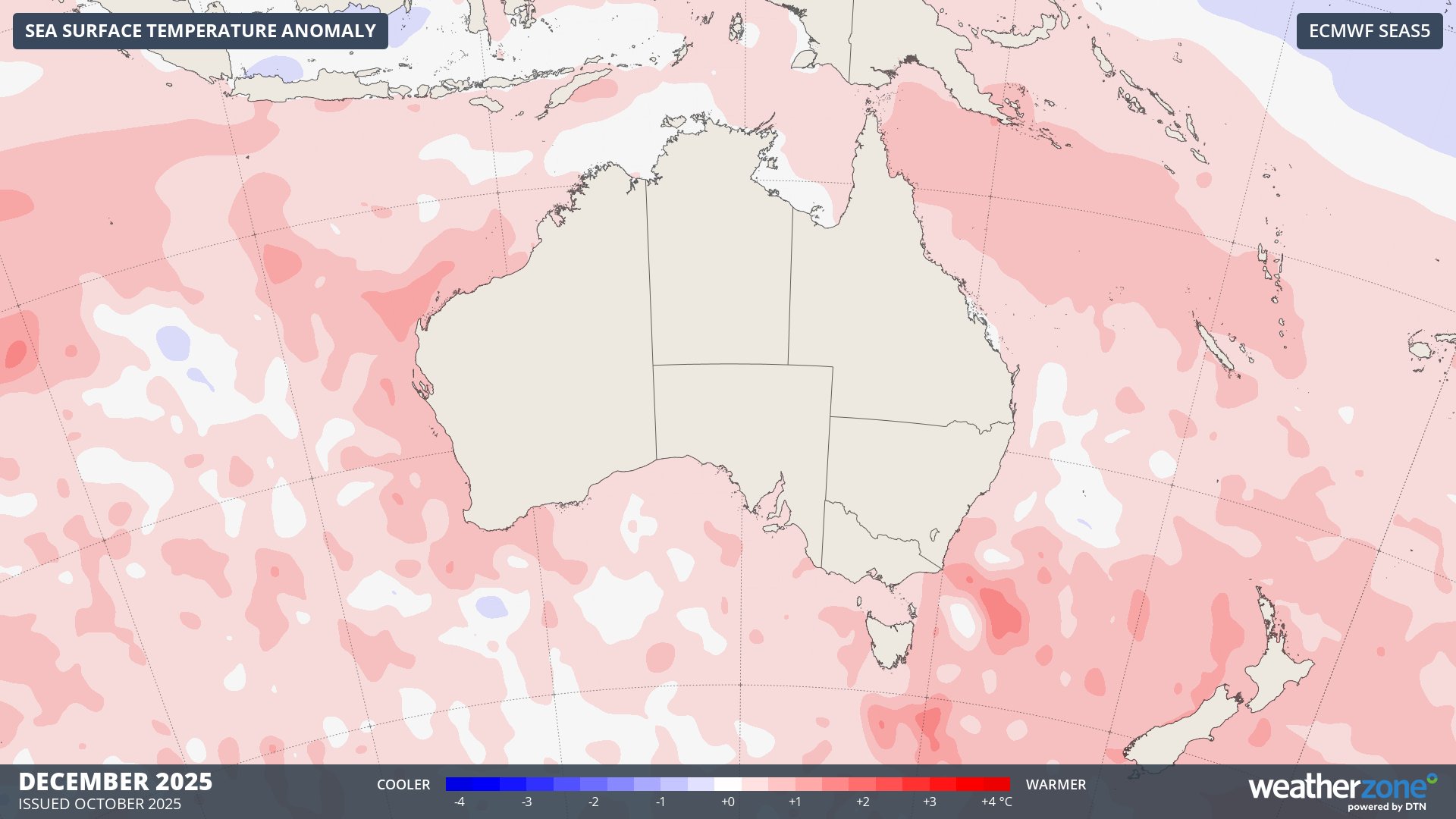
Image: Sea surface temperature outlook for December 2025, showing abnormally warm water surrounding Australia.
However, this ample cyclone fuel will be counteracted by the background influences that have underpinned the long-term decline in cyclone activity near Australia in recent decades.
With all these factors considered, conditions are expected to favour a near to slightly above average number of tropical cyclones in the Australia region this season. There should also be a higher-than-average proportion of severe tropical cyclones, meaning that once systems do form, they have an increased risk of intensifying rapidly. More than half of the tropical cyclones that form in the Australian region this season could become severe, reaching category 3 or higher.
One of the most important things to understand about tropical cyclones is that it only takes one to have a big impact on communities and the landscape in northern Australia. Regardless of how many tropical cyclones form near Australia this season, if you live in the tropics, be sure to have an action plan ready in case one approaches your region this season.
Cyclone names this season
Naming tropical cyclones in the Australian region is the responsibility of the Bureau of Meteorology and has been occurring since the 1960s. These names are assigned using a predetermined list that runs in alphabetical order and alternates between male and female names.
The next 11 tropical cyclone names that will be used for systems forming in Australia’s area of responsibility are shown below, starting with Fina.
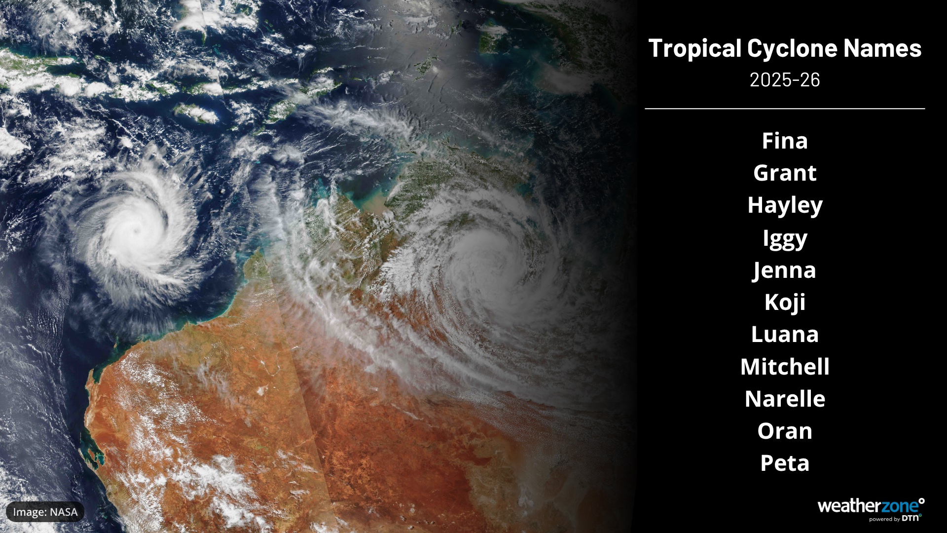
Image: Tropical cyclone names to be used for the next 11 systems that form in the Australian area of responsibility.
If a tropical cyclone forms in a neighboring region, such as Fiji or Indonesia, the system will be named by that country’s national meteorological service. This name is then retained if the cyclone moves into the Australian region.