
Australian summer to start with snowfalls
Snow has fallen overnight in Tasmania for at least the fifth time this November, and an even colder, snowier change looks likely to arrive in time for the start of summer next Monday, December 1.
Thursday morning's snow at the highest elevations in Tasmania marks the latest cold outbreak in what has been an unseasonably chilly November for our southernmost state, and also for the southernmost parts of the southeast mainland.
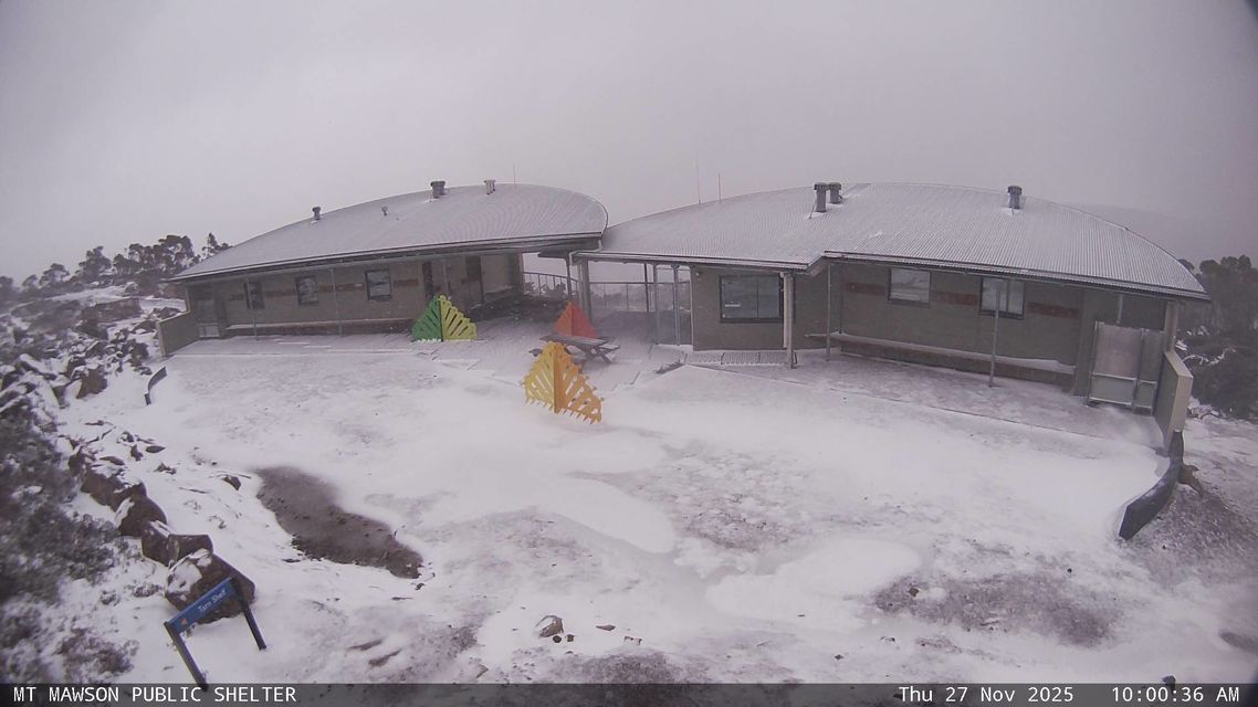
Image: Fresh snow at the Mt Mawson public shelter in the Mt Field National Park, about 90 minutes NE of Hobart, on Thursday, December 27, 2025.
In a pattern reminiscent of a typical winter, frequent cold fronts have surged northwards from the Southern Ocean throughout November.
The repeated injections of cool air are reflected in the running average maximum temperatures for November in Adelaide, Melbourne, Hobart and Canberra, with each of those capitals tracking at between half a degree and two degrees below the monthly average, as of November 27.
And as mentioned, yet another cold outbreak is due to arrive just in time for summer.
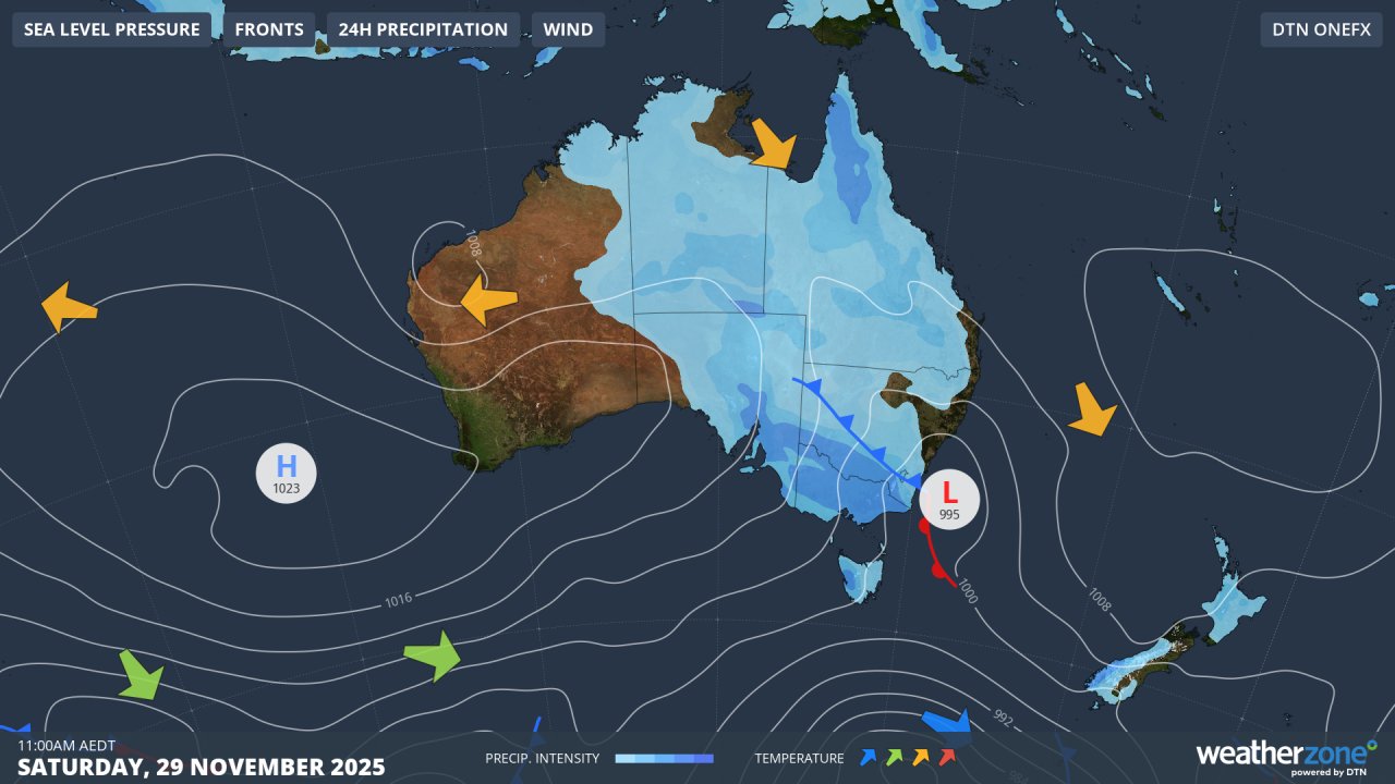
Image: Synoptic chart for Saturday, November 29, 2025.
The synoptic chart (above) for this coming Saturday shows the next cold front pushing over Tasmania and the alpine area of mainland Australia.
Snow should begin to fall on Saturday night or Sunday morning in elevated areas above about 1700 metres on the mainland and much lower in Tasmania, with snow showers persisting on Sunday and Monday. Around 10cm or more is likely to accumulate at higher elevations.
At this stage, the coldest surge of air looks due on Monday morning, just in time for the start of the Aussie summer.
How unusual are summer snowfalls in Australia?
Actually, they're not that rare. Cold airmasses originating in polar latitudes can make it as far north as southern Australia even during the summer months.
Here is a picture from Mt Hotham, Victoria, on December 2, 2019. That was the final month of Australia’s warmest and driest year on record. It was also the start of the so-called Black Summer of bushfires – not exactly a historical period remembered for snowfalls.
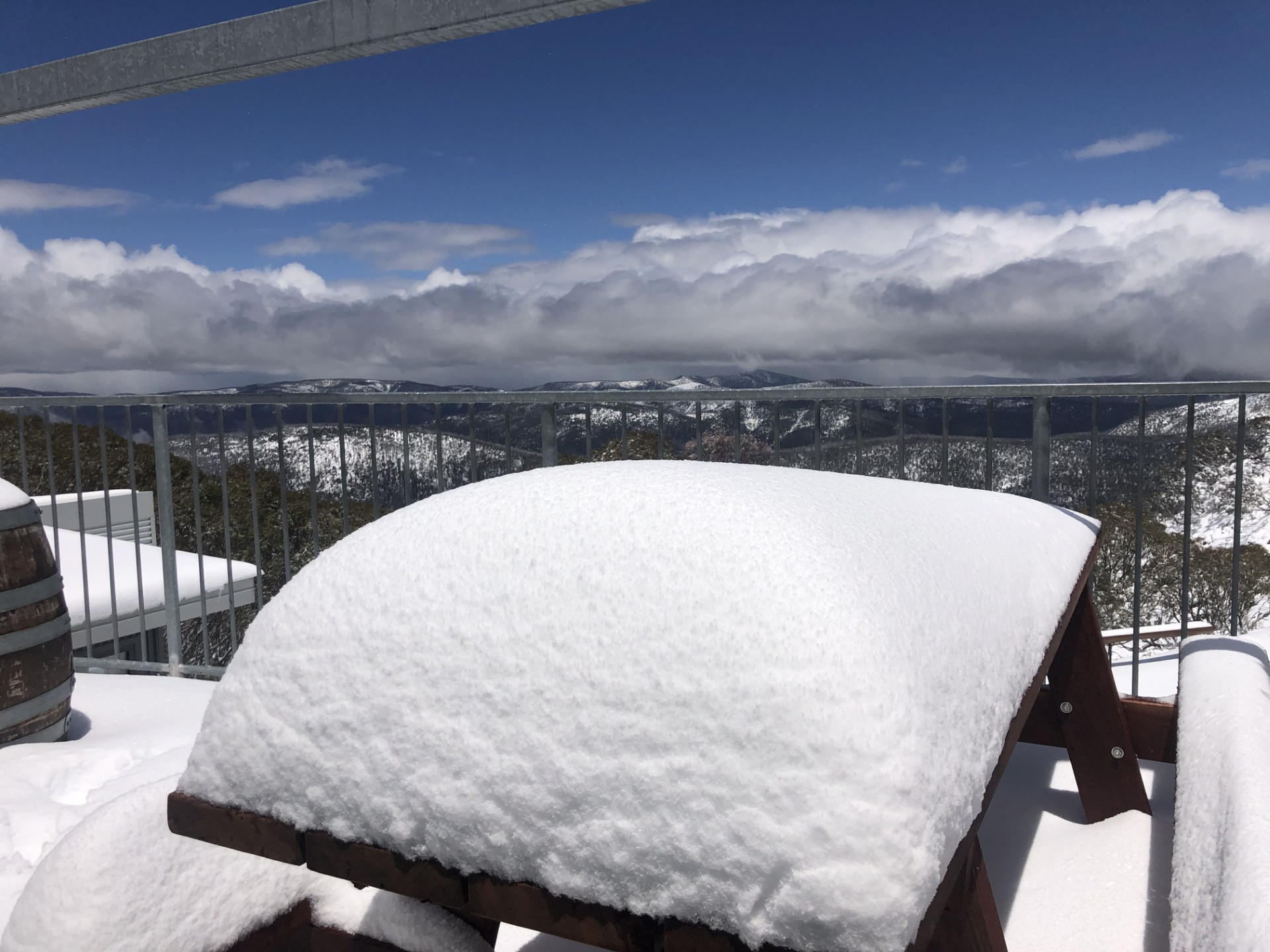
Image: Around 60cm of snow on an outdoor table at The General Store, Mt Hotham, on December 2, 2019. Source: supplied.
The effects of summer cold fronts are usually short-lived, with even heavy snowfalls melting entirely within a day or two. Hot weather often occurs just a few days either side of such events too.
Why so much cool weather in late spring and the first week of summer 2025?
The unseasonably cool weather is consistent with the current negative phase of the Southern Annular Mode (SAM), and also the strong negative Indian Ocean Dipole (IOD) we've been experiencing, which tends to lead to more cloud and rainfall.
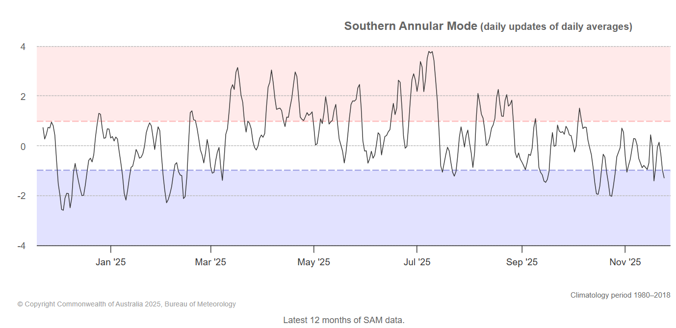
Image: Phases of the Southern Annular Mode over the past 12 months to late November, 2025. Source: BoM.
During a negative SAM, cold fronts tend to be pushed northwards towards southern Australia, causing outbreaks of cold weather. It doesn't always work out that way – sometimes the fronts peak just east or west of Australia – but plenty have hit the bullseye this spring.
READ MORE: Southern Annular Mode - What is the SAM and how does it affect Australia?