
Australian monsoon onset possible before Christmas
Heavy rain could engulf northern Australia next week, with signs the season’s first monsoon burst could arrive in northern Australia during the lead up to Christmas.
What is the Australian monsoon?
The monsoon refers to a reversal of winds over the Australian tropics, which cause moisture-laden air to flow over Australia form the north and northwest. These rain-bearing monsoon winds affect northern Australia in periodic bursts throughout the wet season, which runs from November to April. Australia usually sees about two to four active phases of the monsoon each wet season.
Numerous computer models are predicting the monsoon to develop over northern Australia next week, which would be the first time we have seen an active monsoon phase over the country so far this wet season. On average, the monsoon onset at Darwin typically occurs in late December.
Wet lead up to Christmas
The prospect of an active monsoon phase in northern Australia from next week significantly increases the likelihood of widespread rain over parts of Australia in the coming weeks. The monsoon can also cause low pressure systems to form near northern Australia, which increases the potential for tropical cyclone activity if these lows form over, or move over open water.
While there is still some uncertainty regarding the strength and timing of the impending monsoon, most models are showing signs of enhanced rain over parts of Queensland, the NT and northern WA from next week.
The maps below show how much rain is being predicted over Australia during the next 10 days from three different computer models. They all anticipate heavy rain over parts of northern Australia during the second half of December, with areas of heavy rain also possibly extending further south into Qld.
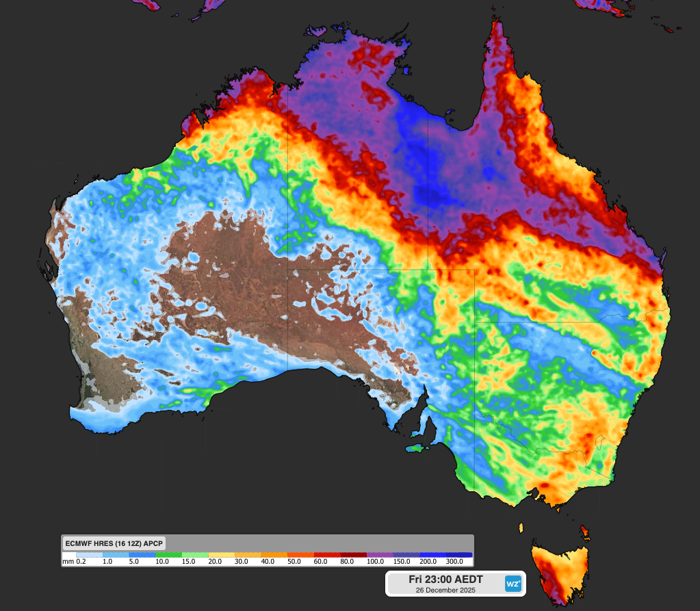
Image: Forecast accumulated rain during the 10 days ending at 11pm AEDT on December 26, 2025, according to the ECMWF model. Source: Weatherzone.

Image: Forecast accumulated rain during the 10 days ending at 11pm AEDT on December 26, 2025, according to the ACCESS-G model. Source: Weatherzone.
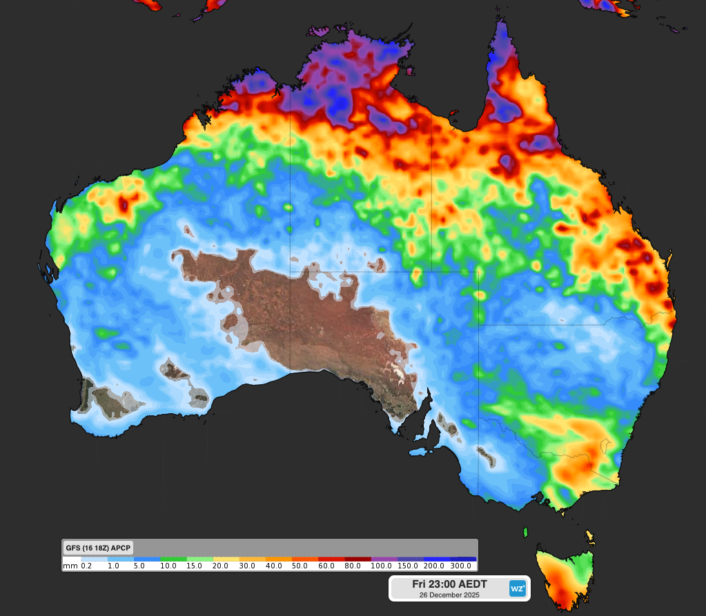
Image: Forecast accumulated rain during the 10 days ending at 11pm AEDT on December 26, 2025, according to the GFS model. Source: Weatherzone.
While the monsoon directly impacts northern Australia, it can also feed moisture into rain-bearing systems over other parts of the country.
Weatherzone’s meteorologists will be keeping a close eye on the monsoon during the next couple of weeks and providing updates on its impacts on the Weatherzone news feed.