
Australia surrounded by ring of rainfall this week
Despite rain surrounding Australia this week – including hundreds of millimetres off the north coast – most of the country will be dry over the next seven days, a clear sign that a seasonal shift is underway in the Southern Hemisphere.
The map below shows how much rain is expected to fall across Australia this week. Unless you live in far northern Queensland, western Tasmania or a few places along the country’s east coast, you will see little if any rain this week.
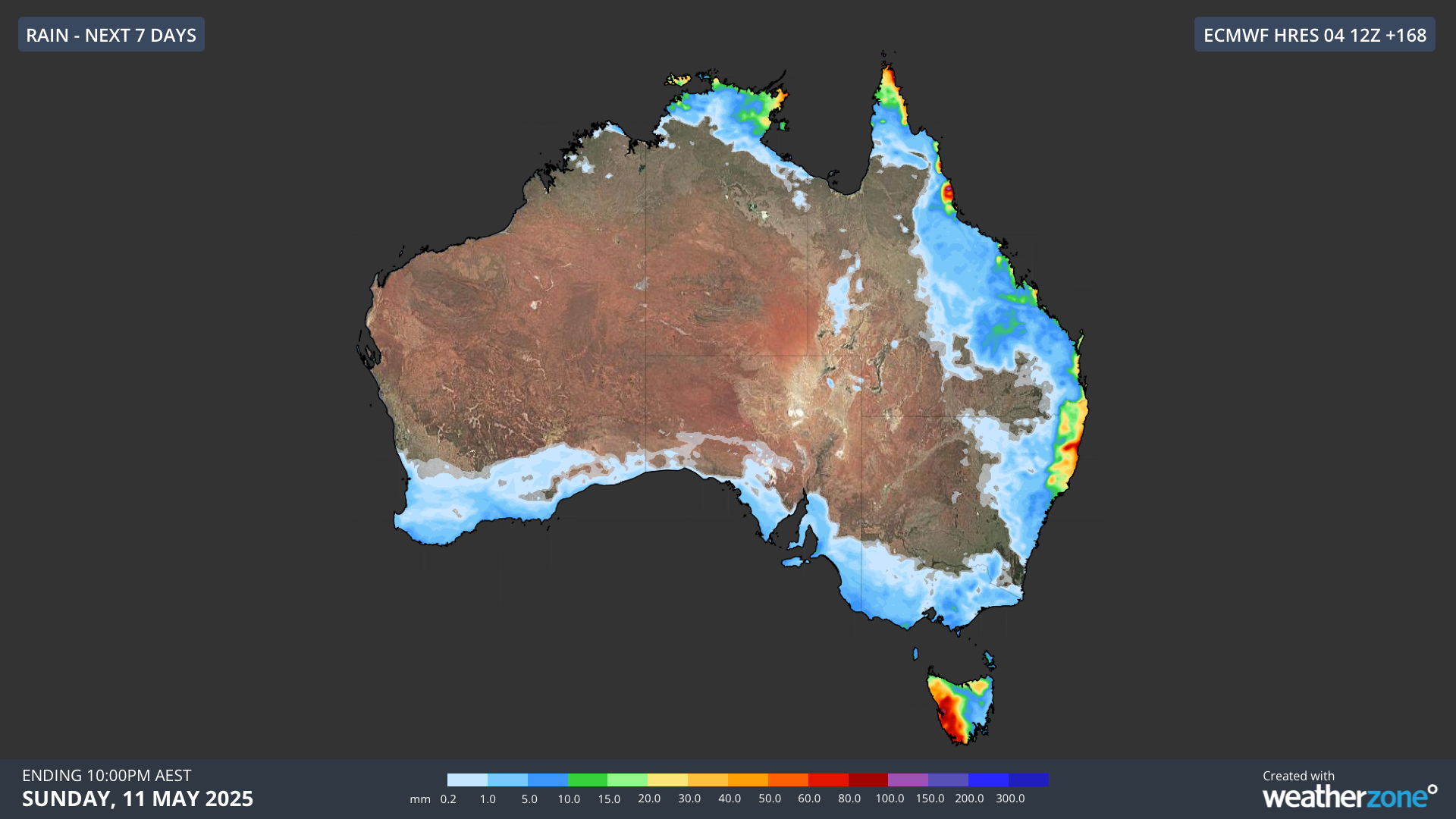
Image: Forecast accumulated rain during the seven days ending at 10pm AEST on Sunday, May 11, 2025.
The map above only shows the rain that’s likely to fall over the Australian continent this week. If we also include what’s expected to fall over the oceans surrounding Australia, the lack of rain over the Australian continent stands out as an island of dryness.
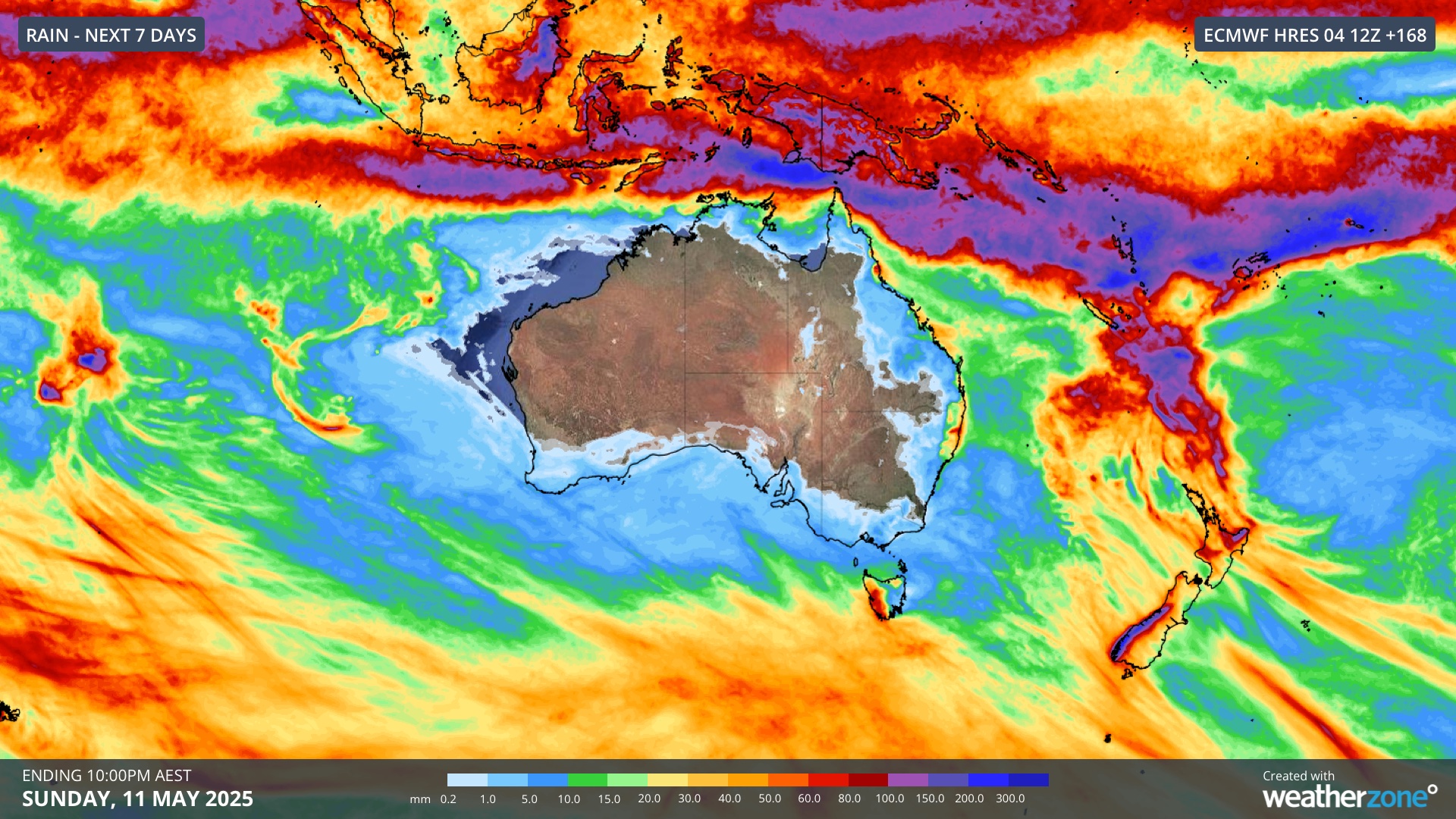
Image: Forecast accumulated rain in the Australian region this week.
While most of Australia will be dry this week, the country will be surrounded by rain. This includes a huge band of heavy rain within a few hundred kilometres of Australia’s northern coastline, which is forming along the intertropical convergence zone (ITCZ).
The intertropical convergence zone (ITCZ) is a region where trade winds from the Northern and Southern Hemispheres converge in the tropics. This region is characterised by a band of clouds, rain and thunderstorms that encircles Earth, shifting towards the north and south throughout the year.
Zooming further out revels that most of Australia is about the only place in this quadrant of the Southern Hemisphere that’s going to be completely dry this week.
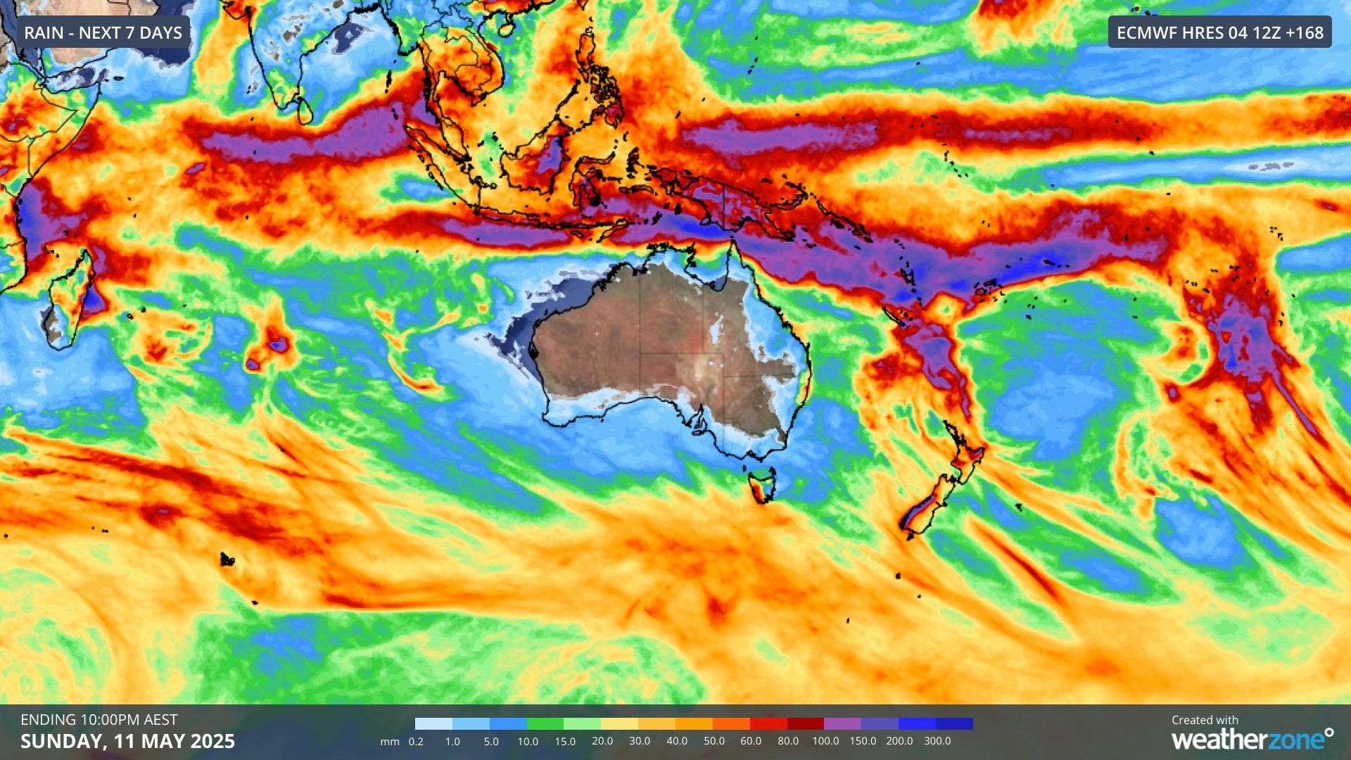
Image: Forecast accumulated rain this week in the broader area of the Southern Hemisphere surrounding Australia.
Why is the rain missing Australia this week?
The weather pattern that will keep most of Australia dry this week involves a sequence of high pressure systems centred over the southern half of the country. These stubborn highs, which are part of a belt of high pressure called the subtropical ridge, will push tropical rain to the north of Australia and force rain-bearing cold fronts to mostly stay south of Australia.
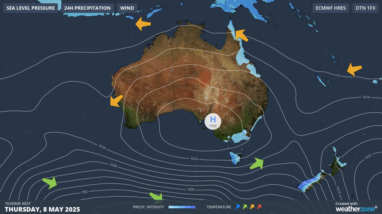
Image: Synoptic chart for 10am AEST on Thursday, May 8, showing a large high pressure system sitting over southern Australia.
Late-autumn is typically a time of year when Australia finds itself in dry sandwich between areas of rainy weather to the north and south. This is because the position of the subtropical ridge at this time of year helps keep the ITCZ to the north of Australia and cold fronts mostly to the south of Australia.
By winter, the subtropical ridge will have shifted further north, which will allow cold fronts to push further north from the Southern Ocean and bring more rain (and snow) to the southern half of the country.