
Atmospheric ripples seen from space near WA
On Saturday the Himawari-9 satellite caught an interesting view of atmospheric gravity waves spreading out like ripples in a pond when someone throws a rock into it. The cloud indicates the peaks of the waves and the clear spaces in between indicate the troughs.
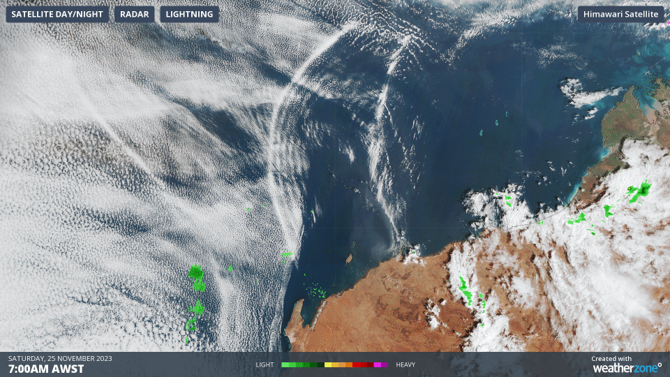
Animation: Himawari-9 visible satellite image and BOM radar on Saturday 25th from 7am to 10 am WST.
The events leading to this phenomenon were firstly seabreezes triggering thunderstorms near the Pilbara and the Kimberley coasts on Friday afternoon. As the thunderstorms matured and then weakened overnight, they sent currents of cold air rushing down to the surface. These currents of cold air acted like rocks thrown into a pond.
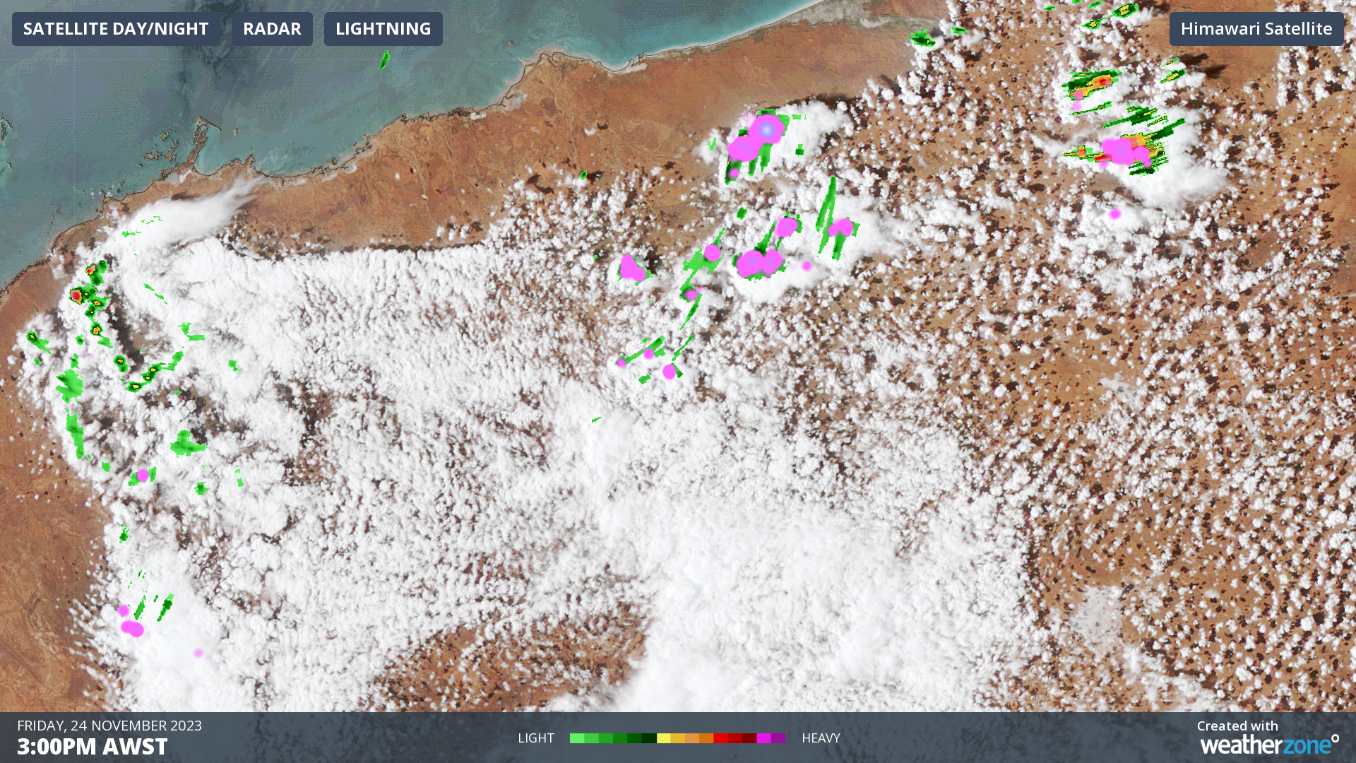
Image: Himawari-9 visible satellite image, BOM radar and Weatherzone lightning at 3pm WST on Friday 24th.
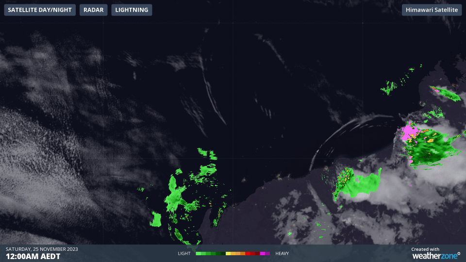
Animation: Himawari-9 infrared satellite image, BOM radar and Weatherzone lightning on Saturday 25th from 12am to 3am.
In the above animation, the purple indicates the lightning observed and this decreases into the end of the sequence indicating the thunderstorms weakening. You might be able to see a few lines of thin clouds moving away from these storms. This is the edge of the cold outflow that continued towards the Indian Ocean during Saturday and caused the atmospheric ripples of rising and sinking air.