
Another windy night ahead in Tasmania
It's going to get very windy in Tassie tonight, with parts of the state under a severe weather warning for the second time this week.
Northwesterly winds will strengthen over Tasmania on Wednesday afternoon as a cold front gets closer to the state's southwestern coast.
These winds will get even stronger after sunset and could produce damaging gusts overnight into Thursday morning as the front sweeps across the state.
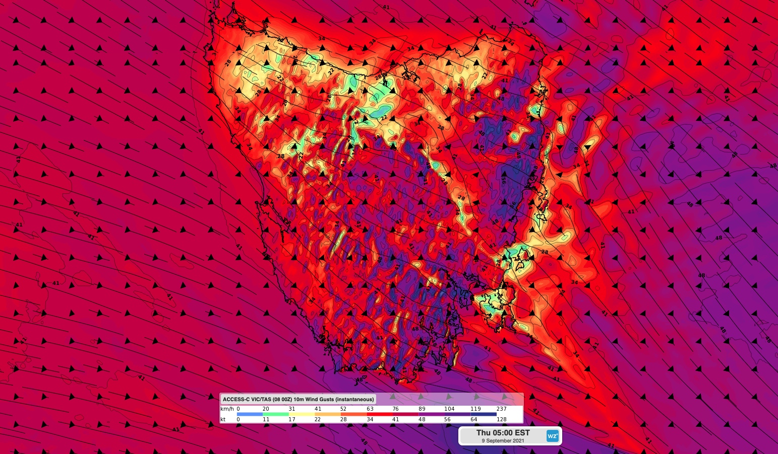
Image: Forecast wind gust speed and direction at 5am AEST on Thursday, according to the ACCESS-C model.
A severe weather warning has been issued for damaging wind gusts in excess of 100 km/h in the Furneaux Islands, South East, North East, East Coast Districts and parts of Western, Upper Derwent Valley and Midlands Districts. This warning includes Hobart.
This front comes two nights after another powerful cold front produced cyclonic wind gusts of up to 148 km/h in Tasmania, which cut power and damaged some homes in western Hobart.
Wind will gradually ease on Thursday as the front moves out into the Tasman Sea, although calmer weather won’t return to many areas until Friday.