
Another relatively dry cold front teases Victoria
The cooler months are when large parts of Victoria can expect their most consistent rainfall of the year, but it’s fair to say that the first half of winter 2025 has not delivered in many areas.
The front crossing the state this Thursday is a good example of a system which is failing to deliver significant rainfall.
You can see the cloudband associated with the front on the four-hour radar loop below. Most of the moisture (the green radar blobs) is impacting Tasmania, which is in the midst of a wet and snowy week.
Image: Combined satellite and radar loop on the morning of Thursday, July 17, 2025.
In the 24 hours to 9am Thursday, only relatively light falls (of 10mm or less) were recorded at most locations in Victoria.
Between 9am and midday this Thursday as the cold front crossed central Vic and Melbourne, rainfall totals were also not high. Only Wilsons Promontory (the state’s southernmost point) and Cape Otway (the southernmost point west of Melbourne) topped 3mm.
This illustrates how the heaviest rainfall associated with this system is much further south towards Tasmania – due to a high pressure ridge over the mainland blocking the northwards march of the cold front and cutting off any potential tropical moisture feed from the north.
Meanwhile, Melbourne CBD appears to have ducked any measurable rainfall thus far today, with only light totals below 2mm in some suburbs.
In Victoria’s far northwest corner, the city of Mildura has not seen a drop of rain for over a week now, with only 5.2mm in the gauge for July 2025 to date, as its severe rainfall deficiencies continue.
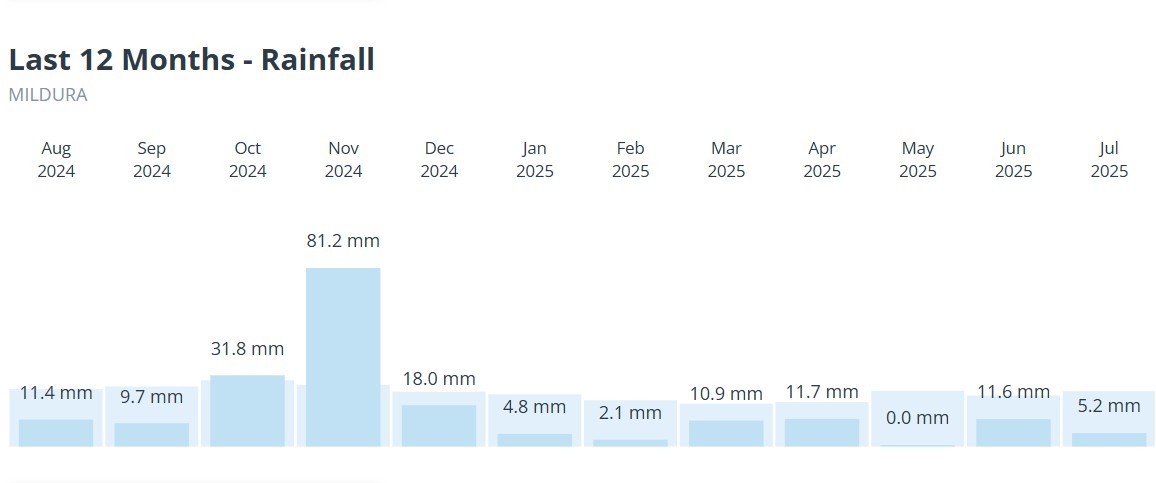
Image: Every month so far in 2025 has seen below-average rainfall in Mildura and July continues the trend for now.
The severe recent rainfall deficiencies in western, northern and central Victoria (as well as large parts of southern SA) over the past 17 months are captured in the image below.
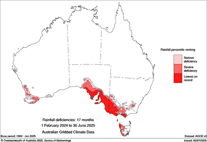
Image: Rainfall deficiencies across southern Australia for the 17 months to the end of June 2025. Source: BoM.
The positive news is that the BoM’s latest climate outlook (published July 10) holds promise for significant rainfall in dry parts of Victoria through late winter into early spring.
According to the BoM, above-average rainfall is likely (a 60 to 80% chance) for much of the eastern two thirds of Australia. There is even an “increased chance of unusually high rainfall” for parts of Victoria and southern SA.
So while today’s cold front is teasing rain-starved parts of Victoria with cold winds and grey skies without much in the way of moisture, frontal systems in coming months may be considerably wetter before October ushers in a likely return to drier conditions.