
Another low barrelling towards northern New Zealand
After ex-Tropical Cyclone Vaianu dumped hundreds of millimetres of rain and generally wreaked havoc over northern New Zealand last week, another deep low pressure system is heading towards the region, this time from the south.
This latest low has been lingering to the southwest of the country for the last two days, swinging troughs and rain bands east, including one that caused heavy rain, slips and evacuations in the Whanganui region overnight. The low is now set to take a northward track over the North Island and upper South Island. Heavy rain and southerly gales are expected, most likely on Monday and Tuesday and for regions around Wellington, Manawatu-Whanganui, Marlborough and Kaikoura. Though, with terrain as complex as New Zealand's, combining with the small scale of this weather system, specifics could change.
It is most likely though that the worst affected regions will be away from Northland (that bore the brunt of Vaianu last week). However, the northeast South Island has also seen rainfall anomalies exceeding 300% in the last two weeks, and it is likely to see more heavy falls with this coming system.
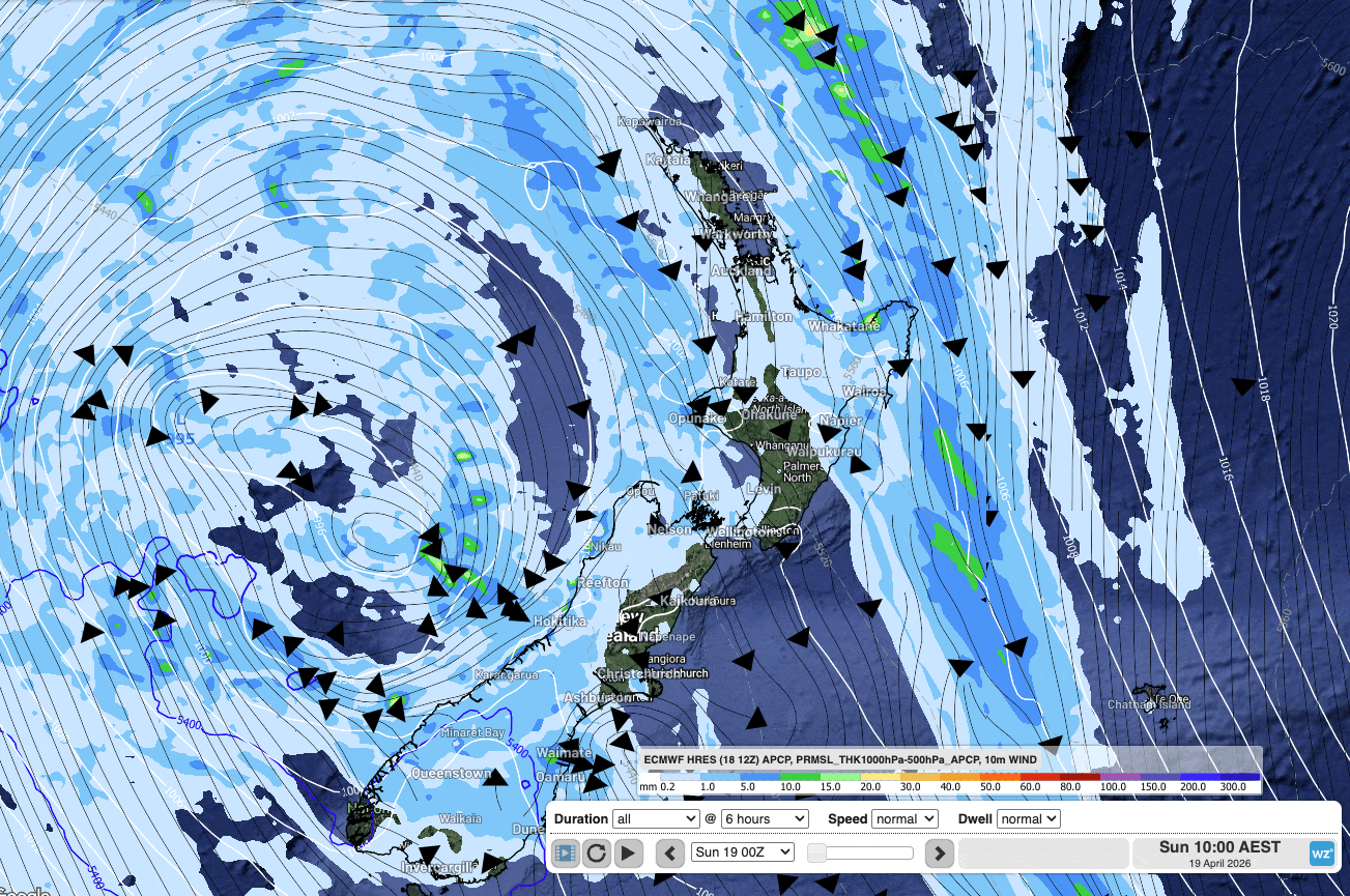
Image: Animation showing the ECMWF forecast rain, wind and MSLP in 6 hourly timesteps through to Tuesday midnight.
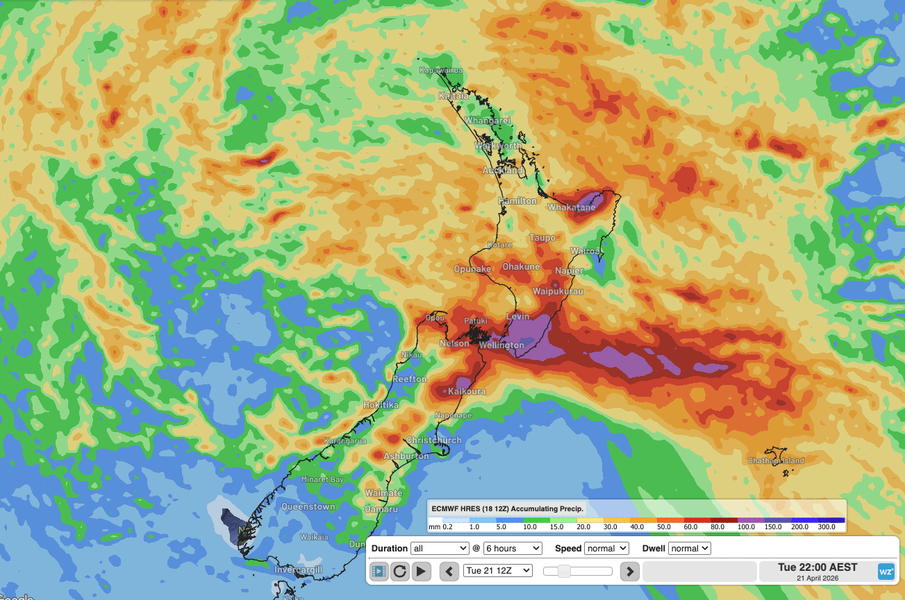 Image: Accumulated rainfall Saturday midnight to Tuesday midnight, according the to the ECMWF model.