
Another day of damaging winds in SA
A large area of South Australia is under a severe weather warning with damaging winds set to lash the state for a third consecutive day.
A complex low pressure system passing to the south of Australia this week has been causing repetitive bursts of powerful winds over SA.
On Tuesday, wind gusts reached up to 111 km/h on Neptune Island and 100 km/h at Cape Willoughby as the first in a series of cold fronts ploughed across the state. This front also produced the strongest wind gusts in more than a year at Wudinna (85 km/h) and Edithburgh (76 km/h).
Tuesday’s blustery conditions resulted in 43 GWh of electricity generation from wind power in SA, which is the highest daily value for at least the last 12 months.
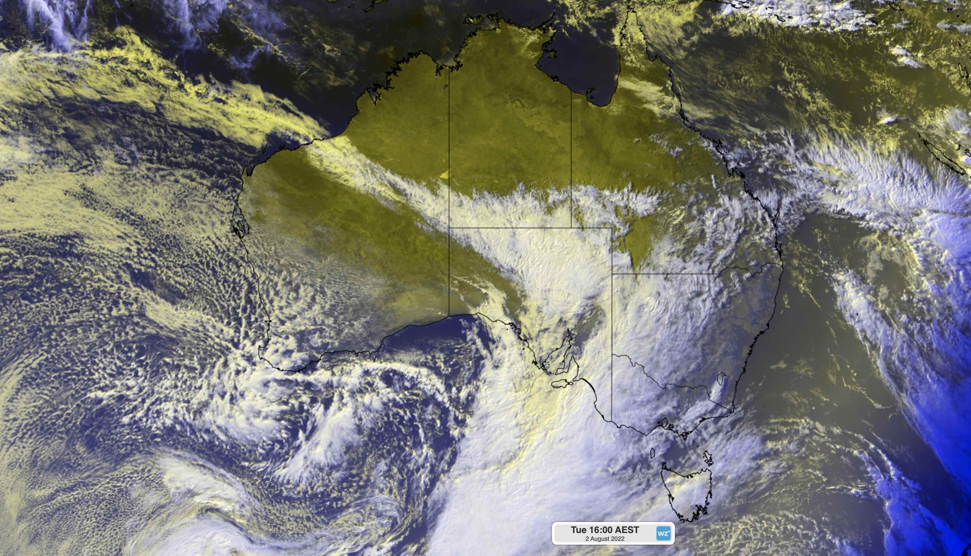
Image: Enhanced visible/infrared satellite image showing a cold front crossing SA on Tuesday, August 2, 2022.
Another strong front then crossed the state on Wednesday, producing more damaging winds as gusts reached 104 km/h at Neptune Island and 95 km/h at Cape Borda.
Today will be another day of wild weather across a large swath of SA as the third cold front in as many days barrels over the state.
Wind gusts had already edged above 90 km/h at Neptune Island by 10:30am local time. At this time, a severe weather warning was also in place for damaging winds over all of SA’s southern and central districts, including Adelaide.
The strongest winds in the next 24 hours should occur on Thursday afternoon and evening, although some elevated areas of SA could continue to see damaging gusts into Friday morning.
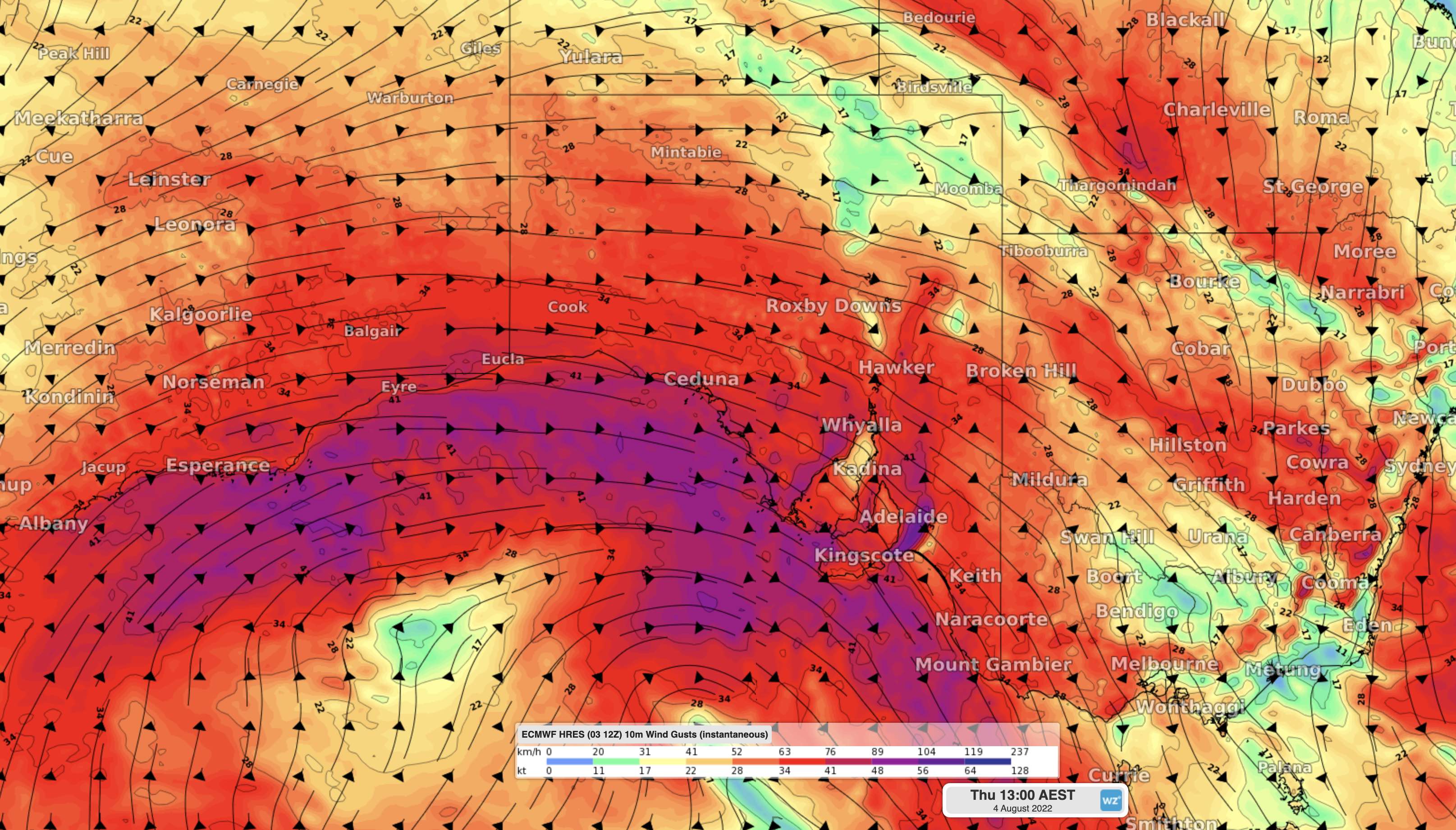
Image: Modelled wind gusts (speed and direction) at 12:30pm ACST on Thursday, August 4, 2022.
In addition to this wind, localised areas of heavy rain and squally thunderstorms are likely to affect the state’s Agricultural Areas on Thursday. These conditions may cause pockets of flash flooding, while rain-softened ground may allow trees and power lines to come down.
Be sure to keep up to date with the latest warnings in SA during the next 24 hours.