
A very mild night in Queensland
Days have been unseasonably warm across much of eastern Australia in recent days, and nights have been no different. This was especially noticeable across northern and interior parts of Queensland on Saturday night and into Sunday morning.
An approaching low pressure trough is filtering a warm airmass over large parts of eastern Australia. This warm airmass coupled with some patchy cloud over parts of the state allowed for this mild evening and morning.
Widespread overnight temperatures in northern and interior parts of the Sunshine State were four to six degrees above the August average. There were some areas that had even larger deviations from the monthly norm. In the Central West, most locations were six to nine degrees above average. Longreach had the warmest minimum temperature in the district, cooling to just 19.8°C. This is 11 degrees above average and its warmest August night in 54 years. Elsewhere, Blackall dropped to 17.2°C and Tamo 14.5°C, both nine above average.
Across the Cape York Peninsula, overnight temperatures were four to six degrees above average including Weipa and Coen. It was even milder in the Northern Goldfields, mostly six to eight degrees above average. However, for this district it was as warm, or even warmer, earlier in the month.
The mild conditions also extended to the southern interior of the state. In Maranoa and Warrego, Charleville cooled to 13.2°C, which is 7.3 degrees above average. In Channel Country, Ballera had their warmest August morning in four years with a low of 15.7°C (7.3 degrees above average).
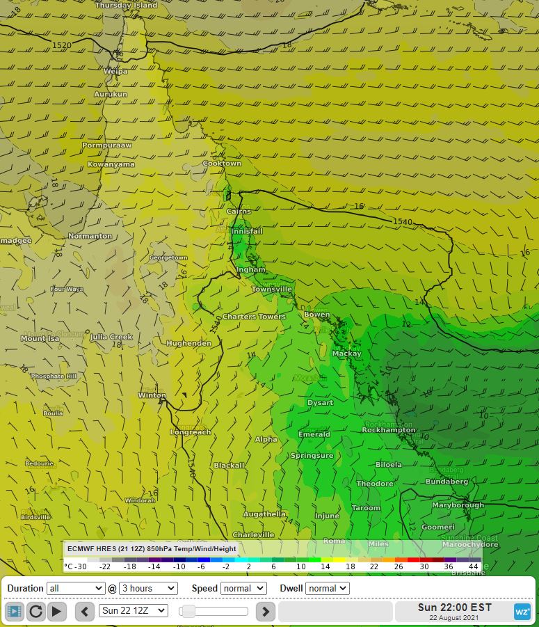
Image: Forecast warm 850hPa on Sunday evening according to the ECMWH HRES model.
The Cape York Peninsula can expect similar temperatures tonight and tomorrow morning. Further south, it will be even warmer tomorrow as the airmass warms further and winds start to increase as the trough nudges closer.