
A trough and low bringing heat and storms to parts of southwestern WA
A trough and embedded low slowly dipping south over western WA is bringing a very warm Sunday, with widespread thunderstorms sparking up inland.
The trough and low have been hanging around central western WA over the last few days, dragging northern warmth southward and triggering a few storms. On Sunday, the system moved further south, with easterly winds around its southern flank bringing inland heat to the coast, while instability associated with the trough and low generates widespread thunderstorms.
On Sunday, Perth is forecast to reach 30 degrees, around six degrees warmer than normal for this time of year. To the north, Geraldton's forecast maximum of 32 degrees is about seven degrees on the warm side of normal. If Moora reaches its forecast top of 33 degrees on Sunday, it will be the hottest day there since April this year.
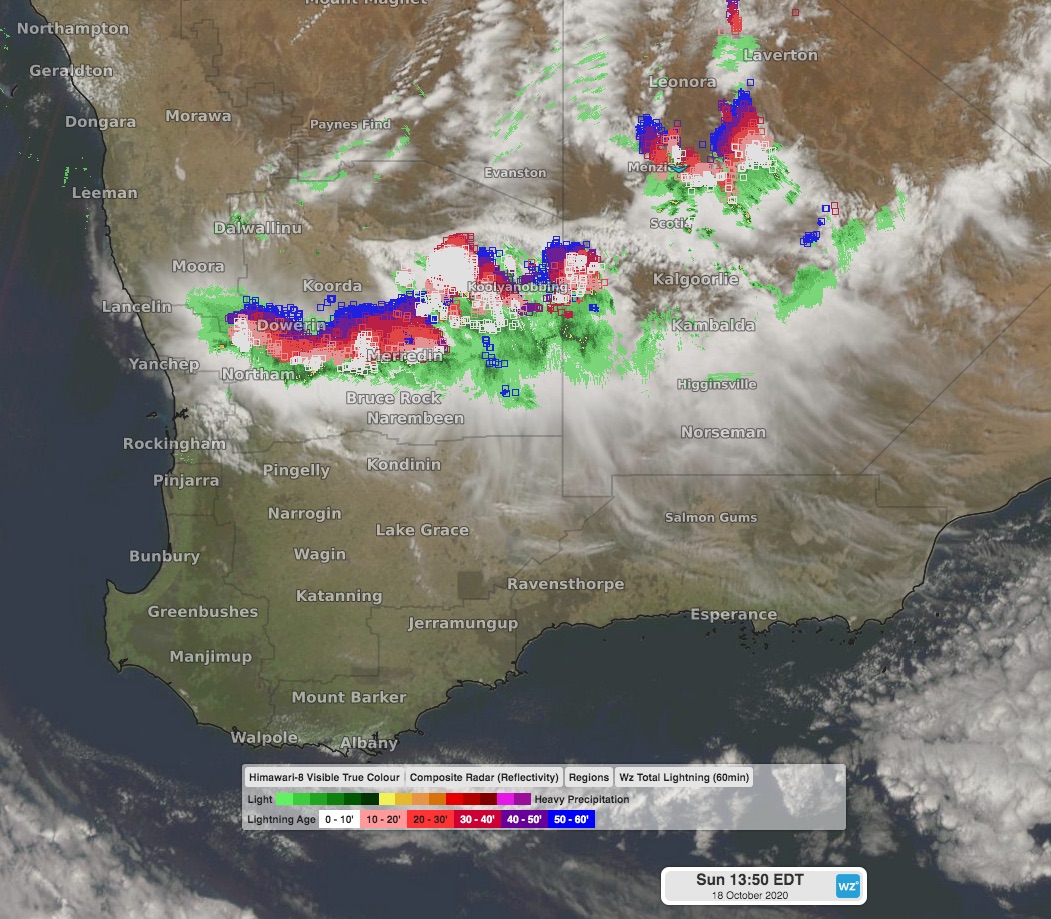 Image: lightning strikes late on Sunday morning over southern WA using the Himawari-8 satellite.
Thunderstorms have been active over areas northeast of Perth during Sunday morning, and are currently moving towards the state capital. There is a chance storms may reach Perth later Sunday evening, but are more likely to stay just to the northeast. At 11am WST on Sunday, over 54,000 lightning strikes were recorded in a 200km radius of Merredin since the early morning, over 4600 being ground strikes.
The trough and low will start moving east on Monday, taking heat and thunderstorms with it, and allowing a cooler southerly flow over coastal areas.